
 Great Theodolite
 The Bache- Wurdemann Compensating Device
 Eimbeck Duplex Bars
 Iced Bar B 17
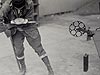 Steel Tape with Tape Stretcher
 Invar Tape
 AGA Geodimeter NASM-2A
 Tellurometer Model M/RA 1
 Laser Signal and Prismatic Mirror Reflecting System
 AGA Geodimeters, Models 4D and 4L
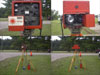 Big Red
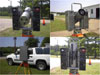 AGA Geodimeter Model 6
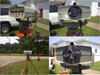 Hewlett-Packard Model 3800B Distance Meter
 Tellurometer Model MA-100
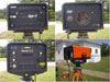 Ranger III and Rangemaster III
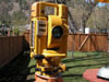 Topcon ET-1 Total Station
 Trimble GPS Antenna
Invar Tape
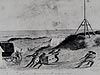
In this photograph, surveyors use an invar tape to measure a base line through a house in Pasadena, California. Invar, an alloy of nickel and steel having a very low coefficient of expansion, resolved the thermal expansion problem associated with the use of other metal rods and tapes for distance measurement. With the invention of invar, tapes and wires became feasible for measuring distances. The Coast and Geodetic Survey began measuring distances using invar tapes in the early 1900s. These tapes would eventually replace steel tapes as the tool for taking high accuracy measurements.
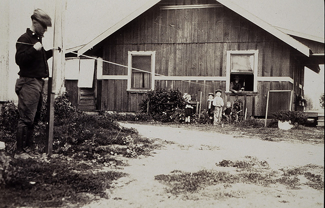
Where there's a will, there's a way! And, hopefully, an understanding home owner. Here surveyors use an invar tape to take a measurement through a house!
As with metal bars, temperature variation was by far the biggest problem with using tapes for distance measurements. In 1905, the Coast and Geodetic Survey (C&GS) purchased tapes made of a nickel-steel alloy invented in 1896 by French physicist Charles Édouard Guillaume. The alloy was named invar, from invariable, to reflect its low coefficient of expansion.
Invar had several advantages over steel tapes. It took a thermometer error of 2.8° C to create the same error in invar as a 0.1° C error would cause in a steel tape. Invar could be used during the day, which meant that it was easier to read and to keep the tapes clear of obstructions and moisture. Working and traveling during the day made for much faster progress than the nighttime measurements required by steel. Although the softer metal could kink near the ends if the handler was not careful, invar tapes were just as accurate and could be handled and manipulated in the same way as steel tapes.
Compared with previous tools, making measurements with invar cost half as much. After comparisons on six different base lines in 1906, invar completely replaced steel for high accuracy distance measuring in the C&GS.
Historic Reference
The 22-mile long Pasadena base line being measured in the photograph was done to assist in studies of the speed of light, in the hope that the experiments would lead to a way to use light to measure distances. At the time, this base line was considered the most accurately determined distance in any survey in the world.
- Distance Measurement Instrument Shown: Invar tape
- Location: Pasadena, California
- Manufacture Date: Early 1900s
- Dates of Use: Early 1900s - Present
- Photo Date: 1922
Works Consulted
Dracup, J. F. (1940). Geodetic Surveys in the United States 1807-1940. Retrieved May 2006, from http://www.ngs.noaa.gov/PUBS_LIB/geodetic_survey_1807.html.
French, O. B. (1907). Six Primary Bases Measured with Steel and Invar Tapes [Electronic version]. Report of the Superintendent of the Coast and Geodetic Survey Showing the Progress of the Work From July 1, 1906, to June 30, 1907. p 105-155.
Related Web Sites