
 Great Theodolite
 The Bache- Wurdemann Compensating Device
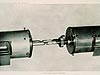 Eimbeck Duplex Bars
 Iced Bar B 17
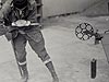 Steel Tape with Tape Stretcher
 Invar Tape
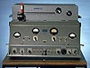 AGA Geodimeter NASM-2A
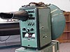 Tellurometer Model M/RA 1
 Laser Signal and Prismatic Mirror Reflecting System
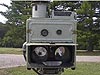 AGA Geodimeters, Models 4D and 4L
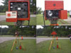 Big Red
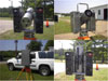 AGA Geodimeter Model 6
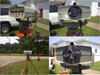 Hewlett-Packard Model 3800B Distance Meter
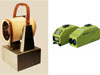 Tellurometer Model MA-100
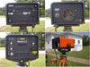 Ranger III and Rangemaster III
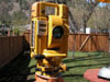 Topcon ET-1 Total Station
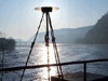 Trimble GPS Antenna
AGA Geodimeter Model 6
This photograph shows a model of a Geodimeter. Geodimeters, like other light-based electronic distance measuring instruments, worked by sending a light signal of known wavelength to a reflector. The wavelength of the returning signal was compared to the outgoing one, and the difference (called the "phase shift") was measured. Using multiple frequences of light, the instrument computed a distance based on the known lengths and measured phase shifts of returning light waves.. These instruments were used by the Coast and Geodetic Survey from the 1950s through the 1970s. The particular model shown here was used by the Survey in the mid- to late-1960s.
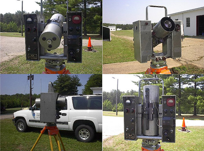
Four views of a 6A, including the sighting telescope visible in the bottom right image. Photos courtesy of Charlie Glover.
Improvements in Geodimeters since their inception in 1953 increased the utility of these instruments for measuring distances in a range of conditions.
The Model 6 series shown in the photograph, first marketed in 1964, was developed with the intent to lower weight and power consumption, increase daylight range, and make pointing on target prisms simpler. The vacuum tubes that comprised the “innards” of earlier models and could take considerable time to warm up were replaced by transistors in the Model 6. Lightweight, rechargeable batteries replaced the heavy 12-volt car battery earlier models had relied on for power.
Historical Reference
This model was mostly used by the Coast and Geodetic Survey earthquake fault crossing parties measuring Earth movement in California.
- Distance Measurement Instrument Shown: AGA Geodimeter, Model 6
- Location: Corbin, Virginia
- Manufacture Date: 1960s
- Dates of Use: Mid- to late-1960s
- Photo Date: 2006
Works Consulted
Burger, T. C., Tomlinson, R. W. (1975). Electronic Distance Measuring Instruments. Washington, DC: American Congress on Surveying and Mapping.
Smith, J. R. (1983) Geodimeter 1947-1983. Unpublished.