The National Spatial Reference System: Fundamental Data for Land Surveys, Nautical Charts, and the Nation's Infrastructure
- Foundations of Spatial Reference
- Survey Marks
- The Global Positioning Revolution
- Shoreline and Spatial Reference
- Conclusion
Foundations of Spatial Reference

Accurately measuring the elevation of this hurricane evacuation route in low-lying areas of coastal Louisiana is just one of many applications for the National Spatial Reference System. Click image for larger view.
For 200 years, NOAA’s National Geodetic Survey and its predecessor organizations have been using geodesy to map the U.S. shoreline, determine land boundaries, and improve transportation and navigation safety. Geodesy is the science of measuring and monitoring the size and shape of the Earth and the location of points on its surface. The National Geodetic Survey evolved from the Survey of the Coast, the nation’s first science agency, established by Thomas Jefferson in 1807, to promote sea-going commerce through safe and accurate nautical charts. Ferdinand Hassler, the first head of the Survey, realized that surveying the coast could only be accomplished by creating a reference system 1 of survey points, each with latitude and longitude coordinates.
With westward expansion and numerous surveys being conducted simultaneously across the growing nation, surveyors needed to establish a common set of reference points. This would insure that surveyors' maps and charts, which often covered hundreds of miles, would align with each other and not overlap. This common reference system began with Hassler's survey of New York Harbor in 1816-1817 and is considered the ancestor of the common set of reference points used today.
Survey Marks and a National Coordinate System
The common sets of reference points used today are the survey marks or starting points from which surveyors work to ensure accurate and consistent surveys across the nation. Most of these survey marks are accurate either horizontally or vertically. A smaller number have data in both horizontal and vertical dimensions. Today, the complete set of survey marks for the United States is known as the National Spatial Reference System (NSRS). These points serve as the foundation for property surveys, nautical charts, highway construction, wastewater facilities or any of the countless activities that require accurate geodetic information. The National Geodetic Survey defines and manages this national coordinate system, one of the most fundamental and necessary components underlying the nation’s infrastructure.

NOAA's National Geodetic Survey maintains a database of hundreds of thousands of geodetic control points with precise latitude and longitude coordinates and/or elevations in the National Spatial Reference System. Permanent in-ground monuments like this mark their position. Click image for larger view.
To identify the survey marks in the NSRS, the National Geodetic Survey has traditionally placed marks, or permanent monuments, where it determined precise latitude and longitude coordinates. These markers are brass or bronze disks (metals that sustain weathering) and are set in concrete or bedrock. Each mark is about 9 centimeters (about 3.5 inches) in diameter and has information about the National Geodetic Survey printed on its surface. Newer survey marks are either disks set in concrete or bedrock or long rods driven into the ground and covered with a metal plate to help ensure that they won't move and that people can not destroy or remove them.
Other federal, state, and local government agencies, as well as some private entities maintain thousands of geodetic reference stations that are also part of the NSRS. The National Geodetic Survey maintains the survey data for all these stations, as well as the data for its own stations, in a central database and makes it available for public access. The NSRS includes approximately 850,000 permanent markers nationwide.
The Global Positioning Revolution

Hundreds of small antennas receive radio signals from Global Positioning System satellites, a sort of "flying" reference system. The receivers make up the Continously Operating Reference System network, a vital part of the National Spatial Reference System. Click image for larger view.
In the 1980s, the Global Positioning System (GPS) revolutionized the National Spatial Reference System (NSRS). GPS is a constellation of 24 satellites, launched and operated by the United States Air Force, which transmits radio signals from about 11,000 miles in space. When used according to special procedures, GPS receivers on Earth can determine position coordinates to centimeter-level accuracy (less than one-half inch).
Surveyors and even private citizens now commonly use GPS to determine precise positions at a fraction of the cost of traditional surveying. In response to GPS, the National Geodetic Survey developed the Continuously Operating Reference Stations (CORS) network. Hundreds of stationary, permanently operating GPS receivers throughout the United States make up this network. Working 24 hours a day, seven days a week, CORS stations continuously receive the GPS satellite signals and transmit their data to the National Geodetic Survey (NGS). NGS then integrates the positional data into the National Spatial Reference System. These data are available to the general public on the NGS Web site, which provides data for surveyors to substantially increase the accuracy of their surveys.
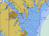
The National Shoreline and the National Spatial Reference System
The National Shoreline is another essential part of the National Spatial Reference System (NSRS). The National Geodetic Survey (NGS) compiles shoreline location data to be included in NSRS as part of NOAA's nautical charts. Traditionally, shoreline data have been collected from aerial photography. But NGS is exploring emerging technologies such as light detection and ranging, also known as LIDAR, as a new method of determining the nation's shoreline as well as measuring the topography of coastal areas and depths in near-shore underwater environments. Technological advances such as these promise to expand our nation's understanding and management of the coastal zone.
Conclusion

The National Spatial Reference System is essential for a host of activities that require highly accurate location and elevation data. Among them are property surveys and siting public infrastructure such as bridges to ensure safe navigation. Click image for larger view.
As positioning and navigation have become fundamental to the functions of society, geospatial science has become increasingly important. And the foundation to accurate and useful geospatial data is NOAA’s National Spatial Reference System (NSRS). Its reach extends to all parts of the nation. No corner of the country lacks the need for the survey accuracy that the NSRS brings. The advent of the Global Positioning System in the 1980s revolutionized NSRS and the painstaking work of manual surveys, allowing surveyors and others to determine precise locations on the surface of the Earth with greater accuracy and speed than ever before. The NSRS is yet another example of a foundation data set that represents NOAA’s long-term and ongoing service and commitment to the nation.
1. To determine a position on Earth requires a starting point from which to begin a survey to determine another position. The National Spatial Reference System provides a network of starting points known as reference stations that serve to accurately position other points.