The Global Positioning System: Revolutionizing Land Surveys
- Traditional Land Surveying
- GPS Revolutionizes Positioning
- A Parallel GPS Revolution
- "Kinematic" Methods
- Conclusion
A Heritage of Traditional Land Surveying

Leveling down the trail into Glen Canyon, Arizona, in 1921. Traditional surveying methods require an unobstructed line-of-sight between survey observation points. Click image for larger view.
From the very beginnings of our nation, surveying has been a vital and instrumental tool to promote commerce and land ownership. Before proving himself as our nation's first military leader, George Washington served the people of Culpeper County, Virginia, as a land surveyor. And when an act of Congress created the Coast Survey in 1807, the first superintendent, Ferdinand Hassler, conducted a land-based survey of the New York City area as the basis for accurate nautical charts of New York harbor.
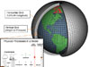
Traditional methods of land surveying, for both horizontal (latitude and longitude) and vertical (elevation) positioning, require a line-of-sight from one observation to the next. A network of positioning survey marks in coastal areas and across the country developed slowly using this time-consuming method. But over the course of the nation's history, the network swelled to be large and dense, and indispensable to surveyors across the nation. Over 850,000 survey marks make up this network which is part of the National Spatial Reference System. (Note: The National Spatial Reference System is one of NOAA's Top Ten Foundation Products.)
A Global Positioning System Revolutionizes Positioning

One in the constellation of 24 GPS satellites that transmits radio signals to Earth from 11,000 miles in space. Click image for larger view.
In the 1970s, the U.S. military began using satellites to position ships and submarines at sea. The promise of satellite-based navigation led the military to develop the Global Positioning System (GPS) of satellites. The first was launched in 1978. By the mid-1990s, the full constellation of 24 navigation satellites, which transmit radio signals from 11,000 miles above the Earth, was complete.
Although initially conceived as primarily a military program, civilian users quickly realized the potential of GPS for everyday positioning and surveying. With GPS receivers today costing less than $100, thousands of private users depend on GPS positioning for automobile, boat, and aircraft navigation; backcountry recreation; and emergency location.
A Parallel GPS Revolution for Even Greater Accuracy

Land surveyors now use GPS receivers (above) to establish positions, enabling surveys to be completed in a fraction of the time required by traditional methods. Click image for larger view.
NOAA's National Geodetic Survey immediately recognized the potential of GPS for uses far more accurate than originally intended. Following the launch of the first GPS satellites, system engineers expected that the positional accuracy for civilian uses would be about 70 m (230 ft). (Military and aviation users would receive a special encrypted signal, enabling them to achieve 10 m (33 ft) accuracy.) While many scientists worldwide lauded a positioning system with 10-meter accuracy, scientists at NGS as early as 1979 were publishing papers on how to use the GPS signals for positioning accuracy down to the centimeter (0.4 in) level!
The National Geodetic Survey led the worldwide research to develop this highly accurate use of GPS, known by the lengthy title of "differential carrier phase positioning." At first, this capability was limited solely to determining positions of two GPS receivers relative to one another, when both sat stationary for hours. Even this limited application was a revolutionary improvement over traditional surveying. No line-of-sight was required, and distances of hundreds of kilometers could be surveyed in hours, rather than the weeks or months required by traditional survey methods.
Within a few years, National Geodetic Survey scientists began developing "kinematic" methods of processing GPS data. Simply stated, this means that even with one of the GPS receivers moving, positioning accuracies within centimeters were possible. This new survey technique revolutionized land surveying even further, greatly multiplying surveyors' productivity over traditional methods.
"Kinematic" Methods Revolutionize Aerial Photography
Kinematic GPS surveying also had a profound effect on aerial photography operations. Kinematic survey techniques positioned aerial photographs to within 30 centimeters–significantly better than traditional methods. This eventually meant that for airborne photogrammetric missions, the number of ground control points (large panels or marks that were required to be visible in a photograph to help accurately determine the airplane's position) was greatly reduced or no longer necessary. Kinematic GPS allowed the location of the airplane to be determined precisely and the hours of pre-flight ground work to establish visible ground control markers by a ground support team were significantly reduced or became unnecessary!
Conclusion
From the beginning, NOAA’s National Geodetic Survey led the way with high-accuracy GPS positioning applications. While GPS itself led its own revolution, the truly innovative scientists of NGS led a parallel revolution to improve the accuracy of GPS for civilian uses. Today, numerous applications for GPS exist which have been spun off of the initial National Geodetic Survey work, and GPS users can (with the right conditions, equipment, and software) determine their position to a centimeter in real-time. NOAA’s contribution to developing precision survey techniques with GPS has had a far-reaching impact on the national civilian survey community.