
 Lewis and Clark Corps of Discovery Bicentennial
 2002 Winter Olympics Salt Lake City
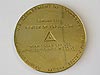 U.S. Center of Population: 2000
 NOAA Heritage Trail: The Calais Observatory
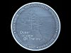 Ocean in View! The Nation's Newest Nickel
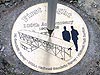 100th Anniversary of the First Flight
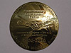 50th Anniversary of the Fredericksburg Geomagnetic Center
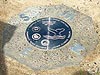 Fagatele Bay National Marine Sanctuary, American Samoa
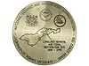 Pago Pago Harbor, American Samoa
 Kilauea Point National Wildlife Refuge, Hawaii
 Hassler Park
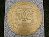 100th Anniversary of the U.S. Forest Service
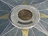 National Estuarine Research Reserve System
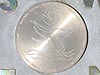 Hawaiian Islands Humpback Whale National Marine Sanctuary
Pago Pago Harbor, American Samoa
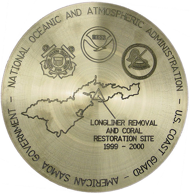
This commemorative disk was set on May 25, 2005 overlooking the Pago Pago Harbor, American Samoa, to commemorate the removal of nine longline fishing vessels stranded on reefs in the Harbor and the restoration and monitoring of local coral reefs.
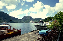
Pago Pago Harbor is a major South Pacific port on the southeastern coast of Tutuila Island, which is part of the American Samoa chain. A United States Naval Station is located on the harbor.
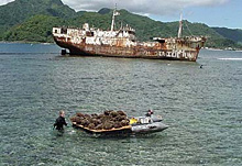
Nine stranded longline fishing vessels, like this one, caused damage to coral reefs in Pago Pago Harbor. Here, volunteers transplant corals to try to reverse the damage.
On May 25, 2005, NOAA's National Geodetic Survey (NGS) dedicated a commemorative mark in American Samoa signifying the restoration of an American Samoan coral reef ecosystem that was heavily damaged when nine longline fishing vessels wrecked in Pago Pago Harbor during several hurricanes in the late 1990s. NOAA, the U.S. Coast Guard, and the Government of American Samoa worked together to remove the fishing vessels.
The mark, which is located in Aua Village and overlooks Pago Pago Harbor, has precise coordinates that will assist coast users such as village fisherman, boaters, and researchers in verifying the accuracy of their global positioning system equipment.
In addition to the dedication, the ceremony highlighted NOAA's recent work in American Samoa, including the establishment of a Continuously Operating Reference Station, an island leveling project in 2002, a proposal to use global positioning to measure tide gauge elevation, and the potential use of NOAA products in coral monitoring.
Taking part in the dedication ceremony were representatives from NOAA headquarters, NOAA's Coral Reef Conservation Program, Fagatele Bay National Marine Sanctuary, NOAA Pacific Services Center, U.S. Coast Guard, and the American Samoan government.
Historic Reference
American Samoa is a group of seven islands in the southern Pacific Ocean. Tutuila is the largest island, with an area of about 55 square miles (143 square kilometers). The island, of volcanic origin, is mostly mountainous. Within the 30-meter depth range, there are some 70 square kilometers of coral reef in American Samoa. Three marine protected areas have been established in the waters surrounding the islands.
In the late 1970s, millions of Acanthaster planci, or crown-of-thorns starfish, a coral-eating animal, ate their way through Tutuila's reefs. More than 90 percent of all the living corals were destroyed.
During the early 1990s, several hurricanes hit Samoa, causing moderate to severe damage to the area's reefs. Following Hurricane Val in 1991, nine longline tuna fishing vessels were stranded on the reefs in Pago Pago Harbor. Diesel fuel and oil from the longliners leaked into sensitive coral reef ecosystems. The clean-up process took years to complete. NOAA's Office of Response and Restoration and NOAA's National Marine Fisheries Service were involved in the clean-up and restoration efforts following the 1990 hurricanes.
The current status of coral reefs in American Samoa is mixed. Corals are in generally good condition, having mostly recovered from the hurricane damage in the early 1990s. More recent, but moderate, damage occurred during Hurricane Heta in 2004. Given the resilience of coral in the Territory and the generally low level of human activities, the corals should rebound.
- Designation: Not yet in database
- PID: Not yet in database
- Year: 2005
- Location: Aua Village, overlooking Pago Pago Harbor, American Samoa
- Latitude/Longitude: Not yet in database
- Event Commemorated: Removal of nine longline fishing vessels from the reef in Pago Pago Harbor, American Samoa
Related Web Sites:
NOAA's Coral Reef Conservation Program