
 Lewis and Clark Corps of Discovery Bicentennial
 2002 Winter Olympics Salt Lake City
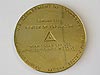 U.S. Center of Population: 2000
 NOAA Heritage Trail: The Calais Observatory
 Ocean in View! The Nation's Newest Nickel
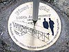 100th Anniversary of the First Flight
 50th Anniversary of the Fredericksburg Geomagnetic Center
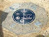 Fagatele Bay National Marine Sanctuary, American Samoa
 Pago Pago Harbor, American Samoa
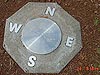 Kilauea Point National Wildlife Refuge, Hawaii
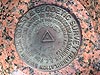 Hassler Park
 100th Anniversary of the U.S. Forest Service
 National Estuarine Research Reserve System
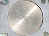 Hawaiian Islands Humpback Whale National Marine Sanctuary
Hassler Park
Hassler Park, located on the NOAA campus, in Silver Spring, Maryland, honors the first Superintendent of the Survey of the Coast, Ferdinand Hassler.
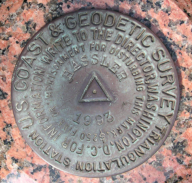
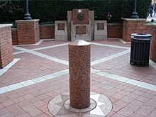
Hassler Park is located in Silver Spring, Maryland, at the NOAA campus. The commemorative mark can be found on top of the granite monument in the center of the park.
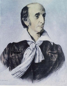
Portrait of Ferdinand Hassler, first superintendent of the Coast Survey.
Hassler Park was established in 1993, during the construction of the new NOAA headquarters campus in Silver Spring, Maryland. This small park honors the first Superintendent of the Survey of the Coast, Ferdinand Hassler, and includes three plaques, a bronze profile of Hassler, and a U.S. Coast and Geodetic Survey triangulation station disk stamped "HASSLER 1993" on top of a granite monument.
Historic Reference
In 1807, Thomas Jefferson created the Survey of the Coast "...to cause a survey to be taken of coasts of the United States, in which shall be designated the islands and shoals and places of anchorage..." The first Superintendent of the new agency was a Swiss mathematician and geodesist Ferdinand Hassler. Hassler realized that the surveying of the coast could only be accomplished by creating a reference system of scale and orientation that was defined by survey points of well-known coordinates of latitude and longitude. This reference system was the ancestor of the present National Spatial Reference System (NSRS).
Hassler established the geodetic surveying standards, procedures, and techniques required at that time to produce the reference system. Over time, geodetic surveying techniques evolved from "line-of-sight" observations to space-oriented observations. Line-of-sight observations required that each survey point in the reference system was visible by at least one other survey point. Hassler used instruments called theodolites to determine orientation and chains or bars to measure scale. Techniques to increase the distance in line-of-sight observations evolved over the next 150 years.
As the nation grew so did the size of the reference system that Hassler initially created. Presently, there are over 1,500,000 control survey points throughout the U.S. that define the NSRS, which is maintained by the National Geodetic Survey (NGS).
The advancement in surveying technology, particularly global positioning system (GPS) technology, has increased the accuracy, reliability, and accessibility of the NSRS. Using today's technology, line-of-sight observations between survey points are no longer as critical as they were during the days of Hassler. NGS developed the Continuously Operating Reference Stations (CORS) network. CORS is a network of hundreds of stationary, permanently operating GPS receivers throughout the United States. Working 24 hours a day, seven days a week, CORS stations continuously receive GPS radio signals and integrate their positional data into the NSRS. This data is then distributed over the Internet.
- Designation: HASSLER
- PID: HV9698
- Year: 1993
- Location: Hassler Park, Silver Spring, Maryland
- Latitude/Longitude (NAD 83): 38 59 34.03378 North, 077 01 52.39173 West
- Event Commemorated: Construction of NOAA's Silver Spring campus
Related Web Sites:
The Coast Survey: 1807-1867: Part I: The Hassler Legacy