
 Thomas Jefferson's Theodolite
 Hassler's Camp
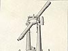 The Great Theodolite
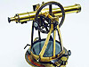 Würdemann Six-inch Theodolite
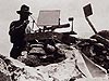 Heliotrope
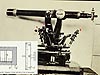 Micrometer Scale
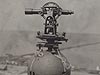 Theodolite Mounted on Water Tank
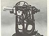 Seven-inch Repeating Theodolite
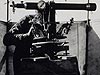 C&GS Twelve-inch Theodolite
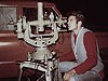 Wild T-4
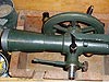 K&E Theodolite, Parkhurst Design
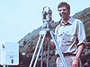 Wild T-2
 Wild T-3
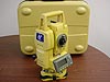 Topcon GPT-3002LW Total Station
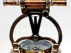
Wild T-2
The Wild T-2, shown in this image, was used throughout the 1950s – 1980s. It is a relatively small, yet rugged, theodolite that could take observations both during the day and at night. The Coast and Geodetic Survey used the T-2 for third-order surveys.
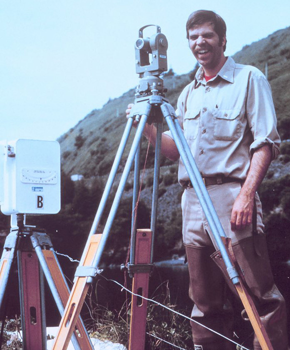
Image courtesy of Commander Grady Tuell, NOAA Corps (ret'd).
Prior to the Global Positioning System (GPS), a keen observer – Lt. Grady Tuell in this image – tracked a moving launch with a T-2 during hydrographic surveys, reading the azimuth every minute or so. Azimuth plus a radio range allowed repeated positioning of the boat during operations.
The Wild T-2 is relatively small, light, and very rugged. Having glass horizontal and vertical circles internal to the instrument, the angular measurements were made by way of various internal prisms and could be read with an accuracy to one second of arc.
Two adjustable mirrors provided light during the day. For night observations, batteries and bulbs were substituted for the mirrors. The T-2 was especially useful for providing horizontal and vertical control for hydrographic surveys, which measure water depth along coasts. Transported from ship to shore in open boats, with their cases frequently splashed with salt water, the instruments were often carried across rocks and up cliffs to reach the high-point location of a survey mark. Set up on its tripod in rain, snow, and wind, the instrument was expected to measure extremely accurate angles...and it did.
The Coast and Geodetic Survey used the T-2 for third-order horizontal surveys, which are surveys with a tolerance of one foot of error in a distance of 10,000 feet. The T-2 met third-order requirements when four sets of horizontal angles were observed at each survey mark. Two horizontal angle measurements, direct and reverse, made up each set of measurements, so each angle was actually measured eight times! Elevation differences were determined by measuring vertical angles. With care in leveling and centering the instrument, in following standardized procedures, and in meeting the tight tolerances for comparing each set's angles with the mean of the set, the result was usually excellent-quality observations.
The Wild T-2 was called a "universal theodolite" because it could deal with virtually any surveying problem.
- Instrument Shown: Wild T-2
- Location: Alaska
- Manufacture Date: 1926 - 1996
- Dates of Use: Approx. 1952 - 1980s
- Photo Date: 1982
Works Consulted
UNSW Virtual Surveying Instrument Collection (2000). Optical Micrometer Theodolite. Retrieved August, 2006, from http://www.gmat.unsw.edu.au/currentstudents/ug/projects/f_pall/html/t24.html