The Future of NOAA Aircraft: Going Where No Man Can Go
NOAA aircraft and professional crews operate throughout the United States and around the world—over open oceans, mountains, coastal wetlands, and Arctic pack ice. These versatile aircraft provide scientists with airborne platforms necessary to collect the environmental and geographic data essential to their research.
- Introduction
- Unmanned Aircraft Systems
- NOAA and Partners...
- "What If" Applications of UAS
- Conclusion
The low-level hurricane environment. A forest fire. The vast interior of the Earth's arctic regions. These are places where it is "too dull, dirty, or dangerous" to send people and conventionally piloted aircraft. However, if we could venture into these areas, imagine the information that we could gather.
Since its inception, NOAA has been in the business of observing and collecting data to understand the natural Earth system. Today, NOAA's fleet of light and heavy aircraft play a key role in making these observations and acquiring data. Data and observations are used in every facet of NOAA's work, from measuring snow pack to help hydrologists and water resource managers prepare for floods or droughts, to gathering meteorological data inside turbulent hurricanes to enable forecasters to make landfall and intensity predictions.
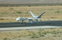
Unmanned Aircraft Systems, such as the Altair platform shown here, can help scientists collect data from otherwise inaccessible areas. Click image for larger view.
But not all airborne-derived data needed for NOAA's research, forecasting, and observational requirements can be safely or cost-effectively acquired using manned aircraft.
This article explores an emerging new technology, Unmanned Aircraft Systems (UAS), that could change the face of NOAA's aircraft fleet and help us reach new heights in our ability to understand and predict the world in which we live.
Unmanned Aircraft Systems: An Overview
Although Unmanned Aircraft Systems (UAS) have been widely used by the military and intelligence agencies overseas in recent years, civilian agencies like NOAA, the National Aeronautical and Space Administration (NASA), and Department of Homeland Security are only beginning to test the use of UAS. NOAA scientists are realizing that UAS have the potential to take measurements in areas that are currently unmonitored due to airplane and pilot limitations and could provide research and operational activities in these hard-to-reach environments more accurately, more economically, and with less risk involved.
UAS are powered aerial systems that do not carry a pilot, but are independently or remotely piloted. They can be land-, air-, or ship-launched and can carry an internal or external payload of scientific equipment.
The system typically consists of the aerial vehicle itself, a ground flight control station, and a ground data retrieval and processing station (including a satellite communications link).
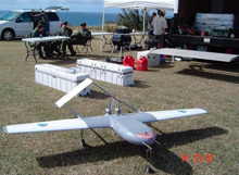
The Manta UAS is a small, unmanned aircraft that can monitor the ocean surface using a hyperspectral camera. Click image for larger view.
Although these aircraft are "unmanned," support to operate and maintain them is still required. NOAA will assign a NOAA Corps officer at NASA-Dryden at Edwards Air Force Base in California. This officer will develop expertise in UAS operations, maintenance, and coordination with the Federal Aviation Administration (FAA) and advise NOAA scientists working with these technologies on operational issues. He or she will also provide NOAA with critical in-house expertise if UAS become permanent members of the agency's fleet.
One of the challenges facing unmanned aircraft is their same day "file-and-fly" access into the National Airspace System (NAS). While the technological maturity of UAS has increased substantially in recent years, safe operation and FAA regulatory compliance are issues that must be addressed before UAS are allowed to routinely fly in the NAS with traditional air traffic. The FAA is developing regulations with regard to UAS operations within the NAS, in particular, the FAA requirement for UAS to "see-and-avoid" other aircraft, as required in manned aircraft. This "see-and-avoid" technology is under development by a number of private companies. The current FAA plan shows 2010-2011 as the realistic target for UAS and manned aircraft to routinely fly together in the NAS.
NOAA and Partners Take to the Skies
Since the application of UAS to scientific research is a new idea, before NOAA puts the technology to full use, we are "testing the skies," to ensure that UAS are used in the most useful and economic ways possible.
In developing this technology, NOAA will not go it alone. We are working closely with partners such as the NASA; the FAA; the Department of Energy; the National Science Foundation; the Department of Homeland Security including the U.S. Coast Guard; and academic institutions such as Scripps Institution of Oceanography and the Universities of Colorado, Alaska, Hawaii, and New Mexico.
Exploring the "What If" Applications of UAS
Since 2005, NOAA has worked with partners to test the use of UAS in scientific and operational missions. Many of these demonstration projects have revealed some of the possibilities if UAS are incorporated into NOAA's aircraft fleet.
Mapping and Monitoring Our Coasts
NOAA aircraft currently fly missions to collect aerial photographs that are used to create coastal survey maps and update nautical charts. UAS could allow NOAA to map and explore areas that are currently inaccessible to human-flown aircraft, such as the Northwest Hawaiian Islands and the Arctic regions, or to patrol the 3.4-million-nautical mile U.S. Exclusive Economic Zone for illegal fishing.
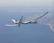
Altair is a high-altitude long-endurance UAS, able to reach altitudes of 13-15 kilometers and stay aloft for more than 20 hours carrying a payload of at least 300 kilograms. Click image for larger view and full caption.
NOAA and NASA have tested the use of large, high-altitude long-endurance (HALE) aircraft that can fly for over 25 hours. These aircraft carry instruments for measuring ocean color, atmospheric moisture and chemical composition, and temperature, as well as a surface imaging and surveillance system.
This demonstration project illustrated that a HALE UAS could support NOAA's research operational needs for mapping, monitoring, and surveillance in the future.
Flying With Hurricanes 24/7
For years, NOAA's hurricane hunters have been flying into storms equipped with sophisticated meteorological instruments, radar, and digital cameras. The trip is rough, to say the least, and the valuable data collected on the flight is sent directly to NOAA's Hurricane Center to make real-time forecasts.
Unlike the current manned flights, UAS could fly further out over the ocean, dropping sensors into storms at regular intervals. These sensors, or sondes, could then detect changes in storm tracks and intensity. This could improve hurricane forecasts by an entire day, allowing coastal residents and authorities more time to prepare for a storm, potentially saving lives and billions of dollars.
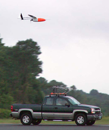
The Aerosonde unmanned aerial vehicle being released from its transport vehicle on the runway at the NASA Wallops Flight Facility, in Wallops Island, Virginia, to fly into and take measurements of Tropical Storm Ophelia on September 16, 2005. Click image for larger view and image credit.
NOAA and NASA scientists are currently testing a small UAS called an Aerosonde. In September 2005, such an UAS was successfully flown into Tropical Storm Ophelia. This mission used the unique capabilities of UAS to document areas of the tropical storm environment near the surface of the ocean. These areas have historically been either impossible, or impractical, to routinely observe by either NOAA or U.S. Air Force Reserve hurricane hunter aircraft.
In the future, UAS will allow NOAA to fly closer to the air-sea interchange of a hurricane, typically less than 1,000 feet, to better understand how these storms derive their power. Lightweight instruments carried by the UAS will measure the heat exchange, which is the engine for the hurricane. Capturing the air-sea interaction will also allow improvement of the models used by NOAA to predict hurricane track and intensity.
It's a Sanctuary, Please Don't Fish Here
NOAA is responsible for protecting our nation's coastal resources, including areas in our oceans that have been set aside as marine sanctuaries. Many of these areas are too difficult to monitor continuously using conventional means such as boats or manned planes.
UAS could almost hover over an area, or fly back and forth at frequent intervals, to protect these sanctuaries from threats such as illegal fishing boats and marine debris. NOAA will play a leading role in managing these national treasures using UAS.
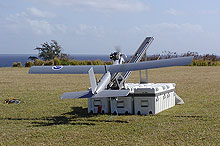
The Silver Fox is a small, low-altitude, short-endurance UAS designed to function primarily as an expendable, over-the-horizon surveillance tool. It can be launched from ships or from land. Click image for larger view.
In February 2006, NOAA participated in a field demonstration of the aerial survey capabilities of the Silver Fox UAS over the Hawaiian Islands Humpback Whale National Marine Sanctuary. The Silver Fox is a small, low-altitude, short-endurance UAS designed to function primarily as an expendable, over-the-horizon, surveillance tool.
The Silver Fox UAS was used to observe surface ocean features, living resources, and vessels and demonstrated the potential of UAS for monitoring threatened and endangered species like whales, as well as illegal, unregulated, and unreported fishing activities.
Enhanced Climate Monitoring
Climate science has been revolutionized in the past decade and NOAA has played a significant role in planning and sponsoring the world's most extensive program of scientific research, monitoring, data management, and assessment for climate change and variability. Despite increased understanding of our climate system, there is still much that remains poorly understood.
UAS could fill a gap in understanding climate change, by allowing researchers to monitor changes in our Earth's environment such as radiation, temperature, and air quality. Additionally, UAS could take routine measurements in polar regions and oceans over an indefinite period of time—allowing continuous records from specifically defined locations.

The Manta UAS is a larger sibling to the Silver Fox. Since 2005, NOAA has worked with its partners to complete four successful UAS demonstration projects, including the Manta (shown above) project. The agency has plans for more demonstration projects in the next few years. Click image for larger view.
In 2006, NOAA's Climate Program tested the use of three Manta UAS based out of Hanimaddhoo Island in the Maldives. The UAS were equipped with radiation and aerosol sensors to detect smog from India. The flights also coordinated with the ground-based measurements made at the Maldives Climate Observatory, part of NOAA's Earth System Research Laboratory Global Monitoring Division. This project demonstrated the ability of UAS to obtain new information about how aerosols and clouds regulate planetary albedo (light reflection), which can affect our weather and climate.
Conclusion
NOAA constantly seeks better and more cost-effective ways to accomplish its mission for the nation as we work to understand and predict changes in the Earth's environment. UAS are just one example of the emerging technologies NOAA is exploring that have the potential to alter how we monitor and respond to changes in the Earth's environment. NOAA will continue to examine how UAS, and other emerging technologies, could assist us as we develop our daily weather forecasts, manage our nation's marine resources, and research the changes occurring in our climate.
The future of this new technology and the role it will play in scientific research is unclear, but one thing is certain: UAS are getting a lot of attention. The scientific and academic communities are very excited about the possible uses of UAS for obtaining data that have never before been available and which could contribute greatly to a better understanding of the Earth system.
