Marking the Surveys—NOAA's Commemorative Marks
The National Geodetic Survey, often in partnership with other organizations, produced and set the commemorative marks in this online collection. Most of the marks are one-of-a-kind, or one-of-a-series, disks specially manufactured to mark or celebrate a particular occasion. Commemorative marks are also used for positioning needs relative to a local area and become part of the National Spatial Reference System.

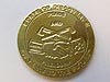
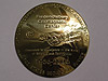
This commemorative survey mark will be set in 2007, the year NOAA celebrates the 200th anniversary of the establishment of the Coast and Geodetic Survey (as the Survey of the Coast). Click image for larger view.
There are many reasons for needing to know exact locations and elevations on the surface of the Earth. Positional information provides the foundation for many human activities, such as finding where you are or where you are going, establishing property boundaries, for many scientific and engineering applications such as constructing buildings and bridges, and to ensure the safe passage of ships. Without positional information, we would be lost in countless ways.
NOAA's National Geodetic Survey (NGS) develops and maintains the National Spatial Reference System (NSRS)—the national coordinate system that defines position (latitude, longitude, elevation), strength of gravitational pull, the national shoreline, and how these change over time. The earliest component of the NSRS was the network of precisely located, permanently marked, in-the-ground survey marks, which are still in use today. Each of these survey marks provides one or more types of accurate survey data.
Since 1807, NGS and its predecessor agencies have placed hundreds of thousands of these permanent survey marks or monuments throughout the United States. Today, a typical mark is a brass, bronze, or aluminum disk (or rod), but marks might also be prominent objects like water towers or church spires. Well into the 20th century, the Survey used an eclectic assortment of materials as survey marks, including earthenware cones, jars, bottles, and holes drilled into rock. One surveyor tells the story of recovering several beer bottles used as survey marks buried in the permafrost on Alaska's North Slope. So, while the "kitchen sink" may not have been used to mark surveys, bottles, jugs, pots, and more certainly were used!
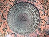
Today, the National Geodetic Survey's database contains information on approximately 1,200,000 survey disks, set all over the United States and its possessions. This network of precisely placed survey marks is the set of reference points used by geodesists, surveyors, and others interested in precise positioning on the Earth's surface.About this Collection
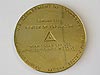
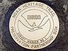
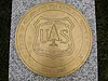
NGS, often in partnership with other organizations, produced and set the 14 commemorative marks in this online collection. Most of these marks are one-of-a-kind, or one-of-a-series, disks specially manufactured to mark or celebrate a particular occasion(s). Commemorative marks are also used for positioning needs relative to the local area, like any other survey mark, and become part of the NSRS. Commemorative marks also give government agencies or local surveyors a chance to showcase their program in a public forum, such as at the dedication ceremony. Often a formal dedication ceremony accompanies the setting of a commemorative mark and representatives from NOAA, other partners, and local politicians or officials attend or make presentations.
Another objective of the commemorative mark partnership program is to inform the American public about how geodesy impacts and benefits our lives. Geodesy, the science of measuring the size and shape of the Earth and precisely locating coordinates on the Earth, is having a greater effect on our lives than ever before, especially with the broadening applications of global positioning system (GPS) technology and geographic information systems.
Most of the commemorative marks are 10- or 12-inch diameter brass disks, but some are stainless steel. After they are set in the ground, the accurate geographic location of the disk is determined using GPS technology and the data are made available on the NGS Web site.
You can browse through the marks in the collection by clicking on the links to the right or click here to view the items in the Commemorative Survey Marks Collection.
To better navigate this collection, first take a closer look at the different kinds of survey marks that NOAA and its predecessor agencies have used over the past 200 years.
Survey Marks: A Closer Look
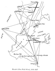
Sketch of the survey points in Hassler's first "survey of the coast" in New York Harbor (1816-17). Click image for larger view.
The original mandate of the Survey of the Coast in 1807 was to survey the coast of the United States in order to assure safe maritime transportation and navigation. To determine positions on the water, surveyors first needed to determine the positions of points on land. Consequently, the first field survey performed by the Survey of the Coast took place in 1816-17 and was a land survey along a portion of New York Harbor, supervised by the first Superintendent of the Survey of the Coast, Ferdinand Hassler.
This first survey took a considerable amount of time and effort. To preserve the work, Hassler's team established marks on the ground at each of the points where they made survey observations. As it still is today, these marks were required so that future surveyors could find and use the same points for surveying needs far into the future. We don't know how Ferdinand Hassler marked the points of this first survey, but in subsequent surveys, he used drill holes in bedrock or buried earthenware cones, one of a few types of materials available at the time that were slow to deteriorate.
Survey Marks 101
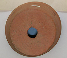
An early clay mark used by the Survey of the Coast. This mark was placed at a survey point near Tom Nevers Head, Nantucket Island, Massachusetts, in 1887 underneath a stone monument on the surface. Click image for larger view.
The three most important characteristics of a survey mark are stability, longevity, and placement that maximizes the likelihood that those who want to use the mark in the future can find it. In other words, the mark should not move, wash or rust away, or otherwise be destroyed or damaged.
To make marks last as long as possible, from the earliest days, they were made of non-corroding materials such as pottery, rock, glass, brass, or copper. In addition, surveyors returning to the survey point needed to be able to easily find the mark and positively identify it. The mark thus needed to remain very stable and readable (if applicable); otherwise, the survey values will no longer be accurate or valid. For this reason, marks were generally buried or set in bedrock. Burying the mark helped avoid natural damage such as erosion and cultural damage such as vandalism. Today, long stainless steel rods, driven deep into the ground (i.e., "driven to refusal"), are most often used as marks.
Marks should also be easy to access and recover, and a survey instrument must be able to fit over the top of the mark so its location can be determined. Lastly, there must be no known conflict with plans for development that might result in the mark being destroyed or damaged. Today, marks must also be placed so that the sky is visible to ensure quality reception of satellite signals when using GPS.
Early Marks Used by the Survey
The earliest marks used by the Survey of the Coast were buried earthenware cones and holes drilled in bedrock. The center of the smaller end of the hole in the earthenware cone was the survey mark, as was the center of the drill hole in bedrock. Sometimes, drill holes were filled with sulfur or some other substance to reduce the effects of water freezing in the hole. At other times, metal rods, bolts, or nails were placed or cemented in drill holes, sometimes with an "X" etched into the top of them, to mark the exact survey point. Marks that were of unusual importance, such as the ends of base lines, were often marked above ground by large cut stones, usually marble, sandstone, or limestone, about two to three feet long.
An early mark consisting of a copper bolt set into a large rock with a cross etched on it. Click image for larger view and credit.
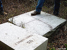
An early stone base line monument with a bolt and an "X" etched in its center. Click image for larger view and credit.
At some survey points, an underground mark was set in addition to the main mark near or at the surface. The intent was that the underground mark might survive if the surface mark was damaged or destroyed. The first sub-surface marks were Hassler's earthenware cones, but later marks included earthenware jugs and crocks, bottles, and similar items.
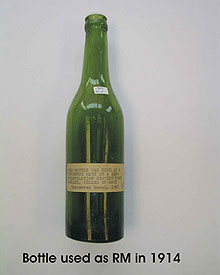
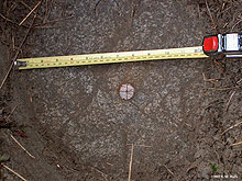
A bottle used as an underground reference mark in 1914. Click image for larger view.
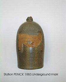
An earthenware jug used as an underground mark in 1883. Click image for larger view.
When setting a mark, a circular ditch four to eight feet in diameter and eight to 18 inches deep was often dug around the survey point and then the hole was filled with coal or charcoal, as an aid in recovering the mark in the future. Hassler buried seashells and other rubble above some of the survey marks he set. However, once concrete became readily available, two to three–foot-long tile and tin pipes were filled with some substance such as concrete or foreign objects. Today, a metal pipe or sleeve is often used.
A reference mark or "witness" post was set near the mark, to help in finding and positively identifying the survey point. Two or more references could be used to reset the survey mark, if it is moved or disturbed, and one of these could be used as a substitute mark, if necessary. The types of reference marks included drill holes, chiseled "X's" in rock, and earthenware cones. The witness post (originally a wooden post) later evolved into a metal post with a metal sign, and most recently into a fiberglass sign.
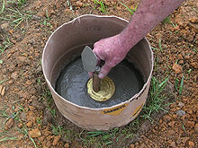
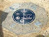
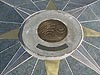
A modern survey team sets a new survey disk, in this case, a horizontal control mark. Click image for larger view.
Around 1900, the Survey first introduced cast bronze disks as survey marks. Later, brass and aluminum disks were also introduced.
Mark Recovery and Preservation
To aid in relocating a mark, the original surveyor wrote a brief description explaining the type of mark used and the surrounding terrain. These descriptions were later developed into comprehensive narratives containing the mark's general location, an explanation of how to find the mark, and a list of reference distances and directions to nearby objects.
Today, all survey points are entered into the NGS database and assigned a permanent identifier, or a "PID," which will never change. PIDs are comprised of six characters—two upper case letters followed by four numbers. The PID and other information applicable to that particular survey point (or station) are published as a "datasheet."
Datasheets contain information application to that particular site, such as official station name, latitude, longitude, elevation, mark logo and stamping, stability, recovery history, and a detailed description of the station so that it can be relocated easily. Some datasheets also include photographs of the mark and the area around it. Datasheets can be retrieved directly from the NGS online database by specifying a PID, official station name (called its "designation"), location (state, county, town, etc.), or survey project identifier.
Each year, many marks are destroyed by construction equipment, highway maintenance, erosion, and vandals. Surveyors, engineers, and others can no longer use a severely damaged or destroyed mark for its intended purpose. Please do what you can to ensure the preservation of survey marks that you encounter—ultimately, we all benefit!
Contributed by CDR George E. Leigh, NOAA Corps (Ret'd.)Works Consulted
Dracup, Joseph F. (Date Unknown). Geodetic Surveys in the United States – The Beginning and the Next One Hundred Years, 1807 – 1940. Retrieved October 24, 2006, from http://www.history.noaa.gov/stories_tales/geodetic1.html.
Leigh, G. (2003). History of Survey Disks in the Coast & Geodetic Survey. NGS Observer, NOAA's National Geodetic Survey Newsletter.