
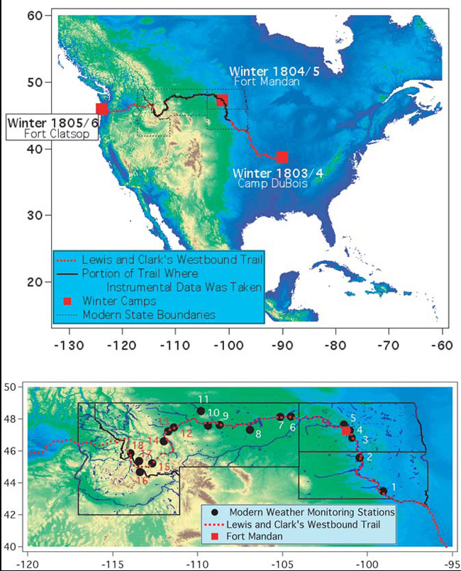
These maps illustrate the Lewis and Clark westbound trail. The map of North America shows the portion of the trail where daily temperature measurements were made without fail (black), along with the outlines of the modern states where those data were taken and the sites of the three winter camps. The locations of Fort Mandan, North Dakota, the expedition trail, and nearby Cooperative Observer weather stations are shown in the expanded view of the High Plains area.