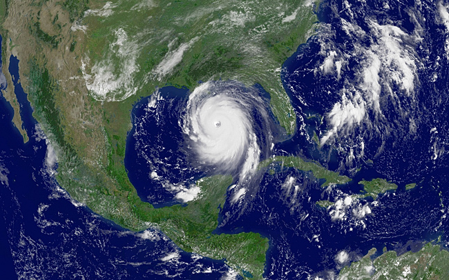
NOAA satellite image of Hurricane Katrina, taken on Aug. 28, 2005, at 11:45 a.m. EDT, a day before the storm made landfall on the U.S. Gulf Coast. While in the Gulf of Mexico, Katrina’s winds peaked near 175 miles per hour.
With the NOAA 200th Celebration coming to a close at the end of 2007, maintenance of this Web site ceased. Updates to the site are no longer being made.

NOAA satellite image of Hurricane Katrina, taken on Aug. 28, 2005, at 11:45 a.m. EDT, a day before the storm made landfall on the U.S. Gulf Coast. While in the Gulf of Mexico, Katrina’s winds peaked near 175 miles per hour.