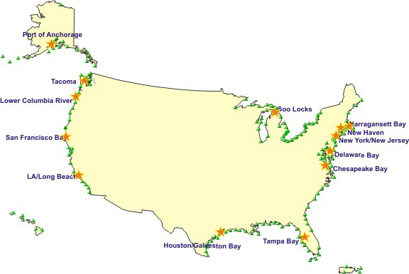
This map shows the current location of National Water Level Program water level stations. Stars on the map represent Physical Oceanographic Real-Time Systems (PORTS®) that reside in major U.S. harbors.
With the NOAA 200th Celebration coming to a close at the end of 2007, maintenance of this Web site ceased. Updates to the site are no longer being made.

This map shows the current location of National Water Level Program water level stations. Stars on the map represent Physical Oceanographic Real-Time Systems (PORTS®) that reside in major U.S. harbors.