Postcards from the Field
As part of the 200th Celebration, we have asked staff from around NOAA to send in their "Postcards from the Field." A "postcard" is a photo from a NOAA field office, science center, or any site on the globe where NOAA is conducting research or field work. The postcard includes—anywhere in the shot—a NOAA 200th emblem or banner.
For more information about "Postcards from the Field," including details about how to participate, please contact David.P.Miller@noaa.gov.
This creative collection of images showcases the breadth and span of NOAA's work...whether it involves conducting research at the South Pole, surveying the ocean floor in Alaska, or flying into hurricanes, NOAA is there. Click on the arrows to browse through postcards submitted thus far.


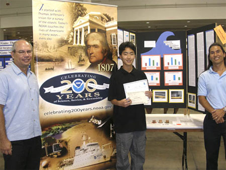 Bill Thomas, Director, Pacific Services
Center (left) and Manning Taite, Environmental Literacy Coordinator, Pacific Services Center (right) are shown at the 50th Hawai'i State Science and Engineering Fair with the winner of
NOAA's "Taking the Pulse of the Planet Award", Christopher Hakoda, a 9th grade student at Mililani High School on O'ahu. Christopher's project was "Reducing Tsunami
Inundation and Run-up." NOAA Education sponsors the "Taking the Pulse of the Planet Award" at state science fairs around the country to the project whose research best
emphasizes the NOAA mission "to understand and predict changes in Earth's environment and conserve and manage coastal and marine resources to meet our Nation's
economic, social, and environmental needs."
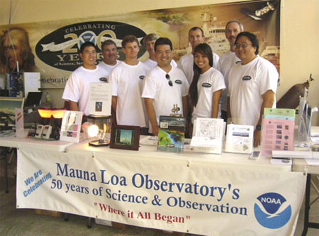 Aloha from the Hilo, Hawaii, Earth Day Fair! Mauna Loa Observatory (MLO) scientists and
staff joined other NOAA organizations to celebrate Earth Day 2007 and commemorate NOAA's 200 years of science, service, and stewardship. Hundreds of visitors of all
ages were on hand to learn about our planet and NOAA's role in protecting the Earth's environment. This marks the third year MLO participated in Earth Day with the
largest display of atmospheric research instruments, posters, and hands-on learning tools ever. Mauna Loa Observatory is also celebrating its 50th Anniversary this
year! November will be particularly busy month for the observatory with a conference, public tours of the facilities, and a month-long display at the Wailoa Art Center
in Hilo showcasing Mauna Loa Observatory's history, research, and latest discoveries. Pictured (from left): Preston Sato, David Nardini, Trevor Kaplan, Director John
Barnes, Darryl Kuniyuki, Aidan Colton, Kalei Lau, Steve Ryan, and Paul Fukumura-Sawada.
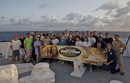 Greetings from the International Dateline! NOAA Ship HI'IALAKAI made her first voyage across
the International Dateline as she transited from Honolulu to Wake Island. Commanding Officer LCDR Jon Swallow served as master of ceremonies during the festive
merrymaking marking this sailing milestone. Pictured are the crew and scientists, who all earned Golden Dragon Dateline Crossing certificates. Photo is courtesy of
Benjamin Richards, Graduate Research Assistant at the University of Hawaii, who will chronicle fish and reefs with underwater photography and videography during this
2007 research cruise.
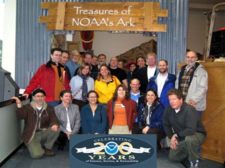 In March, NOAA's Office
of Response and Restoration Emergency Response Division met for an all-hands retreat in Seattle, Washington. During the retreat, a field trip was organized to visit the
Treasures of NOAA's Ark exhibit at the Pacific Science Center in Seattle, Washington. Pictured are (front row, kneeling from left): Ed Levine, Jacqui Michel (RPI), Nickie
Holman, Zach Nixon (RPI), Amy Merten, and Doug Helton; (2nd row, from left): Chris Boring (RPI) and Lisa DiPinto; (back row, from left): Ina Zelo, Cdr. Dave Neander, Jim
Jeansonne, Jordan Stout, Mark Dix, Steve Lehmann, Mike Orr, Debbie Payton, Nancy Kinner, Chris Barker, Neal Parry, Kurt Hansen (USCG), and John Whitney.
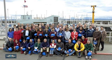 In March, NOAA's Office
of Response and Restoration (OR&R) Emergency Response Division (ERD) met for an all-hands retreat in Seattle, Washington. During the retreat, relationships were
built with internal and external partners and a Three-Year Operating Plan was formulated. ERD facilitates spill prevention, preparedness, response, and restoration at
national and local levels. Specialists in ERD provide scientific expertise to support oil and chemical spill responses in U.S. coastal waters and offer tools, training,
and information to emergency responders and planners. ERD provides scientific expertise to support an incident response and helps the OR&R Assessment and Restoration
Division initiate a natural resource damage assessment. This integrated approach provides for an efficient and effective response, minimizing the harm to people, reducing the
negative impacts to the economy, and enhancing environmental recovery. Pictured above are the participants of the all-hands retreat.
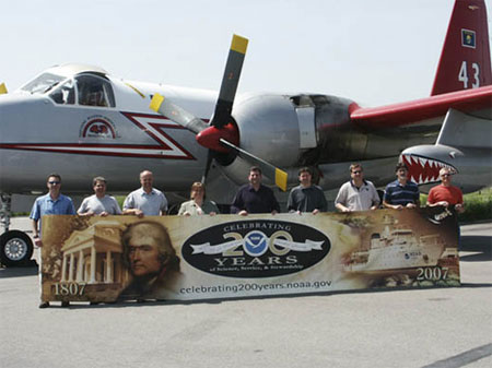 As part of NOAA's year-long 200th celebration, the Weather
Forecast Office Missoula recently held two Open House events for local businesses, partners, and the general public. Activities included facility tours, experiments for
kids, a slide show on the history of the National Weather Service, demonstrations of Missoula's Web page, and an overview of weather forecast and warning procedures.
Special NOAA and National Weather Service celebration cakes were baked for the events. Over 100 spotters, media, HAM radio operators, emergency managers, 911, U.S.
Forest Service employees, and Fire Department personnel as well as a representative from Senator Jon Tester's office attended. Pictured here, the Missoula staff are
standing in front of a "Slurry" Bomber on Neptune Aviation's airfield, which is used to drop fire retardant on wild fires. Shown (from left): Ray Nickless, Peter Felsch,
Bruce Bauck, Michelle Mead, Bryan Henry, Steve Sigler, Bob Nester, Eugene Petrescu, and Mike Johnson.
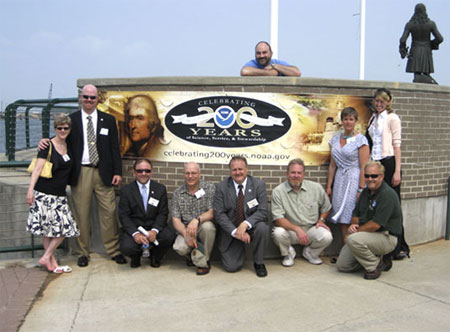 What better way to celebrate 200 years of science than the dedication of NOAA's 200th
operational tide gage in Mobile, Alabama! The Mobile State Docks tide gage is part of the NOAA’s National Water Level Observation Network (NWLON). The NOAA team you see is directly
involved with the installation and operation of this observational network. Shown (from left): Gina Stoney, Darren Wright, Jack Dunnigan, Tom Landon, Mike Szabados, Brad Wynn, Rick James,
Kate Bosley, Heidi Keller and Bruce Servary (at top of photo). The Mobile State Docks tide gage is also the first sensor installed as part of the Mobile Physical Oceanographic Real-Time
System (PORTS) scheduled for installation later this summer.
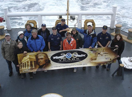 Several NOAA representatives and
other guests recently participated in a NOAA-funded marine debris removal project off the north Oregon Coast. Derelict trawl nets have been lost in close proximity to
undersea fiber-optic cables that carry vast amounts of digital data from North America across the Pacific. A partnership between Oregon's commercial fishing industry,
Tyco Telecommunications, Oregon Sea Grant, and the U.S. Coast Guard worked collaboratively to retrieve the nets, using precise recovery methods in order to avoid
damaging the very expensive undersea cables. The 215-foot Coast Guard Cutter FIR transported personnel to rendezvous with the F/V Seeker (a 98' Alaska class trawler),
which carried out the recovery operations. Pictured (from left): David Crouse (NOAA), LT Jessica Daum (NOAA), Patty Burke (Oregon Dept of Fish and Wildlife), Michael
Bendixon (Oregon Public Broadcasting), Terry Thompson (Lincoln County Commissioner), Mike Crouse (NOAA), LCDR Tim Brown (USCG), LT Johnny Backus (USCG), Steve
Theberge (Oregon Sea Grant), Jill Smith (Oregon Dept of Fish and Wildlife), Barry Thom (NOAA), LCDR Andy Raiha (USCG), and Megan Callahan Grant (NOAA).
 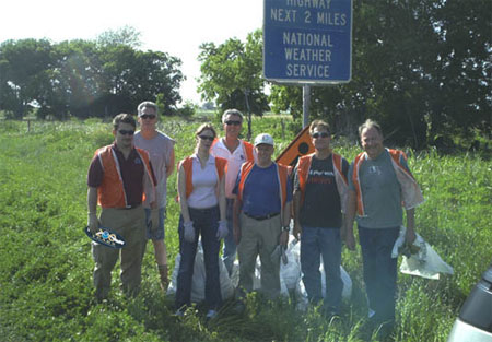 Volunteers from the Austin/San Antonio National Weather
Service Office participated in an Adopt-a-Highway litter program in April to support their community. The Austin/San Antonio Office located in New Braunfels,
has about 25 employees, and serves 33 counties of South Central Texas and the Texas Hill Country. South Central Texas experiences a wide variety of weather, but heavy
rains and flooding are quite common and can occur almost any time, and this area of the country has been coined "Flash Flood Alley" because of the high occurrence of and
threat from flash flooding. The day's participants were (from left): Monte Oaks, Jim Ellis, Marianne Sutton, David Schumacher, Bob Fogarty, Dale Lininger, and Jim
Ward (retired National Weather Service).
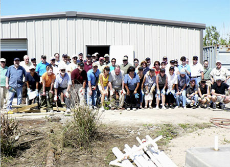 Taking time out from the annual meeting
between the eight Regional Fishery Management Councils and the National Marine Fisheries Service, NOAA Assistant Administrator Bill Hogarth (pictured first row center)
led over 45 fishery managers from around the country on a restoration and cleanup activity to aid a local fisherman and his family. The volunteer effort involved debris
cleanup and constructing a new crab-shedding system in east New Orleans for the Gerica family, whose boats and house were swallowed by Hurricane Katrina's surge. This
year's meeting, hosted by the Gulf of Mexico Fishery Management Council in New Orleans, afforded Council members and their staff, as well as NOAA Fisheries Regional
Directors and other Fisheries Service Directors and staff, the opportunity to see firsthand the impact of the 2005 hurricanes on Gulf fisheries and infrastructure.
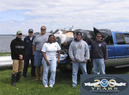 Greetings from Newport, Rhode Island! The crew from NOAA Ship HENRY B. BIGELOW recently led the Naval Station Newport
annual Shoreline Cleanup on May 21. Their efforts helped to keep over a half mile of beach free from debris, trash and plastic. Pictured (from left): Pete Gamache, ENS Patrick Sweeney, Mike
Murray, Ava Dent, CDR Stephen Beckwith, and LCDR Scott Sirois.
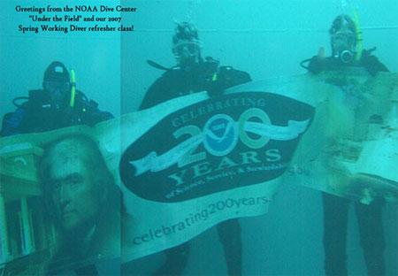 Greetings from the NOAA Diving Program (NDP) headquartered at the NOAA Diving Center in
Seattle, Washington. NDP trains, certifies, and equips NOAA divers to perform the variety of tasks carried out underwater to understand, manage, and conserve our
nation's marine resources. This photo is from our four-day, spring refresher training (to recertify NOAA Working Diver's after prolonged diving inactivity). The divers
are performing checkout dives in the Dive Center's 30-foot tall, 40,000-gallon training tower. Pictured (from left): LT Stephanie Koes, Bill Gordon, and LT Earl
Spencer.
 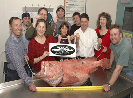 Greetings from Alaska Fisheries Science Center (AFSC) in Seattle, Washington. Pictured
here is one of the largest Shortraker Rockfish ever seen. This Shortraker Rockfish was caught in a commercial fishing net in the Bering Sea in the winter of 2007, then
frozen and donated to AFSC for research. The fish weighed in at 62 pounds and was measured at 112 centimeters (44.1 inches). Scientists with the AFSC Age and Growth
Lab took otoliths (ear bones) from the fish to determine its age. After viewing the otoliths under a microscope, it was determined that the age of the fish was between
90 to 115 years old. Pictured with the now famous fish are several Science Center staff. From left: Jerry Berger, Dan Foy, Glenn Campbell, Karen Teig, Charles
Hutchinson, Susan Mcdermott, Brian Mason, Allison Barns, and Olav Ormseth.
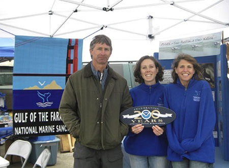 Personnel from NOAA's
Gulf of the Farallones National Marine Sanctuary and the U.S. Fish and Wildlife Service teamed up to promote the Sanctuary's Seabird Colony Protection Program at the
2007 Pacific Coast Dream Machines event. This community event in Half Moon Bay, California, attracts thousands of automobile and aviation enthusiasts every year. The
multi-agency program is designed to improve the survival of California's seabird populations by reducing human disturbances at their breeding and roosting sites on the
North-Central California Coast. Program staff provided information to pilots showing the effects of low overflights on seabird colonies and current Sanctuary regulations
regarding approach distances. Pictured (from left): Gerry McChesney, US Fish & Wildlife Service; Kelley Higgason, Gulf of the Farallones National Marine Sanctuary;
and Karen Reyna, Gulf of the Farallones National Marine Sanctuary.
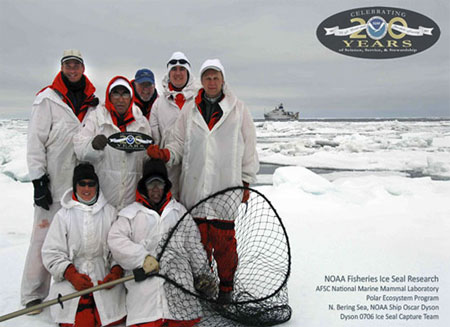 The Alaska Fisheries Science Center's National Marine
Mammal Laboratory (NMML) conducted research on four species of arctic ice breeding seals in the northeastern Bering Sea. The NMML Polar Ecosystem Program was aboard
the U.S. Coast Guard ice-breaker Healy from April 10 to June 18, 2007, and the NOAA Ship Oscar Dyson from May 3 to May 31, 2007. Using aerial abundance surveys and
seal-borne satellite transmitters, researchers are collecting data useful for estimating the population sizes, distributions, and habitat use of these species.
Pictured (from left): John Jansen, Heather Zeil, John Goodwin, Shannon Fitzgerald, Dan Savetilik, Josh London, and Peter Boveng.
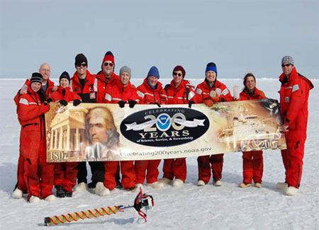 The BEST Scientists on Ice – The Bering Ecosystem Study
(BEST) aims to understand the Bering Sea ecosystem and the potential consequences for the loss of sea ice that accompanies global warming. During the April 2007 cruise
aboard the U.S. Coast Guard Icebreaker Healy, scientists sampled the sea ice and the water below for ice algae, trace metals, nutrients, oxygen production, dissolved
gases, temperature, and salinity. Scientists from NOAA's Pacific Marine Environmental Laboratory and the Alaska Fisheries Science Center joint Ecosystems and
Fisheries-Oceanography Coordinated Investigations are participating in the National Science Foundation-sponsored project. Shown (from left): Brianna Blaud (NOAA/AFSC),
Calvin Mordy (Univ. of Washington/JISAO), A. J. LeFevre (NOAA/AFSC), Dylan Righi (Univ. of Washington/JISAO), Edward Cokelet (NOAA/PMEL), Didier Burdloff (Lamont Doherty
Earth Observatory), Nancy Kachel (Univ. of Washington/JISAO), David Kachel (NOAA/PMEL), Jeffrey Napp (NOAA/AFSC), Alex De Robertis (NOAA/AFSC) and Robert Freyer
(NOAA/AFSC).
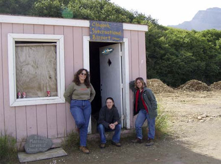 200th Greetings from the small fishing community of Chignik,
Alaska! On the south shore of the Alaska Peninsula, about 250 miles southwest of Kodiak, is the small fishing community of Chignik. Residents of Chignik and two
nearby villages fish for sockeye salmon at the mouth of the Chignik River and cod, crab, sablefish, halibut, and herring in nearby waters. NOAA anthropologists were
conducting field research where they worked with local fishermen and community members to better understand the effects of fisheries policies and Steller sea lion
protection measures in these communities. The only access to the communities is by small airplane or by boat. Pictured (from left) are anthropologists Dr. Palma
Ingles, now with National Marine Fisheries Service Southeast Regional Office, graduate student Amanda Poole, and Dr. Jennifer Sepez of the National Marine Fisheries
Service Alaska Fisheries Science Center as they wait for a small commuter plane to pick them up at the Chignik International Airport.
 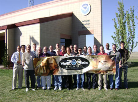 The U.S. Weather Bureau realized
the importance of Amarillo, Texas, as a hub of transportation and agriculture, and opened an office in Amarillo in 1892. Today, the National Weather Service Amarillo provides
services to the citizens of the Texas and Oklahoma Panhandles and supports a diverse customer base. The National Weather Service Amarillo was awarded a Bronze Medal for
providing warnings and forecasts to emergency managers and firefighters battling the Texas Panhandle wildfires of March and April 2006, which resulted in the largest wildfire
acreage ever in Texas. Their team recently worked the 28 March 2007 tornado outbreak, which has become the largest tornado outbreak for any 24-hour period in the Texas and
Oklahoma Panhandles during the month of March. They have confirmed at least 28 tornadoes so far this year – the most tornadoes ever observed in the Amarillo area for so
early in the season. (Front row, from left): Glen Woodall, Rich Wynne, Chris Kimble, Tabatha Tripp, Ed Andrade, Scott Plischke, Mike Johnson, Dave Wilburn;
(back row, from left): Jose Garcia, Roland Nuñez, J.J. Brost, Steve Bilodeau, Ken Hunter, Steve Drillette, Lance Goehring, Ken Schneider, David Hennig, John Cockrell,
Jason Jordan, Oferal Wise, and Matthew Kramar.
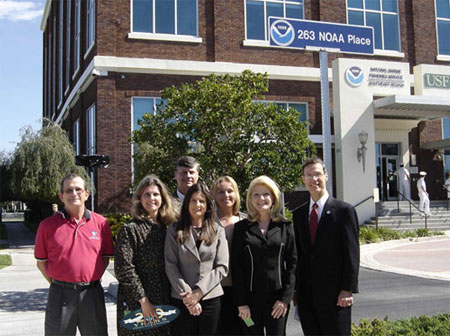 The NOAA Fisheries Service Southeast Regional
Office unveiled their new address, "263 NOAA Place," with the help of NOAA Administrator VADM Conrad Lautenbacher. VADM Lautenbacher and Regional Administrator Dr.
Roy Crabtree are standing with the Employees of the Year from the Southeast Regional Office. Located in St. Petersburg, Florida, the Southeast Regional Office is
responsible for managing and conserving fish populations, protected resources, and habitat from Texas to North Carolina, including the U.S. Caribbean. Pictured
(from left): Phil Steele, Monica Smit-Brunello, Dr. Roy Crabtree, Becky Stanley, Kim Amendola, Cheryl Franzen, and VADM Lautenbacher.
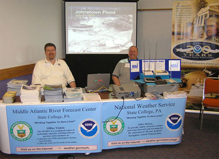 Peter Jung, Senior Service Hydrologist (left),
and William Gartner, forecaster (right), staff a booth at the recent Open House held at the co-located Weather Forecast Office and Middle Atlantic River Forecast Center
facility in State College, Pennsylvania. The National Weather Service teams with other state and federal agencies to provide weather and hydrologic services to the
citizens of the Commonwealth of Pennsylvania. The United States Geologic Survey, United States Army Corps of Engineers, and the Susquehanna River Basin Commission, a
federal interstate compact, participated in the event to discuss weather and water issues with the community.
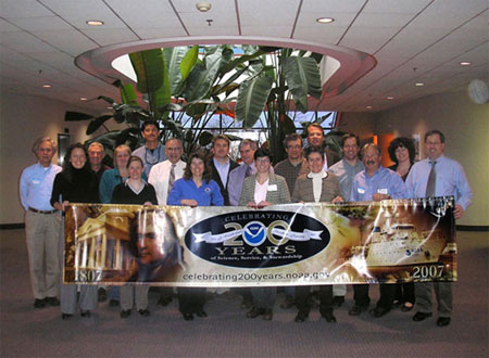 The first retreat of the North Atlantic Regional Team (NART), a cross-section of NOAA
leaders collaborating and seeking innovative solutions to environmental issues facing NOAA, took place at the National Weather Service's Eastern Region Headquarters in Bohemia, New York.
Team members learned about each other's line office responsibilities, defined regional priorities for this year and the future, and conceptualized an outreach and communication plan to
engage NOAA representatives as well as regional and national partners. Front row (from left): Betsy Nicholson, Jennifer Costanza, Amy Holman, Ellen Mecray, Kathi Rodrigues, Bill O'Beirne,
and Anthony Siebers. Second row (from left): Ronald Schlitz, Brian Gross, Darlene Finch, Steve Giordano, Dean Gulezian, Scott Mowery, Robert Thompson, Hernan Garcia, Peter Gabrielsen,
Peyton Robertson, and Molly Baringer.
 The
National Weather Service in Charleston, South Carolina, participated in the Beaufort South Carolina Marine Corps Air Station Blue Angel Air Show on April 21st and 22nd. Pictured are
meteorologists Wendy Moen (left) and Robyn Van Dyke (right) in front of a few F/A-18 Marine aircraft stationed at the base. The Charleston National Weather Service Office had an outreach
tent located just feet away from the runways where the Blue Angels and other stunt planes and aircraft performed to an estimated 100,000 visitors.
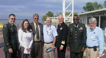 Greetings from the Mississippi River, near Memphis, Tennessee!
During its annual high-water inspection tour aboard the M/V MISSISSIPPI, members of the Mississippi River Commission (MRC) stopped for a photo with staff from
NOAA's Memphis Weather Forecast Office. The inter-agency MRC, established in 1879, is composed of seven members, including the NOAA position held by RADM Sam De Bow,
director of the NOAA Corps and NOAA's Office of Marine and Aviation Operations. The MRC provides leadership on environmental issues affecting the Mississippi River.
The river is critical to the nation's economy and transport of imported and exported goods to and from the heartland. Pictured (from left): COL Charles
Smithers (MRC), Kristin Scotten (NWS), Danny Redd (Captain, MISSISSIPPI), Zwemer Ingram (NWS), RADM Samuel De Bow (OMAO), BG Robert Crear (MRC), and Gene
Rench (NWS).
 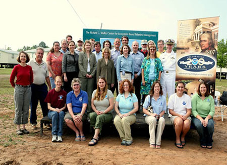 NOAA employees from around the Gulf of Mexico participated in the "Discover 200 Years of NOAA" day-long
community festival held at the Dauphin Island Sea Lab in Alabama, raising awareness of NOAA programs among the festival's 3,000 visitors. NOAA offices who participated include: Pascagoula
Florida Lab, the Grand Bay National Estuarine Research Reserve, the National Marine Fisheries Service (Panama City Beach, Florida), the National Weather Service, the NOAA
Restoration Center (St. Petersberg, Florida), the NOAA Coast Survey (LaFayette, Lousiana), and the Weeks Bay National Estuarine Research Reserve.
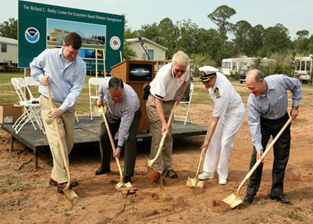 As part of the 200th Celebration "Discover 200 Years of NOAA" day-long
community festival held at the Dauphin Island Sea Lab in Alabama, NOAA leadership participated in a groundbreaking ceremony for the new Richard C. Shelby Center
for Ecosystem Based Fisheries Management lab. The day-long outreach event attracted 3,000 people, of which many were children who participated in the numerous
hands-on education activities provided by NOAA offices from throughout the Gulf of Mexico. Bearing golden shovels: (from left) Ryan Welch (Legislative Director for
Senator Shelby's office), Tim Keeney, George Crozier, Captain Rick Brown, and Rick Spinrad.
 NOAA's National Climatic Data Center
(NCDC) in Asheville, North Carolina, and the Asheville Chapter of the American Meteorological Society hosted a series of three lectures on Climate Change as part of
NOAA's 200th celebration. Each lecture featured an NCDC scientist: first lecture, Dr. Tom Peterson (upper left); second lecture, Dr. David M. Anderson (right); and the
final lecture, NCDC Director Dr. Tom Karl (center). The final lecture was attended by over 300 including correspondents from China, France, Germany, Japan, Norway,
Slovenia, Spain, and Sweden (arrangements by Mr. Keith Peterson, U.S. State Department, Washington foreign Press Center).
 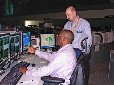 Shown in this picture are Al Williams
(seated) and Tom Boyd monitoring the GOES-11 spacecraft from the Satellite Operations Control Center.
 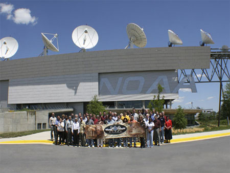 200th celebration greetings from the NOAA Satellite Operations facility in Suitland, Maryland.
The new NOAA Satellite Operations Facility is home to the Operations Control Center, which provides command, control, and communications for NOAA's satellites and the
Defense Meteorological Satellite Program; a computer center that processes and distributes operational satellite data and products that support weather, climate, land,
and oceanography users; the U.S. Mission Control Center for the Search and Rescue Satellite-Aided Tracking program, called COSPAS-SARSAT; and the National Ice Center,
operated by NOAA, the U.S. Navy, and the U.S. Coast Guard. Pictured above are some of the approximately 550 employees who work at the new facility, which was officially
dedicated on June 11, 2007.
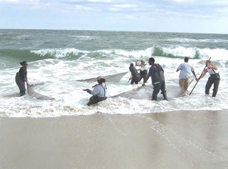 Greetings from Maryland's eastern shore! NOAA's Office of Education sent this photograph of
fieldwork led by Dr. Joseph Love, a faculty researcher with the NOAA Living Marine Resources Cooperative Science Center at the University of Maryland Eastern Shore.
Dr. Love took his undergraduate and graduate students on a two-day field trip to Assateague Island for a variety of sampling activities. The students are sampling for
fishes in the surf zone on the island. The mission of the Center is to conduct research congruent with the interests of NOAA Fisheries and to prepare students for
careers in research, management, and public policy that support the sustainable harvest and conservation of our nation's living marine resources. The Center is a part
of NOAA's Educational Partnership Program with Minority Serving Institutions. To date, 311 University of Maryland Eastern Shore students have participated in the program
and several are now NOAA researchers or scientists. Pictured are (from left): Danielle Taylor, Dr. Joseph Love, Ryan Corbin, Greg Oliver, Brandon Fortt, and Reginald
Black.
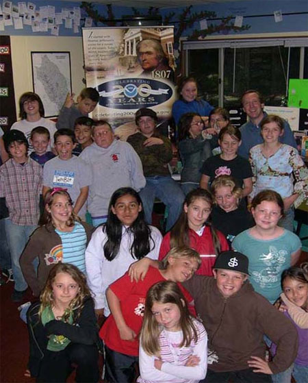 Warning Coordination Meteorologist Dave Soroka from the National Weather Service
Weather Forecast Office in Monterey, California, gave three lectures on March 27, 2007, with topics including the Weather Service Mission, Weather Safety, Hydrological
Cycle, Drawing Isobars, and Severe Weather. In this photo, Dave is shown with a group of 4th and 5th grade students from San Lorenzo Elementary School in Felton,
California.
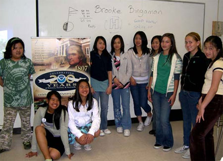 200th Celebration greetings from Monterey, California. Brooke Bingaman and Dave Soroka from the National Weather Service Weather
Forecast Office in Monterey participated in several community outreach programs for local middle and elementary school students. The 29th annual San Jose State University (SJSU) "Expanding Your
Horizons" Conference took place at SJSU on Saturday, March 17, 2007. Approximately 800 young women and 200 accompanying adults attended the conference. This annual event is a great success at
encouraging young women's interest in science and math. National Weather Service forecaster Brooke Binagman provided multiple presentations to the participants.
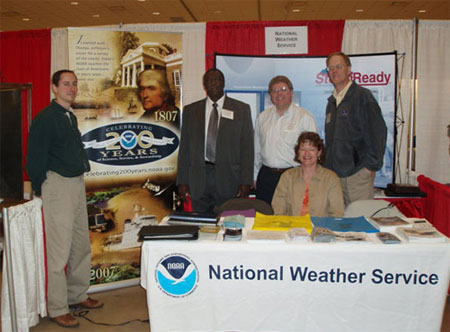 Warning Coordination Meteorologists (WCMs) with NOAA's National Weather Service are spreading the
word about severe weather safety at the 40th Annual Wisconsin Governor's Conference on Homeland Security that was recently held in La Crosse, Wisconsin. WCMs routinely
work with NOAA partners in a support and informational role, often times meeting with officials ranging from the federal to the local level as a link between NOAA and
the communities. In this photo, WCMs with service in Wisconsin stand with the Administrator of Wisconsin Emergency Management, celebrating 200 years of NOAA, at an
informational booth. Shown (from left): Todd Shea, Johnnie L. Smith (Administrator, Wisconsin Emergency Management), Todd Krause, Carol Christenson [seated], and
Anton 'Rusty' Kapela.
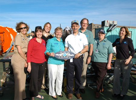 The Tradition Continues! NOAA's National Marine Sanctuary Program continued the 200-year tradition of
mapping by participating in a ground-breaking expedition, featuring more than a dozen partners. The Secrets of the Gulf expedition built on previous mapping work
coordinated by the Flower Garden Banks National Marine Sanctuary. Sanctuary researchers explored the deeper water low-relief ridges and scarps that connect the various
banks along the continental shelf in the northwestern Gulf of Mexico, including two of the three banks that comprise the Flower Garden Banks National Marine Sanctuary.
Their mission was to observe and document plants and animals that use these 'hidden highways' between the banks to determine how the sanctuary may be affected by events
that occur outside its boundaries. University of Rhode Island researchers, led by Dr. Robert Ballard, explored the same areas for evidence of ancient shorelines and the
people who may have lived there. They used the sophisticated technology on the Navy's only nuclear research submarine to conduct even higher-definition mapping data of
those areas thought to be the Texas/Louisiana shoreline 12 to 20 thousand years ago. Shown in photo: (from left) LTJG Lindsay Kurelja, Jennifer Morgan, Ensign Kyle
Byers, Kelly Drinnen, Sanctuary Sam (NMSP Spokes Sealion), Lou Cafiero, George Schmahl, Shelley Du Puy, and Emma Hickerson.
