
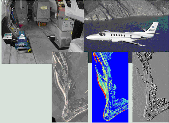
Images from the NGS sensor fusion project. Top: hyperspectral imager, high-resolution digital camera, and lidar system installed in a NOAA Cessna Citation (top right). Bottom: examples of derived data products. These are all examples from a data fusion project completed by the National Geodetic Survey in which a hyperspectral imager (i.e., a sensor that collects data in dozens to hundreds of narrow, contiguous spectral bands), an airborne lidar system, and a high-resolution digital aerial camera were operated simultaneously from a NOAA Cessna Citation aircraft.