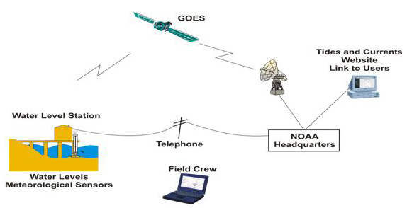
This illustration shows the typical path for Next Generation Water Level Measurement System data to ultimately travel to NOAA Headquarters where it can be processed.
With the NOAA 200th Celebration coming to a close at the end of 2007, maintenance of this Web site ceased. Updates to the site are no longer being made.

This illustration shows the typical path for Next Generation Water Level Measurement System data to ultimately travel to NOAA Headquarters where it can be processed.