
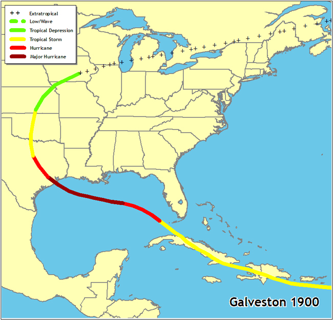
This map shows the approximate path of the 1900 Galveston hurricane. This killer weather system was first detected over the tropical Atlantic on August 27. While the history of the track and intensity is not fully known, the system reached Cuba as a tropical storm on September 3 and moved into the southeastern Gulf of Mexico on the 5th. A general west-northwestward motion occurred over the Gulf accompanied by rapid intensification. By the time the storm reached the Texas coast south of Galveston late on September 8, it was a Category 4 hurricane. After landfall, the cyclone turned northward through the Great Plains. It became extratropical and turned east-northeastward on September 11, passing across the Great Lakes, New England, and southeastern Canada. It was last spotted over the north Atlantic on September 15.