David Simonds Johnson: Ardent Champion of Satellite Technology
- A Half Century of Service
- Earth Observation Satellites
- International Use of U.S. Satellites
- Mentor & Advocate for NOAA
A Half Century of Service
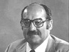
David Johnson joined the Weather Bureau in 1956 and worked tirelessly throughout his career to advance the use of satellites for weather forecasting and other earth observations. Beginning in 1976, he served as first assistant adminstrator of NOAA's National Environmental Satellite, Data, and Information Service until retiring in 1982. Click image for larger view.
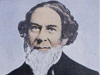
David Simonds Johnson (1924-2005) was a meteorologist and administrator for NOAA for over a quarter-century, serving as the first assistant administrator of the National Environmental Satellite, Data, and Information Service (NESDIS). Widely regarded as a pioneer in satellite technology, Johnson combined a world-class knowledge of science with an ability to communicate science to ordinary people as well as his professional colleagues. This marriage of intellect and affability enabled him to excel both as a meteorologist and as an advocate for NOAA.
Born in Potterville, California, in 1924, Johnson studied at the University of California, Berkeley, and Reed College at Harvard University. After transferring to the University of California, Los Angeles, he earned his bachelor's degree in 1948 and a master's degree in meteorology in 1949. Johnson joined the U.S. Weather Bureau in 1956 as one of the four founding members of what was then called the Meteorological Satellite Activities (MSA) Branch in Suitland, Maryland. For the next 26 years, he served as the director of the successor organizations to MSA, which included the Meteorological Satellite Laboratory, National Weather Satellite Center, National Environmental Satellite Center, National Environmental Satellite Service, and finally the National Environmental Satellite, Data, and Information Service. In 1976, Johnson became the first assistant administrator of NOAA for satellites and data.Two Series of Earth Observation Satellites
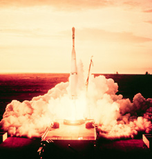
The launch of the polar-orbiting TIROS I atop a Thor-Able rocket in 1960 marked the birth of the meteorological satellite system. It demonstrated the ability to acquire images to aid weather forecasting over much of the planet. Following the launch, David Johnson became chief of the Weather Bureau's Meteorological Satellite Laboratory. Click image for larger view.
Johnson routinely paved the way for modern satellite technology in NOAA. Above all, he worked for innovation and reliability in NESDIS products. He oversaw creation of two series of earth observation satellites in use today: polar-orbiting environmental satellites (designated TIROS and later NOAA) and geostationary operational environmental satellites (designated GOES).
Following a nearly circular path around the Earth, polar-orbiting satellites track atmospheric conditions that eventually affect the weather and climate of the United States and are able to image the entire Earth twice daily. Geostationary satellites follow the equatorial plane of the Earth at a speed matching the Earth's rotation, allowing them to “hover” continuously over one position on the surface.
Johnson helped to create and advance the geostationary operational environmental satellites (GOES), like the one shown here, that “hover” 22,300 miles above the earth. Click image for larger view. 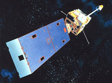
This “geosynchronous” plane is about 35,800 km (22,300 mi) above the Earth, high enough to allow the satellites a full view of the Western Hemisphere. These two series of satellites have produced great quantities of data that, among other things, allow for increased warning times for severe weather and a better understanding of the meteorological trends and cycles of the Earth.
Promoting International Use of U.S. Satellites
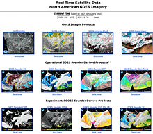
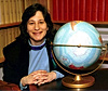
Johnson championed efforts to share U.S. satellite data with other nations throughout his career with NOAA and before the age of the Internet. Now satellite imagery, above, is available in real time on the World Wide Web. Besides weather features, imagery from NOAA satellites shows fire, snow and ice cover, volcanic eruptions, dust storms, and floods on Earth. Click image for larger view.
Johnson also valued cooperation not only among U.S. federal agencies, but also among nations. In the early 1960s, while serving as the president of the American Meteorological Society, he brokered an agreement with the People’s Republic of China to share meteorological data. He also established a “weather hotline” allowing near-real-time data exchange between the U.S. Weather Bureau and the former Soviet Union. To encourage international use of weather satellites, he conceived and supported round-the-clock dissemination of U.S. weather satellite data for easy access by any country. These and other similar agreements led to creation of the current Global Telecommunications System operated among nearly 200 members of the World Meteorological Organization.
Mentor and Tireless Advocate for NOAA
Among his many attributes, Johnson was an enthusiastic mentor of young scientists. Because of this, the National Space Club named an award for him in 1999. The NOAA David Johnson Award, presented annually, recognizes one young scientist who “encourages new thinking, problem solving, or applications of satellite data.” This award truly captures Johnson’s belief in encouraging emerging talent.
Whether advocating for the worldwide availability of weather satellite data or inspiring young meteorologists, this eminent scientist worked tirelessly to achieve the goals of NOAA. His accomplishments established the foundations for many of the data products that are vital to modern weather forecasting and earth observation, and his style and ability for communicating earth science is a quality to be emulated.