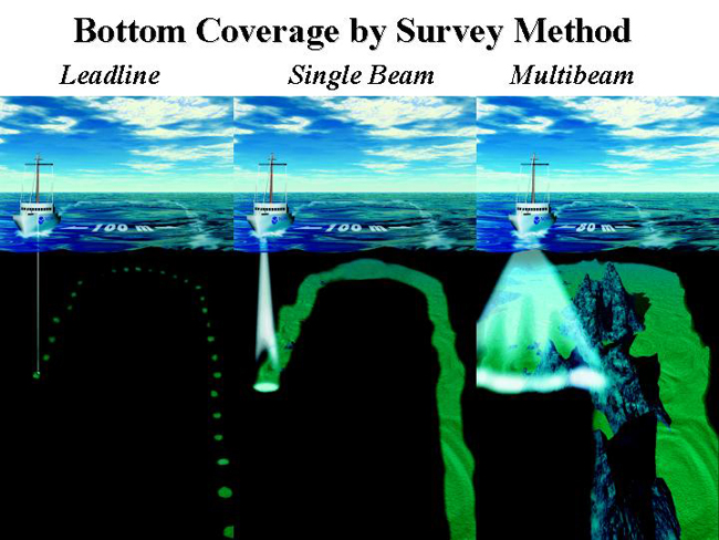
Hydrographic surveying techniques and procedures have changed over time with evolving technology. Multibeam sonar technology makes it possible to collect 100 percent bottom coverage of an area and creates large volumes of data. The Coast Survey’s Hydrographic Survey Division continues to perform research and evaluation of emerging technologies. For example, interferometric sonar systems are capable of providing large swath bathymetry in shallow water that has the potential to greatly improve NOAA's charting capabilities in shallow, near-shore areas.

