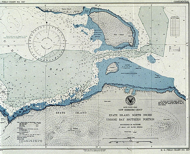
One of the 64,000 copies of maps and charts produced on the Pathfinder. This chart shows Efate Island, which is about 1,100 miles east of Australia.
High resolution available. (366 Kb, 1292x1052).
With the NOAA 200th Celebration coming to a close at the end of 2007, maintenance of this Web site ceased. Updates to the site are no longer being made.

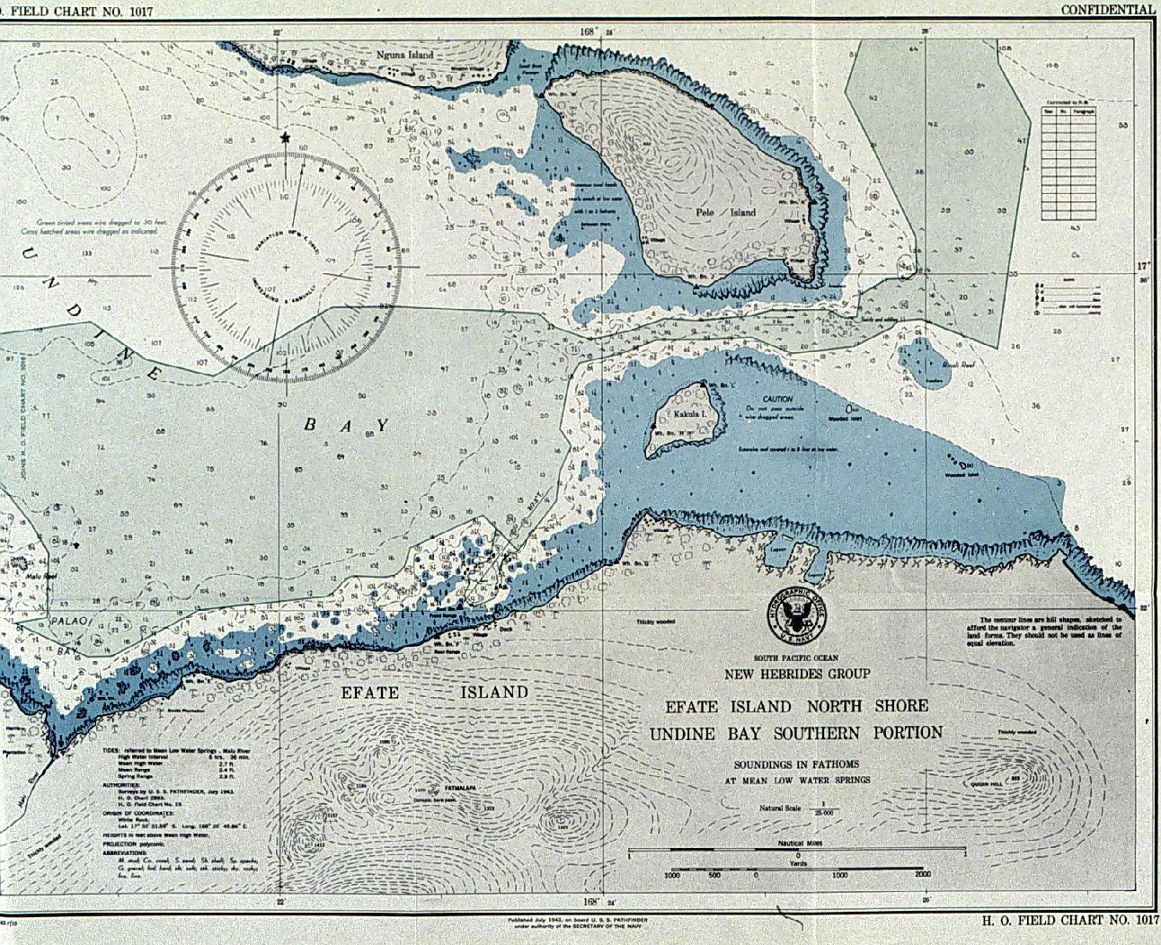
One of the 64,000 copies of maps and charts produced on the Pathfinder. This chart shows Efate Island, which is about 1,100 miles east of Australia.
High resolution available. (366 Kb, 1292x1052).