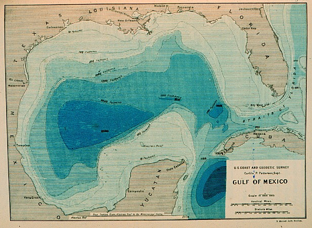
Coast and Geodetic Survey personnel developed the first realistic bathymetric map of any oceanic basin (above) from 3,000 soundings taken on the Survey Steamer Blake between 1873 and 1875 in the Gulf of Mexico.
With the NOAA 200th Celebration coming to a close at the end of 2007, maintenance of this Web site ceased. Updates to the site are no longer being made.

Coast and Geodetic Survey personnel developed the first realistic bathymetric map of any oceanic basin (above) from 3,000 soundings taken on the Survey Steamer Blake between 1873 and 1875 in the Gulf of Mexico.