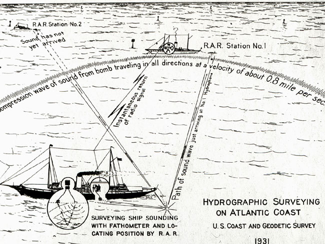
Schematic representation of radio acoustic ranging (RAR). Hydrographic surveyors used RAR to establish their position at sea by combining sound waves and radio signals. Click here for a more complete discussion of RAR.
With the NOAA 200th Celebration coming to a close at the end of 2007, maintenance of this Web site ceased. Updates to the site are no longer being made.

Schematic representation of radio acoustic ranging (RAR). Hydrographic surveyors used RAR to establish their position at sea by combining sound waves and radio signals. Click here for a more complete discussion of RAR.