Postcards from the Field June 2007
As part of the 200th Celebration, we have asked staff from around NOAA to send in their "Postcards from the Field." A "postcard" is a photo from a NOAA field office, science center, or any site on the globe where NOAA is conducting research or field work. The postcard includes—anywhere in the shot—a NOAA 200th emblem or banner.
For more information about "Postcards from the Field," including details about how to participate, please contact David.P.Miller@noaa.gov.
This creative collection of images showcases the breadth and span of NOAA's work...whether it involves conducting research at the South Pole, surveying the ocean floor in Alaska, or flying into hurricanes, NOAA is there. Click on the arrows to browse through postcards submitted thus far.


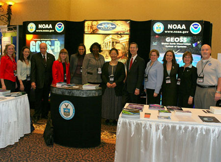 In April, the 200th Celebration sponsored school tours at the National Space Symposium and
held an art contest with Colorado Springs, Colorado, area school children themed "200 Years of Exploring Your World." VADM Conrad Lautenbacher was on hand at the symposium to present awards to the
winners and visit the NOAA booth and its staff from Washington, DC, Silver Spring, Maryland, and Boulder, Colorado. Pictured (from left): Jane Whitcomb, Sam Jacob, Tony Comberiate, Mary Kicza,
Toni Parham, Nina Jackson, Patricia Huff, VADM Conrad Lautenbacher, Renee Leduc Clarke, Karrie Carnes, Adele Stevens, and Ed Erwin.
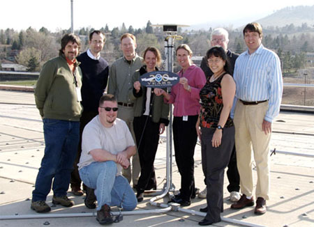 This postcard was photographed on the rooftop of NOAA's David Skaggs Research Center in
Boulder, Colorado, during a meeting of the National Geodetic Survey's Continuously Operating Reference Stations (CORS) program members from Silver Spring, Maryland, and Boulder. The CORS
program provides the backbone for the National Spatial Reference System, which determines latitude, longitude, height, gravity, and the national shoreline for the United States. The group is
standing next to a CORS station which is part of a network of permanently installed geodetic quality Global Positioning System receivers that continuously monitor their position and provide a
wealth of scientific knowledge that contribute to such wide fields as meteorology, plate tectonics, ionospheric mapping, subsidence, and of course, surveying and positioning.
Shown (from left) Jim Tomlin, Giovanni Sella, Ernie Joynt, David Gietka, Pamela Fromhertz, Sue Mclean, Francine Coloma, Bill Denig, and Rob Prentice.
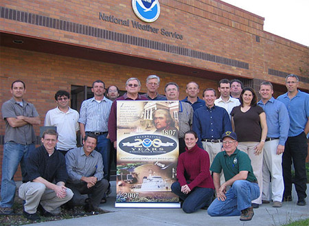
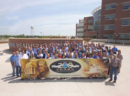 Greetings from the National Weather Center in Norman, Oklahoma! Located in the heart of
tornado alley, the NOAA organizations in Norman are united in their focus on severe weather. Co-location in Norman invigorates collaborations that lead to a rapid transfer of knowledge from
research into technology, training, and improved forecasts and warnings nationwide. NOAA organizations at the center include: the Office of Oceanic and Atmospheric Research National Severe
Storms Laboratory, the National Weather Service Storm Prediction Center, the National Weather Service Norman Forecast Office, the National Weather Service Warning Decision Training Branch,
and the National Weather Service Radar Operations Center. Pictured here are some of the approximately 400 employees of the five NOAA organizations posed in front of the new National Weather
Center. NOAA occupies half of the 244,000-square-foot National Weather Center located on the University of Oklahoma campus. The building was officially dedicated in September 2006.
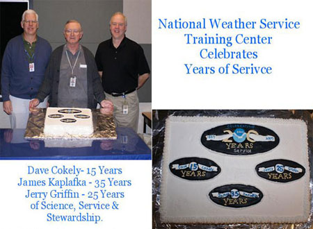 Greetings from the National Weather Service Training Center in Kansas
City, Missouri. The center provides classes in Administration, Aviation Weather Prediction, Advanced Weather Interactive Processing System (AWIPS), Convection and Severe Weather, Engineering,
Forecaster Development, Fire Weather, Hydrology, Hydrometeorology, Interactive Forecast Preparation System (IFPS), Information Technology, Leadership and General Meteorology. In March, the
National Weather Service Training Center celebrated the service of three of its staff members. Top photo (from left) Dave Cokely, hydrologist - celebrating 15 years of service; James Kaplafka,
computer specialist - celebrating 35 years of service; and Jerry Griffin, meteorologist - celebrating 25 years of service. The special cake was provided by NOAA center employee,
Cathy Burgdorf.
 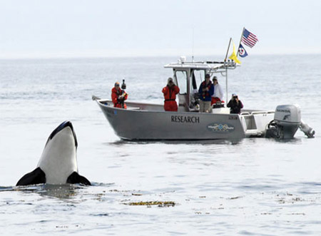 Southern Resident killer whales
suffered a significant population decline in the late 1990s and are now listed as endangered under the U.S. Endangered Species Act. Killer whales are exposed to
disturbances from commercial and private vessels during the summer whale watch season, and whether such vessels change killer whale behavior is still unknown. In July
2006, the crew aboard the National Marine Fisheries Service vessel Noctiluca observed a "spy hopping" Southern Resident killer whale off San Juan Island, Washington.
The Northwest Fisheries Science Center's marine mammal program also conducts innovative research to better understand killer whale ecology, taxonomy, physiology, and
behavior. Shown (from left): Deborah Giles, Erin Ashe, Dr. Dawn Noren, Jaclyn Daly, and Dara Rehder.
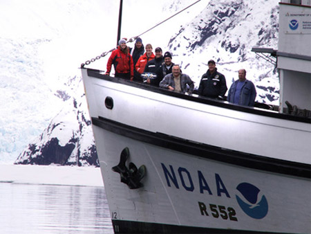 Greetings from the NOAA Ship JOHN N. COBB, during a cruise in March to Tracy Arm in
Southeast Alaska waters! Research needed to be conducted while it was cold enough for the ice to remain solid but just warm enough to allow diving operations. The
ship was supporting NOAA Fisheries' Auke Bay Laboratory's research into shallow water coral and sponge populations. The researchers used SCUBA diving, remotely
operated vehicle operations, and CTD (conductivity, temperature, depth) data to examine the life history and distribution of red tree corals. Good times and hot
chocolate were had by all aboard! In this photo, the ship is in front of the South Sawyer Glacier. Shown (from left): Kris Cieciel, Robert Stone, Jennifer Mondragon,
LT Chad Cary, David Taylor, Bill Lamoureux, LCDR Peter Fischel, and Sam Hardy.
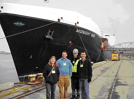 Alaskan National Weather Service employees visited the
M/V Midnight Sun, an 840-foot container ship that makes regularly scheduled freight runs between Anchorage and Tacoma. The vessel is a top-scoring vessel in the Alaska
Region Marine Observation Program and the National Weather Service Voluntary Observing Ship (VOS) Program. On any given day, volunteer crew members on nearly 1,000 ships
around the world observe the weather at their locations, encode each observation in a standard format, and send the data over satellite or radio to the many national
meteorological services that have responsibility for marine weather forecasts. These data are archived for future use by climatologists and other scientists.
Accompanied by Larry Hubble, Alaska Region Port Meteorological Officer, the Weather Forecast Office Anchorage Meteorologists gained valuable insights into the VOS
Program. Chief Mate Russell Horton provided a demonstration of the equipment used to take weather observations and discussed vessel operating capacities as well as the
effects of weather on the ship while underway. In this photo, (from left) Louise Fode, Todd Foisy, Larry Hubble, and Tom Dang are Dockside with the M/V Midnight Sun in
the Port of Anchorage.
  Greetings from the National Weather Service Office in Monterey,
California. Members of the office recently participated in an Emergency Preparedness Fair in Mountain View, California. Shown are personnel from the Monterey office.
Front Row (from left): Brian Tentinger, Dave Reynolds, Brooke Bingaman, and Dan Gudgel. Back Row (from left): Steve Anderson, David Rosenberg, Wayne Bailey, Wilfred Pi,
Bob Benjamin, Jeff Kopps, Jeff Helms, Chris Brenchley, Dave Soroka, Matt Mehle, Mark Strobin, Carolina Walbrun, Ryan Walbrun, and Duane Dykema.
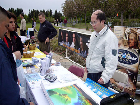 Greetings from the National Weather Service in Monterey,
California! The National Weather Service participated in a recent Emergency Preparedness Fair in Mountain View, California. With the recent wave of strong earthquakes
in the Pacific and potential tsunamis in the coastal areas, there was a lot of interest in a tsunami's impact on the San Francisco Bay Area. With a population of over
seven million, it is extremely important to get tsunami information out to the public. In this photo, meteorologist Wilfred Pi (far right) explains that a NOAA Weather
Radio can broadcast a tsunami watch or warning and activates a tone alarm within minutes of issuance by the Alaska Tsunami Warning Center. He also explained that the
National Weather Service alerts the news media just as quickly, who in turn activate the Emergency Broadcast System.
 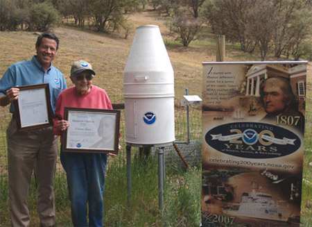 Cooperative
Observer service awards are given to recognize and honor individuals for their service to the National Weather Service. Dave Reynolds, Meteorologist-in-Charge at the National
Weather Service office in Monterey, California, presents Clorene Akers of San Benito County with the Benjamin Franklin Award. This award is given to cooperative observers for
completing 55 years of service. Akers, who has been providing rainfall observations for the past 55 years, just turned 93 and still manages 85 head of cattle on her ranch where
she has lived since 1933.
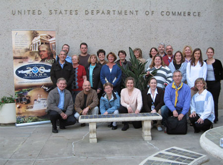 200th Celebration Greetings from the
NOAA Office of General Counsel for Enforcement and Litigation during a recent training conference held at the Southwest Fisheries Science Center! As NOAA's chief
prosecutor, these dedicated attorneys and support staff pursue hundreds of enforcement cases each year and, in fiscal year 2006, recovered almost $3.7 million in
fines and forfeited assets.
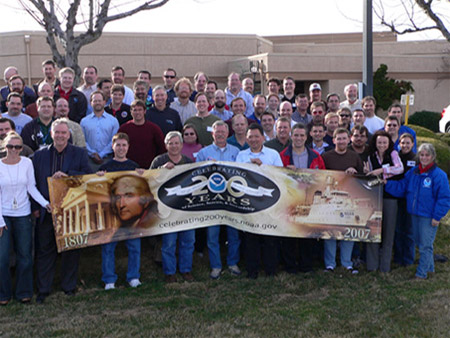 NOAA's National Weather Service
Incident Meteorologists (IMETs) gathered at their annual workshop held in Boise, Idaho. IMETs are specially trained meteorologists who work in the field side-by-side
with firefighters and other emergency personnel during major wildfires on Federal lands and for other incidents. The IMET workshop provides NOAA's IMETs with the
opportunity to share experiences and best practices and to update their skills with the communications technology that provides the unique, "anywhere, anytime" access
to NOAA data and forecasts. Former NWS Director BGEN D.L Johnson, USAF (Ret.) attended this year's workshop to recognize the IMETs for their service during the record
fire year of 2006.
 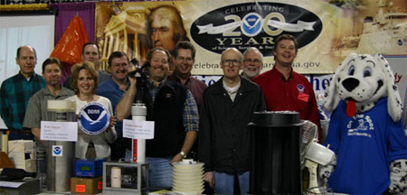 NOAA's National Weather Service in Pocatello, Idaho, teamed up with NOAA's Air
Resources Lab Field Research Division (ARL FRL) in Idaho Falls to showcase weather instruments at their outreach booth in Pocatello. The Air Resources Lab folks maintain a "mesonet"
of weather instrumentation in the Idaho desert that helps them determine dispersion challenges for a variety of real-world scenarios. The National Weather Service uses the data to
help determine the position of frontal boundaries, thunderstorm outflow boundaries, and even for verification of their warnings. Shown (from left): Dennis Finn, Richard Eckman,
Donna Harris, Jason Rich, Shane Beard, Dean Hazen, Kirk Clawson, Neil Hukari, Tom Strong, Rick Dittmann, and Spot.
 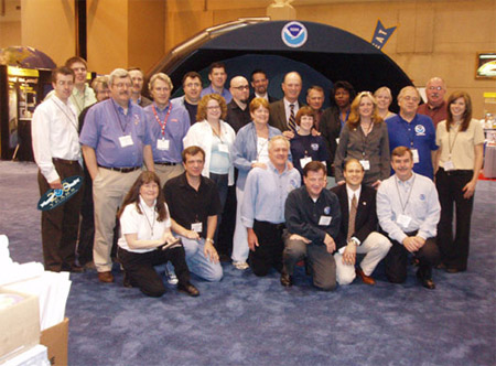 The National Science Teachers Association Annual
Conference attracted over 10,000 science teachers in St. Louis, Missouri, this year. NOAA's 200th Celebration, as well as the International Polar Year, were the theme
and focus for the conference. Nearly 30 sessions, symposiums, workshop, or courses were presented by NOAA employees. Some of the NOAA highlights from the conference
included a tour of the National Weather Service St. Charles, Missouri Forecast Office arranged by Jim Kramper; a plenary talk on Ozone Depletion and Climate Change by
Dr. Susan Solomon, Earth System Research Lab; GPS and Geodesy for Dummies Symposium provided by staff from NOS's Geodetic Survey; the 3-D data visualization of NOAA's
virtual island by Eric Hathathorn; and a plenary talk by well-known oceanographer Bob Ballard, who praised the work of NOAA and it's efforts in education. Shown in the
photo is Bob Ballard surrounded by NOAA staff: Ron Gird, Dennis Cain, Jim Kramper, Ron Przybylinski, Doug Tilly, Peg Steffen, Paul Taylor, Bruce Moravchik, John Brooks,
John Kermond, Frank Niepold, Nina Jackson, Jane Whitcomb, Erica Handleman, Liz McMahon, Les Adams, Jeannine Montgomery, Judy Reeves, Daphne, AL Shewmaker, Joe Shewmaker,
Christos Michalopoulos, Carrie McDougall, Bob Hansen, as well as friends of NOAA, David McConville and Clay Hooker.
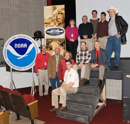 NOAA's National Weather Service in Paducah, Kentucky, sponsored a Severe Weather Seminar
titled "Infamous Tornadoes" at John A. Logan College in Carterville, Illinois. This seminar showcased two renowned researchers in the field of meteorology: Dr. Charles A. Doswell III and Ron
W. Przybylinksi, Science and Operation Officer Weather Forecast Office St. Louis, Missouri. Learning from the past and looking for ways to improve for the future was the theme of this seminar.
Dr. Doswell discussed his preliminary work on reanalyzing aspects of the Tri-State Tornado of 18 March 1925 and thoughts for how a tornado of this magnitude would affect us today. He also
treated the crowd with his views on stormchasing. Mr. Przybylinksi offered his analysis of damage survey results from the November 6, 2005 killer tornado that ravaged the Evansville, Indiana,
area. Shown (top from left): Christine Wielgos, Ron Przybylinksi, David Blanchard, Mike York, and Dr. Charles Doswell. (Bottom from left): Pat Spoden, Shane Luecke, Beverly Poole, Ryan
Presley, Rick Shanklin, and Daniel Spaeth.
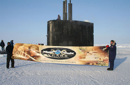 Navy Sends NOAA a North Pole "Postcard From the Field." Commander Mike Bernacchi, (right),
commanding officer of the nuclear-powered attack submarine USS Alexandria, and his shipmate send NOAA a "Postcard from the Field" from atop the world, after the submarine's sail broke
through the ice at the North Pole. The submarine was there with a Royal Navy submarine for "Ice Exercise 2007," at an Arctic Ice Base built for the exercise by the University of
Washington. In addition to the science missions, a film team was on the submarine and at the ice camp filming scenes for the upcoming motion picture, "Stargate SG-1: Continuum."
 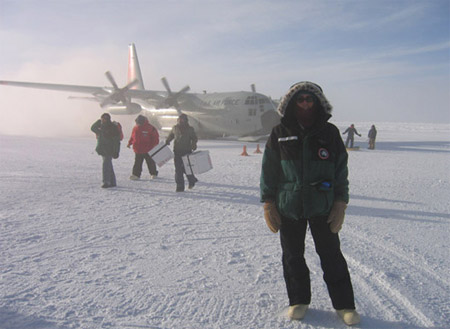 On October 31, 2006, NOAA Earth System
Research Laboratory Global Monitoring Division technician, Emrys Hall, arrived at the Amundsen-Scott South Pole Station, Antarctica. Seen behind Emrys is the first
flight of the 2006/2007 summer season, the ski-equipped New York Air National Guard LC-130, which flew the NOAA staff to the Pole. ESRL has two people stationed at South
Pole year-round to maintain the continuous long-term records of atmospheric variables. These records have documented a wide range of changes in the composition,
chemistry, and radiative balance of the atmosphere over the Antarctic continent since the inception of the measurements. NOAA first began work at South Pole in 1957 and
has had staff working there continuously since 1971.
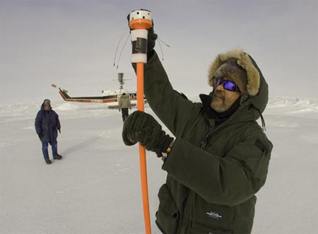 "Saludos" to NOAA on its
200th Celebration from Pablo Clemente-Colon, U.S. National Ice Center (NIC) Chief Scientist. The NIC is a tri-agency operational center bringing together elements from
NOAA, the Navy, and the U.S. Coast Guard to support coastal and marine sea ice operations and research globally. Dr. Clemente-Colon participated in the 2007 Applied
Physics Laboratory Ice Station (APLIS07), a Navy and National Science Foundation (NSF) ice camp established on a multi-year ice floe in the Beaufort Sea, roughly 200
NM north of Prudhoe Bay, Alaska. The NIC is participating directly or indirectly in a significant number of cooperative research and application projects with other
national and international groups as part of International Polar Year (IPY) activities throughout 2007 and 2008. In the photo, the NIC Chief Scientist is making a final
adjustment to a USIABP/IABP ice beacon deployed on a multi-year ice floe 100 NM west of APLIS07 on April 06, 2007. Bruce Elder, CRREL Research Scientist, is observing
in the background while pilot Lambert De Gavere walks back toward the helicopter.
 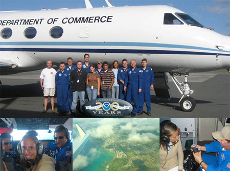 Greetings from Honolulu, Hawaii,
from the crew of the NOAA Gulfstream IV jet and NOAA's Teacher in the Air! During its recent Winter Storms Reconnaissance project for the NOAA National Centers for
Environmental Prediction, the G-IV acquired atmospheric data from severe winter storms originating over the Pacific Ocean that will affect the continental United States,
Hawaii, and Alaska. The data will help improve forecasts released 24 to 96 hours before a winter storm in support of NOAA's goal to serve society's needs for weather and
water information. Joining the G-IV crew on its February 24 mission was Jessica Schwarz, a seventh grade science and math teacher from West Hawaii Explorations Middle School
in Kona, Hawaii. As a participant in the NOAA Teacher in the Air (TIA) Program, an offshoot of the NOAA Teacher at Sea Program, she wrote logs and lessons that correspond
with the G-IV's research. Her work is posted on the NOAA Teacher at Sea Web site at http://www.teacheratsea.noaa.gov. The top photo shows the G-IV crew with TIA Jessica
Schwarz and two University of Hawaii meteorology students. Pictured (from left): Gordon Kitson, Martin Mayeaux, LCDR John Longenecker, Paul Flaherty, Mark Rogers, Cindy
Dettmer, Chuck Rasco, Paul Fuentes, Jessica Schwarz, David Brogan, CDR Jeff Hagan, and LCDR Gregg Glover. Bottom photos (pictured from left): LCDR Gregg Glover, Jessica
Schwarz, and LCDR John Longenecker in the cockpit; G-IV in flight over Honolulu; and Jessica Schwarz and Chuck Rasco preparing a dropsonde for launch during a G-IV mission.
 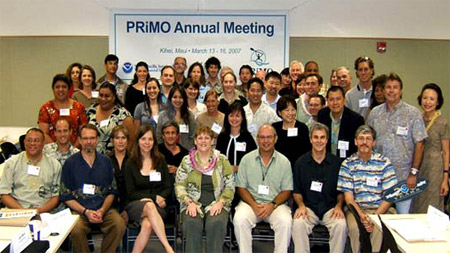 Aloha from Maui! The NOAA Pacific Services Center coordinated the 5th Annual Pacific Risk Management 'Ohana (PRiMO)
meeting. PRiMO is an interagency working group who strives to enhance community resilience by developing and disseminating risk management-related information products
and services in the Pacific Islands. NOAA Offices represented included: the Pacific Services Center, Coastal Services Center, IDEA Center, Office of Oceanic and
Atmospheric Research, Office of Response and Restoration, and the National Weather Service. Other representatives from federal, state, and county governments, as well
as participants from academia, the private sector, and nongovernmental organizations attended the meeting. The meeting was co-hosted with the Pacific Disaster Center
(PDC) and held at their facility in Kihei, Maui.
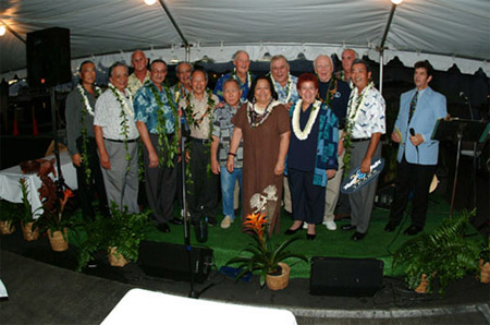 The Western Pacific Regional Fishery
Management Council recently celebrated its 30th anniversary and commemorated NOAA's 200th celebration in Honolulu, Hawaii. Over the years, the Council has promoted
environmentally responsible fishing by banning trawls, drift gillnets, and other destructive fishing gears and by employing side-setting, circle hooks and other
methods to reduce protected species interactions. The Council continues to work towards ecosystem-based management by developing Fishery Ecosystem Plans for the U.S.
Pacific islands archipelagic and pelagic ecosystems. The Council also provides opportunities for native U.S. Pacific islanders to participate in fishing and promotes
the use of traditional knowledge and practices for fishery management. Past and current Council chairs and original Council members (from left): Edwin Ebisui, Frank
Farm Jr., Jim Cook, Paul Stevenson, Peter Reid, Wadsworth Yee, Frank Goto, William Paty, Kitty Simonds (executive director), Frank McCoy, Judith Guthertz, Peter
Fithian, Sean Martin, Roy Morioka, and Mike Buck (emcee).
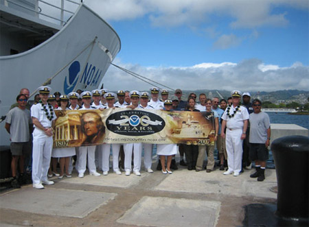 Greetings from Pearl Harbor, Hawaii! The crews of NOAA ships OSCAR ELTON SETTE (pictured) and
HI'IALAKAI join Rear Admiral Samuel P. De Bow Jr. (mid-right), Director, NOAA's Office of Marine and Aviation Operations and NOAA Corps, on Pier F-10. The picture was
taken shortly after the two Hawaii-based ships arrived at their new home port at historic Ford Island, with a third ship to follow later this year. The three NOAA ships
acquire data that primarily support fisheries, coral reef, and oceanographic research. Additional historic building renovations are to be completed this September,
allowing all NOAA ship operations to move out of Snug Harbor to Ford Island. The U.S. Navy has authorized NOAA's exclusive use of a portion of Ford Island for its ship
operations function as part of an upcoming larger NOAA presence — the Pacific Regional Center. The NOAA Pacific Regional Center is a multi-year, multi-phase
construction project to consolidate NOAA programs and operations on the island of Oahu into a single facility on Ford Island.
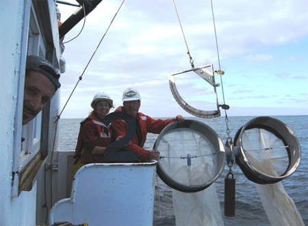 Greetings from NOAA Ship DAVID STARR JORDAN, off the coast of California!
During the ship's Winter California Cooperative Oceanic Fisheries Investigations (CalCOFI) cruise, Fisherman Joao Alves looks on as scientists Sue Manion and Ron
Dotson from NOAA Fisheries' Southwest Fisheries Science Center pause before deploying a Bongo plankton net. CalCOFI is one of the longest ongoing
fisheries/oceanographic investigations conducted by NOAA in support of NOAA's goal to protect, restore, and manage the use of coastal and ocean resources through an
ecosystem approach to management. The picture was taken during operations off the central California coast on one of the historic CalCOFI research stations.
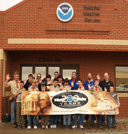 200th Celebration Greetings from the Weather Forecast
Office (WFO) in Pueblo, Colorado, and Colorado Springs Boy Scout Troop 27. The scout troop toured the WFO and worked on their weather Merit Badge with help from WFO
Staff, Eric Petersen, Makoto Moore, and Mike Nosko.
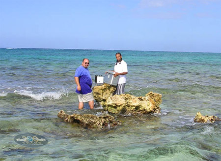 NOAA's National Geodetic Survey (NGS) regularly
cooperates with foreign governments to do field observations and geophysical data sharing. In this photo, acceleration of gravity measurements are being conducted in the
Cayman Islands jointly with the Cayman Islands Lands and Survey Department (C.I. L&S). The gravity work, in combination with leveling (elevation) surveys, Global
Positioning System (GPS) surveys, and Continuously Operating Reference Station (CORS, or continuous GPS) stations will redefine the Cayman Island geodetic
network. C.I. L&S is also doing hydrography and establishing seismograph stations as part of the Caribbean tsunami warning network. Pictured are Daniel Winester
of NOAA-NGS (left) and Colin Rankin of C.I. L&S at Fisherman's Rock located in North Sound of Grand Cayman.
 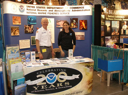 Greetings from Long Beach, California! NOAA Fisheries Service participates in a wide variety of community events to
provide information on NOAA products and services. In March 2007, personnel from the Southwest Regional Office hosted an exhibit at the Fred Hall Fishing Tackle &
Boat Show. Educational materials and information provided to attendees included programs of the NOAA Fisheries Service, Office of Law Enforcement, Weather Service, Sea
Grant, National Marine Sanctuary Program, and Office of Coast Survey. Some 10,000 people attend this show each year. Here, Gabrielle Dorr, NOAA, NOAA Fisheries Service,
Southwest Regional Office, and Marty Golden, NOAA Recreational Fishing Services Team work at the NOAA exhibit.
 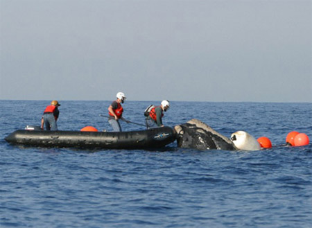 NOAA Fisheries is responsible for the Large Whale Disentanglement Program which
conducts disentanglement operations, research, and management to enhance the recovery of large whale species. In this photo taken off the coast of Jacksonville, Florida,
NOAA staff and external partners perform close operations to disentangle a North Atlantic right whale. The animal was observed entangled with gear wrapped around both
flippers and encircling its entire body. The rescue team was able to remove enough gear to allow the whale to shed most of the remaining gear on its own. The bow person
is Dr. 'Stormy' Mayo of the Center for Coastal Studies, the middleman with the cutting tool is Jamison Smith of NOAA Fisheries, and the driver in the stern of the
vessel is Chris Slay of Coastwise Consulting.
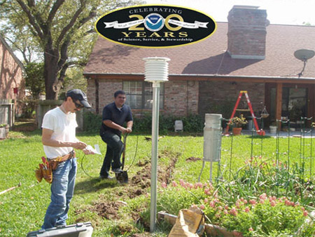 National Weather Service employees from the Weather Forecast Office in Corpus Christi, Texas, install a temperature sensor and a rain gauge for a new volunteer Cooperative Observer at their
home in Sinton, Texas. More than 11,000 Cooperative Observers across the United States volunteer their time and effort to maintain daily climate records. Most stations
provide temperature and rainfall information, but some also provide soil temperatures, evaporation amounts, and river stages to the National Weather Service. Data and
forms received from observers are quality controlled at each Weather Forecast Office and then forwarded to the National Climatic Data Center for archive and
publication. Shown from left to right in the photo are Steve Smart, hydrometeorological technician, and Nick Hampshire, in the Student Career Experience Program.
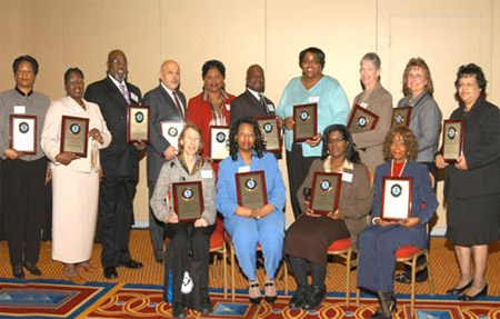 Congratulations to
members of NOAA's 2007 Women's History Month Training Conference Committee, pictured here at the 5th annual event held in Bethesda, Maryland. Over 200 people from NOAA's
community attended last month's conference. Observing this year's National Women's History Month theme, "Generations of Women Moving History Forward," the conference
featured outstanding motivational speakers, trainers, and government experts. Topics spanned networking skills, team-building, changes in the workplace, personal
finance, leadership development, health, and NOAA training opportunities. Shown standing (from left): Robbie Tyler, Alfreda Alexander, Charly Wells, Alfred Corea,
Michelle Crockett, Salim Abddeen, Hope Hasberry, Rosemary Pettis, Carolyn McDonald, and Toni Hollingsworth. Sitting (from left): Marian Katz, Sabrina Cook, Patricia
Taylor, and Carol Summers. Natalie Huff and Queen Spriggs also are on the committee.
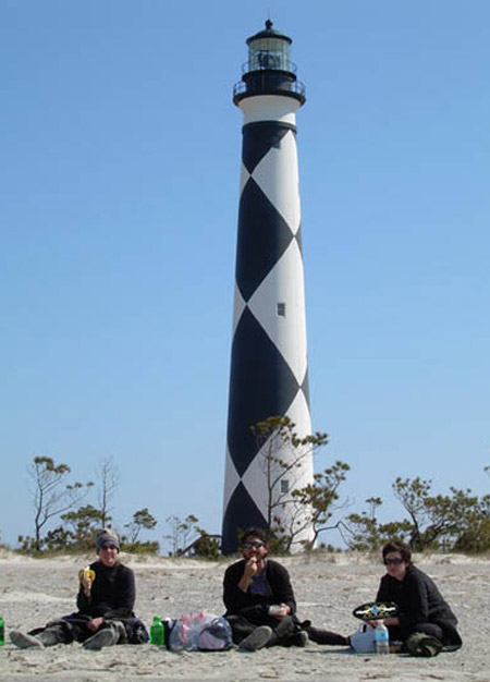 Greetings from Beaufort, North
Carolina, where for over 30 years, NOAA's Center for Coastal Fisheries and Habitat Research (CCFHR) has been at the forefront of research advancing the science of
productivity, ecology, restoration, and fishery utilization of seagrass habitats. Recent research at CCFHR has focused on how physical parameters such as water column
turbidity and wave energy may influence the structure of eelgrass landscapes. To determine if wave exposure influences the flowering rate of this seagrass species,
CCFHR staff are currently conducting a small-scale study to describe eelgrass flowering in both high and low energy regimes in Core Sound, North Carolina. Here, (from
left) CCFHR researchers Amy Uhrin, Giuseppe DiCarlo, and Erika Hansen take a break from counting eelgrass flowers to have lunch beneath the Cape Lookout Lighthouse.
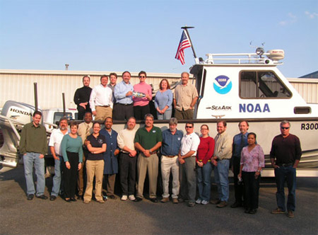 The Chesapeake, Virginia office of the Center for Operational
Oceanographic Products and Services (CO-OPS) hosted Mr. Jack Dunnigan, NOAA's National Ocean Service Assistant Administrator, and his wife Linda, with a tour of the
facility during which Mr. Dunnigan held an informal town hall meeting. CO-OPS collects, analyzes, and distributes historical and real-time observations and predictions
of water levels, coastal currents, and other meteorological and oceanographic data. CO-OPS also manages the National Water Level Observation Program and the national
network of Physical Oceanographic Real-Time Systems in major U.S. harbors. Shown at top (from left): Chris Parish, John Stepnowski, Jason Standridge, Jack Dunnigan,
Linda Dunnigan, Carol Odom, and Rick James. Bottom (from left): Chris McGrath, Warren Krug, Kate Bosley, Eric Ryans, Katie Derner, Anthony Godette, Brad Wynn, Jeff
Oyler, Larry Neeson, Mark Blankenship, Kasey Hall, Kevin Harrison, Mike O'Hargan, Margarita O'Hargan and Jim Lewis.
