NOAA 200th Postcards from the Field August 2007
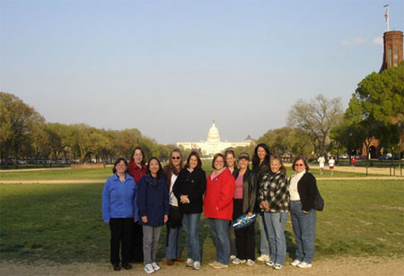 NOAA hosted the 5th Annual Women's History Month Training Conference with a theme of "Generations of
Women Moving History Forward" in April. Several women from the National Weather Service in the western portion of the United States were able to meet during the conference. None of the women
had packed their 200th celebration banners with them, but they were thinking about it as they toured our nation's capital, and hoped that with the U.S. Capitol building in the background that
it would count for a "postcard" photo. Pictured (from left): Janet Nix, Tanja Fransen, Linda Cheng, Mary Smith, Carolina Walbrun, Michelle Mead, Dawn Fishler, Maureen Ballard, Sheila Deiotte,
Michelle Pezel, and Cindy Bean.
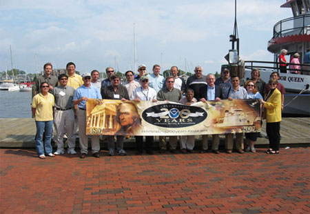 NOAA CoastWatch recently celebrated 20 years of continuous service
and commemorated NOAA's 200th Celebration at the 2007 CoastWatch Node Operations Managers Meeting in Annapolis, Maryland. CoastWatch provides near real-time oceanographic satellite data to
a variety of users via the Internet. Though CoastWatch is housed within NOAA's National Environmental Satellite, Data, and Information Service, it is a NOAA-wide program with Nodes in each
of the major Line Offices. NOAA Offices represented included: Center for Satellite Applications and Research, Office of Satellite Data Processing and Distribution, National Oceanographic Data
Center, NOAA's Chesapeake Bay Office, National Weather Service -- Alaska Region, Pacific Islands Fisheries Science Center, Southwest Fisheries Science Center, Southeast Fisheries Science
Center, Great Lakes Environmental Research Laboratory, National Centers for Coastal Ocean Science, and the Coastal Services Center.
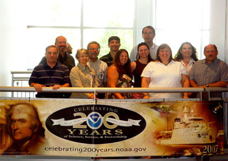 Greetings from the NOAA Fisheries Service National Environmental
Policy Act (NEPA) Coordinators, who had their annual meeting in Boulder, Colorado at the David Skaggs Research Center in June. NEPA provides the process for the public review of environmental
impacts of the Service's actions to regulate and manage offshore fishing, habitat, and protected species. Why would such a group meet in such a land-locked location? The Boulder site was
chosen for its central location to accommodate all of the Regional offices from Hawaii to Massachusetts. The academic atmosphere also was very conducive to resolving the many and difficult
review issues facing the agency. Pictured (from left): David Keys (Southeast), Tony Morton (Southwest), Tamra Faris (Oregon), David Tomey (Northeast), Steve Kokkinakis (NOAA headquarters),
Marilyn Luipold (Pacific Islands), Kathe Hawe (Northwest), Steve Davis (Alaska), Cristi Reid, Shelby Mendez and Mitch Bryman (all NOAA headquarters).
 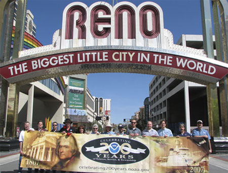 200th Celebration greetings from the "Biggest Little City in the World" —
Reno, Nevada! The staff at the National Weather Service forecast office in Reno is responsible for forecasts and warnings for the northeast California, the
Sierra Mountains, western Nevada, and beautiful Lake Tahoe, which straddles the California/Nevada state line. Pictured under the historic sign, from left to
right: Brian O'Hara, Chris Smallcomb, Mike Freitas, Bubba Cummings, Jessica Kielhorn, Patsy Buckley, Jane Hollingsworth, Gary Barbato, Chris Jordan, Scott McGuire,
Shane Snyder, Dave Pike, and Duffy Johnson.
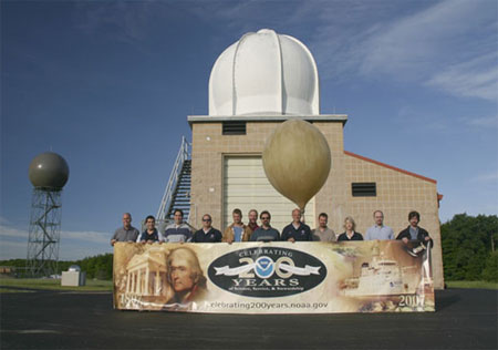 The National Weather Service Office in Gaylord, Michigan, is staffed by a
group of dedicated meteorologists, electronics, administrative, and information technology employees who work rotating shifts providing weather information to the
public 24 hours a day. This photo shows our Upper Air building which is used for weather balloon launches twice daily. These launches are done simultaneously with
69 other launches all over the continental United States to obtain wind speed and direction, temperature, dew point, and pressure information in the atmosphere from
the ground up to about 100,000 feet. This year, our Upper Air equipment, which dates back to the 1950s, is being replaced with a state of the art system known as the
Radiosonde Replacement system. This new system will use Global Positioning System radiosondes to get more accurate data. Shown (from left): Bruce Smith, Kevin A.
Sullivan, David Lawrence, Richard Melton, Scott Rozanski, Gary Campbell, Jeffrey Lutz, Odell Prince, Kevin Farina, Mary Prentice, Jeffrey Zoltowski, and Robert
Weaver.
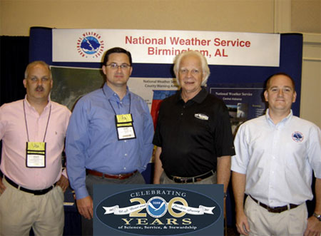 Greetings from the Central Gulf Coast!
NOAA's National Weather Service Forecast Office in Birmingham, Alabama, represented all the National Weather Service Offices serving the state at the Alabama Broadcasters Association
2007 Annual Convention in Point Clear. Forecasters were able to highlight products and services available to our broadcast media partners. Getting the word out is crucial in accomplishing
our mission of protecting lives and property. Kenny "The Snake" Stabler dropped by the display and gave his endorsement for NOAA Weather Radio All Hazards. Mr. Stabler was quarterback
at the University of Alabama and then played professionally for the Oakland Raiders, Houston Oilers, and New Orleans Saints. Currently, Mr. Stabler is a color commentator for Crimson
Tide Football. Shown (from left): Mark Linhares, Scott Unger, Kenny "The Snake" Stabler, and John Sirmon.
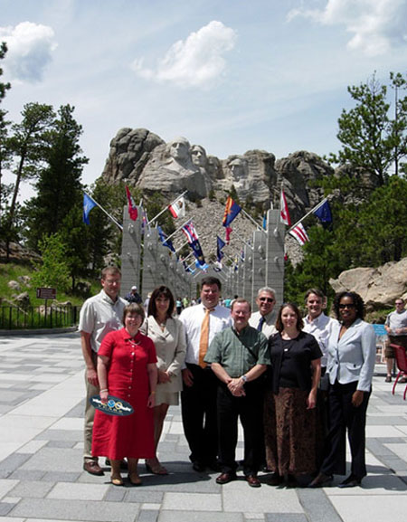 After addressing the Western Governors
Conference in Deadwood, South Dakota, NOAA Chief of Staff Scott Rayder joined several of the staff members from the Weather Service Forecast office of Rapid City,
South Dakota, at Mount Rushmore. Shown (back row, from left): Matt Bunkers, Kelly Whitaker, Scott Rayder, Lynn Maximuk, Joel Cline, and Kandis Boyd; (front row,
from left): Susan Sanders, Dave Carpenter, and Melissa Smith.
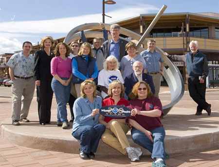 Greetings from sunny
Colorado where several NOAA employees gathered around our Wonder of Science display at the Twenty Ninth Street outdoor mall in the heart of Boulder. The Boulder
Outreach Coordinating Council and other NOAA personnel shown here worked with artist and meteorologist Ken Leap to implement a sundial sculpture and kiosk,
custom-designed to educate the general public about the science we conduct at NOAA. In addition to being a functional time-keeper, this sundial exhibit,
named "Shadows of the Seasons," serves to explain the tilt of the Earth's axis, climate zones, and seasons. To further illustrate NOAA's Earth-science mission, a
weather station is being installed on the educational kiosk that will display real-time weather observations. Pictured (Front row, from left): Annie Reiser, Barb
DeLuisi, and Debra Dailey-Fisher. Back row (from left): Patrick Gajdys, Rhonda Lange, Gabi Accatino, Connie Craig, Phyllis Gunn, Will von Dauster, Gwen Andersen,
Don Mock, Carol Knight, George Sharman, John Schneider, and Woody Roberts.
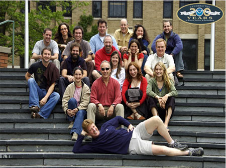 Six NOAA participants from the National Ocean Service and National
Marine Fisheries Service attended a two-week intensive summer course on "Satellite Remote Sensing in Biological Oceanography" at Cornell University. This training will help enable better
integration of environmental satellite data into NOAA's management of fisheries and marine sanctuaries. NOAA participation was made possible by funding from the
NESDIS Satellite Research and Operations program. Pictured -- Back row (from left): Michael Sauer (Bigelow Labs), Pam van der Leeden (NOS), Alfredo Tello
Gildemeister (Salmon Technological Institute, Chile), Doug Weaver (NOS), Jon Grant (Dalhousie University, Canada), Debra Fischman (Conservation International), and
Mike Brown (Cornell TA). Second row (from left): Mike MacDonald (Co-Instructor from Gene Feldman's Group at Goddard), Uriel Zajaczkovski (Servicio de Hidrografia Naval,
Argentina), Philip Tarrant (Arizona State University), Michelle Lander (NMFS), Kalei Shotwell (NMFS), Larry Swenson (NMFS), Third row (from left): Yianna
Samuel (Cornell TA), Sam McClatchie (NMFS), Ana Rita Ferreira (University of Porto, Portugal), Dana Wingfield (U.C. Santa Cruz). Front row: Bruce
Monger (Cornell Instructor).
 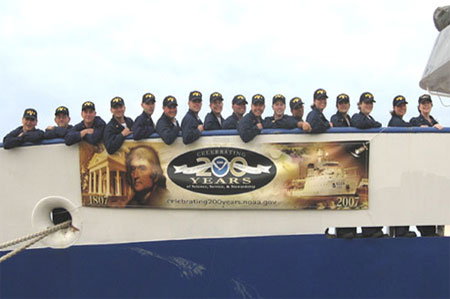 Greetings from BOTC 111 currently stationed at the
United States Merchant Marine Academy in Kings Point, New York. All NOAA Corps officers go through a four-month training program before beginning their work for NOAA. The Basic Officer Training
Course focuses on the development of maritime and nautical skills, with emphasis on shipboard operations, organization and management, marine navigation, ship handling, and seamanship. This
photo was taken on the bow of Kings Pointer Training Vessel just before getting underway on a training cruise. After graduation the officers in this photo will be reporting to NOAA vessels
shortly thereafter. Pictured (from left): ENS Russell Quintero, ENS Jonathan Heesch, ENS Nathan Parker, ENS Mark Andrews, ENS Nathan Witherly, ENS Glen Rice, ENS Brian Player, ENS
Megan O'Brien, ENS Ronald Moyers, ENS Matthew Griffin, ENS Patrick Redmond, ENS Bennie Johnson, ENS Christine Schultz, ENS Claire Surrey, ENS Megan Guberski, ENS Faith Opatrny, and
CDR Anne Lynch.
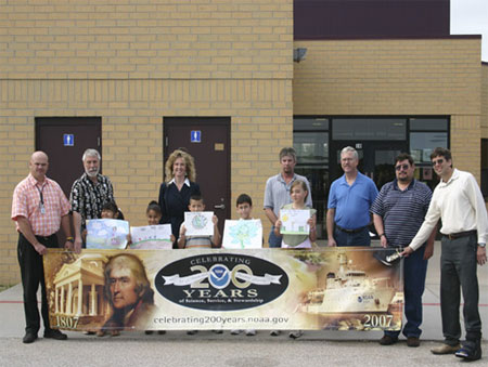 The Dodge City National Weather Service Forecast Office (WFO) sponsored an Earth Day poster
contest among local elementary schools this spring. Each school was challenged to develop posters that best represented the theme of "Protecting Our Great Plains." A total of 538
entries were collected from six elementary schools. The WFO staff selected winners among individual entries for kindergarten through fourth grade. Local businesses provided prizes for
the students who developed the winning entries, and a tree was planted in the yard of the school with the greatest percentage of student body participation. The winning school, Beeson
Elementary, is in the background. Pictured (from left) are winners of the poster contest for Kindergarten, First Grade, Second Grade, Third Grade and Fourth Grade. Back row
(from left): Scott Reiter, Rick Sloan, Serri Baker, Rick Leupold, Tim Burke, Jesse Lee, and Larry Ruthi.
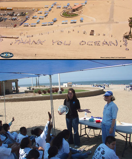 NOAA celebrated June 8th as "World Ocean Day"
and California's First "Thank You Ocean Day" by bringing 1,200 4th and 5th grade students to Dockweiler Beach in Los Angeles from the Los Angeles Unified School
District. Many of these students had never seen the ocean despite living only a few miles away and were in awe of the sights and sounds of their day at the beach.
The students enjoyed lessons on ecosystems and watersheds presented by NOAA Fisheries Service Staff and STAR Ecostation Teachers. Emphasis was made on how they can
help keep their beaches clean, and how their actions affect the world ocean and the global community. NOAA organizations participating were NOAA Fisheries Service,
National Weather Service, and National Marine Sanctuary Program. Other organizations included CA Ocean Communicators Alliance, Waterkeeper Alliance, Surfrider
Foundation and Heal the Bay. In the top photo approximately 320 students joined in spelling out the words “Thank You Oceans” on the beach. Pictured in the bottom
photo are NOAA Enforcement Intern Christina Ramirez (left) and NOAA Volunteer Mary Anne Donahue (right) teaching about the importance of ecosystems to a group of
students.
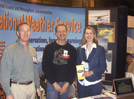 National Weather Service meteorologists teamed
with scientists from the Alaska Volcano Observatory to exhibit at Alaska's premier aviation event, the Alaska State Aviation Trade Show and Conference. This conference, held in Anchorage,
was sponsored by the Alaska Airmen's Association, a non-profit organization of 2,200 members whose sole purpose is to promote and preserve aviation in Alaska. National Weather Service
participants included employees from the Alaska Aviation Weather Unit, the Center Weather Service Unit and Weather Forecast Office Fairbanks. With attendance of over 19,000, the 10th
year of this conference was a huge success! Pictured (from left): Brad Sipperley, Hydrometeorological Technician, WFO Fairbanks; David Hadley, Lead Forecaster, Alaska Aviation Weather Unit;
and Kristine Nelson, Meteorologist in Charge, Center Weather Service Unit.
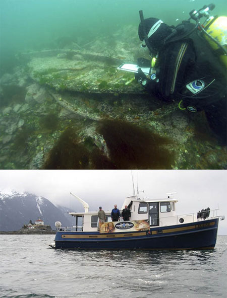 Marine archaeologists from NOAA and the state of Alaska conducted a
survey in May of the wreck of the former U.S. Coast Survey Steamer Hassler. During the expedition, supported by the NOAA National Marine Sanctuary Program, NOAA Office of
Coast Survey, NOAA Fisheries Service, and NOAA Office of Ocean Exploration, researchers deployed divers and a remotely operated vehicle to document the wreck site. Built in
1871 for the U.S. Coast and Geodetic Survey and named for its first superintendent, Ferdinand Rudolph Hassler, the innovative double-hulled iron steamer carried out a
great deal of important hydrographic and oceanographic work. The Hassler was sold in 1895 and transformed into the cargo and passenger steamer Clara Nevada in 1895. It
exploded and sank in Alaska's Lynn Canal during a storm in 1898. Pictured (top photo) is diver Hans Van Tilburg, NOAA maritime archaeologist, exploring the wreck site.
Pictured (bottom photo, from left): Tane Casserley (NOAA), Dave McMahan (Alaska OHA), and John Jensen (SEA) aboard the Legend.
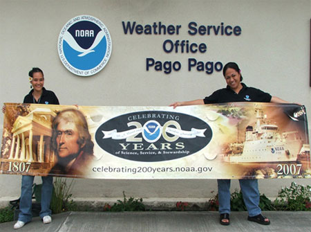 A "Postcard" from the only NOAA National Weather Service Office (WSO) in the southern
hemisphere – WSO Pago Pago in American Samoa. Pictured (from left) are Elinor Lutu-McMoore, Meteorological Technician and Carol Maafala-Baqui, Meteorologist.
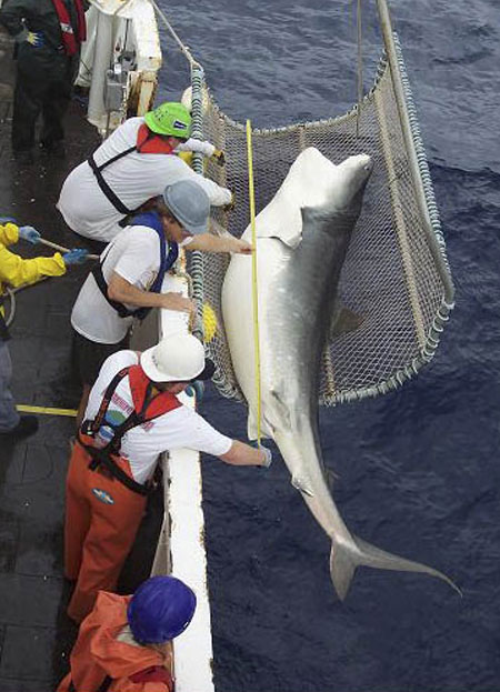 "Postcard From Living On The Edge!" Pictured is
a magnificent female tiger shark (three meters length) captured 80 miles off the Atlantic Ocean coast of northern Florida during the NOAA/National Marine Fisheries
Service/Southeast Fisheries Science Center/Mississippi Laboratories 2006 pelagic longline survey aboard the NOAA Ship OREGON II. The healthy tiger shark was measured,
weighed, tagged, and released. The objective of the National Marine Fisheries Service pelagic longline survey is to assess the relative abundance of pelagic sharks and
pelagic finfish in the U.S. Atlantic Ocean and Gulf of Mexico, and to collect associated environmental and gear technology data. A variety of Fisheries Service, university,
state, and international scientists participate in the project and contribute to its success. The photo of the tiger shark being measured was taken from the wheel house by
former OREGON II Jerry Adams (NOAA Corps, LCDR). Pictured handling the shark are (from top down): Skilled Fisherman Tim Martin, Chief Scientist Mark Grace and Shark
Specialist Trey Driggers.
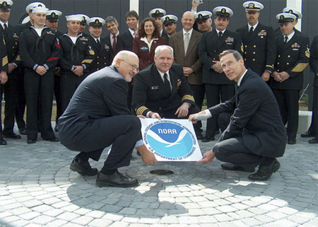 NOAA Administrator Vice Admiral Conrad Lautenbacher
(right), NOAA National Marine Sanctuary Program Director Daniel Basta (left), and U.S. Navy Captain Christopher Murray (center) unveil a NOAA Heritage Marker during the grand opening of the USS
Monitor Center at The Mariners' Museum in Newport News, Virginia. The marker is set beneath a spider-like steel cradle used by NOAA and the Navy in 2002 to recover the USS Monitor's 120-ton gun
turret from the sea floor. The recovery operation, which took place in the Monitor National Marine Sanctuary off Cape Hatteras, North Carolina, involved NOAA marine archaeologists, Mariners'
Museum conservators, and more than a hundred Navy divers, some of whom are pictured here. The turret and other artifacts recovered from the sunken Civil War ironclad are on public display at the
museum.
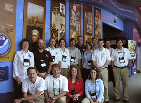 Greetings from the NOAA
at the Nauticus Center at the National Maritime Museum in Norfolk, Virginia. A crew from the National Geodetic Survey and the Coastal Services Center (CSC) teamed up with the NOAA
Office of Communications and NOAA's National Weather Service to showcase NOAA products and services at the 2007 Annual Meeting of the Association of State Floodplain Managers.
With almost 12,000 members, the Association of State Floodplain Managers is a key constituency for NOAA with issues of interest to all offices. NOAA CSC Director Margaret
Davidson received a special award to acknowledge her dedication to bringing coastal inundation into focus as a priority for the Association. Pictured (front row, from left):
Todd Davison, Larry Wenzel, Nicole Belk, and Heather Landry. Back row (from left): Caren Madsen, Scott Lokken, Denis Riordan, Lindy Dingerson, Kirk Waters, Doug Marcy, Nancy
Cofer-Shabica, Mark Walton, Andrew Larkin, Chris Kinkade, and Dave Stein.
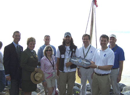 NOAA recently participated in "America's Weekend,"
marking the 400th anniversary of the founding of Jamestown, Virginia, as the first English settlement in North America. NOAA Administrator Conrad Lautenbacher participated
in ceremonies marking the inauguration of the Chesapeake National Historic Water Trail and the launch of the recreation of Captain John Smith's 1608 exploration of Chesapeake
Bay. NOAA is a key partner with the National Park Service in developing the first all-water trail in the National Park system, a trail that retraces Smith's voyage. NOAA is
deploying a series of "Smart Buoys" that allow boaters as well as classroom teachers and the public to access historical information about Smith's voyage as well as current
weather and water conditions by accessing the web at http://www.buoybay.org or by phone at 1-877-BUOY-BAY (286-9229). Pictured (from left): VADM Conrad C. Lautenbacher, Jr.;
Mary Bomar, Director National Park Service; Alicia Jarboe, Doug Wilson, (behind Jarboe), "Captain John Smith" -- Ian Bystrom, Peyton Robertson, Andrew Larkin, and Brady
Phillips.
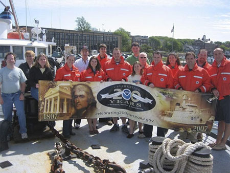 Greetings from the NOAA Fisheries' Ecosystem Survey Branch in Woods
Hole, Massachusetts, where the branch has been conducting fishery-independent surveys for over 40 years! The branch surveys include bottom trawl surveys, scallop, shrimp, clam, and acoustic
research. While out at sea, the group collects data on abundance, distribution, feeding ecology, size, and age composition of stocks that are economically and ecologically important species.
Traveling as far south as Cape Hatteras and north to the Scotian shelf, we have seen a wide range of species and have experienced every type of weather condition! Picture taken aboard the
NOAA Ship DELAWARE II, front row (from left): Robert Gamble, Stacy Rowe, Melanie Underwood, Lara Jarvis, Jonathan Duquette, Alicia Long, Heath Cook, Peter Chase, and Kevin McIntosh.
Back row (from left): Linda Despres, William Kramer, Nikolai Klibansky, Capt. Andrew Hall, Larry Brady, Yvonna Rowinski, and Sean Lucey.
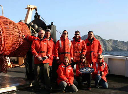 It's a beautiful spring day off San Francisco (with no fog!) as scientists and crew aboard
the NOAA R/V DAVID STARR JORDAN say hello from the Farallon Islands, 25 miles offshore of the Golden Gate Bridge. In the midst of conducting the Southwest Fisheries Science Center's
25th annual midwater trawl survey, these Fisheries Ecology Division researchers collected physical and biological data that is designed to gauge the reproductive success of exploited
groundfish stocks and to monitor the overall state of the California Current ecosystem, including observations on krill, squid, coastal pelagic species, marine mammals, and seabirds.
Shown standing (from left): Ken Baltz, Joao Alves, Keith Sakuma, Kevin Stierhoff, and Jose "Chico" Gomez. Kneeling (from left): Lisa Sheffield, Cathy Preston, and Sophie Webb.
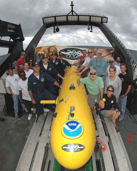 Scientists and crew aboard NOAA Ship NANCY FOSTER recently finished a successful multibeam mapping cruise in several Coral
Habitat Areas of Particular Concern along the Florida coast. In true "One NOAA" fashion, the mission capitalized on the talents of many personnel and organizations to provide data to address
research priorities of the South Atlantic Fishery Management Council. The Southeast Region of the National Marine Sanctuary Program donated 10 days of ship time; the National Undersea Research
Program's Center at the University of North Carolina-Wilmington provided the use of its National Institute of Undersea Science and Technology's Autonomous Undersea Vehicle; and the very
capable personnel from the NANCY FOSTER provided a safe platform. Other contributors to the mission's success include: the National Ocean Service Office of Coast Survey; NOAA's Fisheries
Habitat Conservation Division; Florida Fish and Wildlife Conservation Commission's Fish and Wildlife Research Institute; South Carolina's Department of Natural Resources Marine Resources
Research Institute; and the College of Charleston.
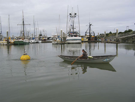 200th Celebration Greetings from the Eureka,
California NOAA National Weather Service Forecast Office! When a malfunctioning SCRIPPS Wave Rider buoy was towed into Humbolt Bay by the U.S. Coast Guard, Service Hydrologist Carol
Ciliberti came up with the innovative transportation to move the 300-pound buoy from the Coast Guard dock to another nearby location so it could be shipped out for repair. These wave
rider buoys measure wave direction, along with wave height and period and are extremely helpful for validating wave forecasts. Just another "day at the office" for Carol.
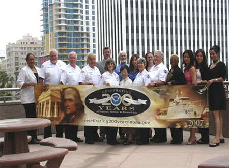 Greetings
from the Southwest Divisional Office of Law Enforcement and the Conservation Education Corps (CEC) Senior Volunteers! The CEC is a Volunteer Corps of motivated,
dedicated, and caring seniors who act as NOAA Wildlife Conservation Stewards to educate the public on California natural resource issues and to raise protection and
conservation awareness. The CEC plans, organizes, and participates in events across the Southwest to educate the public about our coasts and the need to preserve our
ocean. CEC Volunteers do this by teaching marine wildlife conservation in public schools, representing NOAA Office of Law Enforcement at a variety of public events.
Pictured (from left): Martina Sagapolu, David Bloom, Dick Ramseyer, Carmine Pilichi, Mary Ann Donahue, Don Masters, Rod McInnis, Takako Hendershot, Stephanie Picha,
Patti Worsham, Naomi Abaniel, Susanne Rengo, Reon Edwards, Yvonne Lam, Christina Ramirez, and Roxanna Behtash.
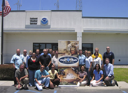 200th Celebration Greetings from Southern California! Developing and maintaining
relationships between different NOAA line offices located within the same area not only helps us do our jobs better and more effectively, but also provides the public
with better service. It's all about science, service, and stewardship! That is why the staff at the National Weather Service in Los Angeles and the staff at the Channel
Islands National Marine Sanctuary in Santa Barbara got together recently at the National Weather Service office in Oxnard, California, to discuss several of their
collaborative efforts. Shown are personnel from both offices. Front row (from left): Gary Strickland, Sean Hastings, Rocio Lozano, Alicia Carretero, Rebecca Young, and
Mark Jackson. Back row (from left): Stuart Seto, Bill Hoffer, Dessa Emch, Crystal Lowe, Todd Morris, Russ Bacon, Curt Kaplan, Dave Gomberg, Rich Thompson, Dave Sweet,
Tom Fisher, Bill Forwood, Natalie Senyk, Danielle Lipski, and Ben Waltenberger.
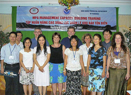 Fulfilling the National Marine Sanctuaries Act mandate to
cooperate with other governments and international organizations in the protection and management of special marine areas, a NOAA team provided support in building marine
protected area (MPA) management capacity in Vietnam. National Marine Sanctuary and Coastal Services Center staff worked with Vietnamese mentors in training the management
team for the soon-to-be-designated Phu Quoc MPA. This MPA is one of 15 being designated in Vietnam. Support for the program was provided for by the Danish aid organization
DANIDA. Pictured (from left): Mr. Nguyen Dat, LMPA project, Ministry of Fisheries; Mr. Nguyen An Khang, Nha Trang Institute of Oceanography; Ms. Doan Thu Ha, LMPA Project
Haiphong Institute of Oceanography; George Galasso, NOS; Ms. Doan Thu Ha, LMPA Project, Haiphong Institute of Oceanography; Ann Weaver, NOS; Bob Steelquist, NOS; Ms.
Nguyen To Uyen, WWF Marine Program; Anne Walton, NOS; Ms. Nguyen Quynh Giao, Nha Trang MPA; Mr. Nguyen Hoang Linh, LMPA Project, Ministry of Fisheries; and Paula Brown,
University of Sydney.
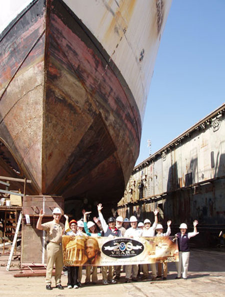 Wishing NOAA a great 200th celebration is this banner-raising team of
employees from NOAA Research and NOAA's Marine and Aviation Operations Office, who gathered in a drydock in Seattle, Washington, beneath the bow of OKEANOS EXPLORER.
The former Navy vessel CAPABLE is being refitted as the only ship in the federal fleet to be dedicated to ocean exploration when it joins NOAA's fleet in 2008. In the
photo (from left): Cdr. Doug Schleiger, Officer in Charge, OKEANOS EXPLORER; Reagan Errera, Sea Grant Fellow; Brenda Loignon, Oak Management, Inc.; Anne Readel, Sea
Grant Fellow; Tim Trembley, Civil Engineer/COTR; Felipe Arzayus, Office of Ocean Exploration and Research; Ken Long, Electronics Engineer/Assistant COTR; Jim Hallock,
Marine Surveyor; Craig McLean, Dep. A.A. (Admin and Programs), for Oceanic and Atmospheric Research; Harriet Longuet, guest; Karen Kohanowich, Office of Ocean
Exploration and Research; Sandra Knight, Director of PPE, Oceanic and Atmospheric Research;and Jana Goldman, Public Affairs Officer.
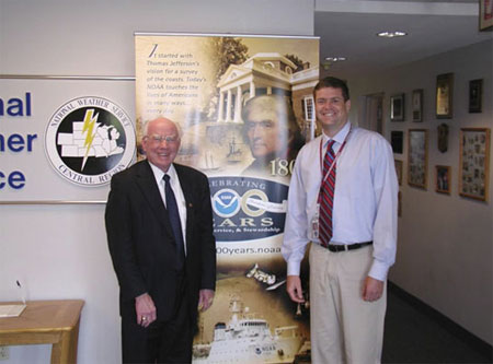 Representative Vern Ehlers (R-MI) accepted a recent invitation to visit the National
Weather Service Forecast Office in Grand Rapids, Michigan. While at the office, he spoke with several forecasters learning about the products and services the forecast
office provides to the citizens of southwest Michigan. Pictured (from left) are Congressman Ehlers and Daniel Cobb, Meteorologist-in-Charge.
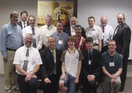 This photo was taken at the North Dakota State University in Fargo on the occasion of the 50th
Anniversary of the Fargo 1957 tornado. That tornado helped prompt Dr. Ted Fujita to develop the Fujita Scale, which is used to measure the strength of those storms. Pictured
are (back row, from left): Dave McShane, MIC, Grand Forks WFO; Brad Bramer, John-Paul Martin, Dr. Doug Dokken, Dr. Joe Schafer, Dr. John Enz, Dr. Ray Jensen, and Greg Gust;
(middle row, from left): John Wheeler and Dr. Adnan Akyuz; and (kneeling, from left): Mark Ewens, Dave Kellenbenz, Shannon Martinson, Pat Ayd, and Chauncy Schultz.
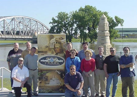 Pictured are some of the staff from the NOAA Weather Forecast
Office in Grand Forks, North Dakota. The photo above was taken on June 22, 2007, at the height of the recent Red River of the North crest – the 3rd highest summer
crest on record of 38.7 feet. Pictured are (back row from left): Brad Hopkins, Greg Gust, Jim Kaiser, Brad Bramer, John Hoppes, Ed Schulz and Mike Lukes; front row
(from left): Al Voelker, Nancy Godon and Kim Klein; and kneeling (from left): Mark Ewens and Dave McShane.
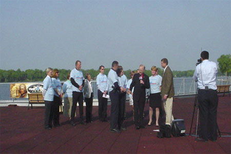 In May, officials from NOAA's
National Weather Service, Michigan State Police and Michigan Emergency Managers Association recognized the City of East Grand Rapids, Michigan, as the first StormReady community in
Kent County. Pictured (from right): Grand Rapid's WZZM TV Cameraman, Grand Rapids NWS MIC Dan Cobb, East Grand Rapids Mayor Cindy Bartman, WZZM Chief Meteorologist George Lessons,
Public Safety Officer Beth Phelps and Public Safety Official Captain Chuck Lark, along with other city officials.
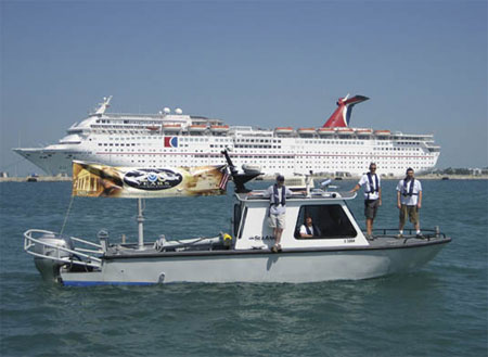 Several members of the Office of Coast Survey ad hoc
SPOT (Special Projects Operations Team) are shown aboard the NOAA Survey Vessel S3004 during an Integrated Ocean and Coastal Mapping project in Key West, Florida. The project was a joint
effort between Office of Coast Survey, National Centers for Coastal and Ocean Science, and National Marine Sanctuaries. Sonar bathymetry and imagery data from the project will be used to
update the area's nautical charts and to develop benthic habitat maps of the Western Sambos Ecological Reserve to ensure safe navigation in the area and to assist Sanctuary managers in
making informed decisions with regards to appropriate use of the area. Shown (from left): Mike Davidson, Dave Elliott, Paul Turner, and Caleb Gostnell from the Office of Coast Survey.
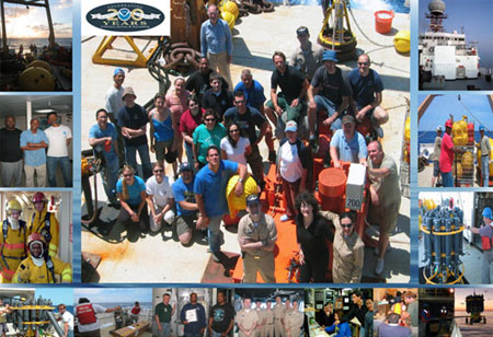 In mid-March to
mid-April, the crew of the R/V Ronald H. Brown and researchers from the Atlantic Oceanographic and Meteorological Laboratory surveyed the western North Atlantic Ocean
and celebrated the 25th anniversary of observations for the Florida Current and the meridional overturning circulation. NOAA was one of the first agencies to recognize
the importance of long-term observations and, beginning in 1982, NOAA's Office of Oceanic and Atmospheric Research started a time-series program to measure flow of the
near surface part of the flow in the Straits of Florida and soon expanded the program offshore as well. NOAA's program has become a cornerstone for the international
Rapid Climate Change program funded by the National Science Foundation and the United Kingdom's Rapid Climate Change Program as part to study the ocean overturning
circulation and the oceans impact on long-term climate change. This photo collage shows many of the personnel involved with this project.
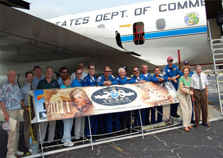 Crew members of
NOAA's WP-3D Orion Hurricane Hunter Aircraft join members of the Weather Forecast Office Melbourne at Daytona Beach, Florida, the final stop of the 2007 Hurricane
Awareness Tour. The annual tour travels to five cities, alternating between the Gulf Coast and East Coast each year, to promote hurricane awareness and preparation as
the hurricane season approaches. This year's tour attracted more than 10,000 visitors from Rhode Island to Florida.
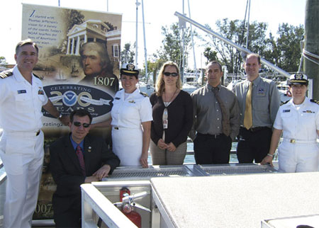 In April, a regional NOAA day at Riviera Beach Maritime Academy was developed by
Joe Shewmaker, Einstein Fellow in the NOAA Office of Education and faculty member at the academy. Joe coordinated a team of NOAA staff to speak with members of the
local community on the full range of NOAA issues. Topics included NOAA's overall mission, severe weather including hurricane awareness, habitat restoration, and career
opportunities. This event was important because it helped to create a community that is better informed on the importance of storm preparedness as well as NOAA's overall
mission. This was one of the first regional approaches to presenting the scope of NOAA's suite of services in this area. NOAA staff commented on the value of regional
collaboration and plans are being developed to continue this format on an annual basis in connection with Earth Day. Pictured aboard the Riviera Beach Maritime
Academy's R/V Triton (from left): LCDR Carl Newman, Joe Shewmaker, LTJG Rebecca Waddington, Jocelyn Karazsia, Hugh Cobb, Robert Molleda, and LTJG Jennifer Pralgo.
 NOAA hosted the 5th Annual Women's History Month Training Conference with a theme of "Generations of
Women Moving History Forward" in April. Several women from the National Weather Service in the western portion of the United States were able to meet during the conference. None of the women
had packed their 200th celebration banners with them, but they were thinking about it as they toured our nation's capital, and hoped that with the U.S. Capitol building in the background that
it would count for a "postcard" photo. Pictured (from left): Janet Nix, Tanja Fransen, Linda Cheng, Mary Smith, Carolina Walbrun, Michelle Mead, Dawn Fishler, Maureen Ballard, Sheila Deiotte,
Michelle Pezel, and Cindy Bean.
 NOAA CoastWatch recently celebrated 20 years of continuous service
and commemorated NOAA's 200th Celebration at the 2007 CoastWatch Node Operations Managers Meeting in Annapolis, Maryland. CoastWatch provides near real-time oceanographic satellite data to
a variety of users via the Internet. Though CoastWatch is housed within NOAA's National Environmental Satellite, Data, and Information Service, it is a NOAA-wide program with Nodes in each
of the major Line Offices. NOAA Offices represented included: Center for Satellite Applications and Research, Office of Satellite Data Processing and Distribution, National Oceanographic Data
Center, NOAA's Chesapeake Bay Office, National Weather Service -- Alaska Region, Pacific Islands Fisheries Science Center, Southwest Fisheries Science Center, Southeast Fisheries Science
Center, Great Lakes Environmental Research Laboratory, National Centers for Coastal Ocean Science, and the Coastal Services Center.
 Greetings from the NOAA Fisheries Service National Environmental
Policy Act (NEPA) Coordinators, who had their annual meeting in Boulder, Colorado at the David Skaggs Research Center in June. NEPA provides the process for the public review of environmental
impacts of the Service's actions to regulate and manage offshore fishing, habitat, and protected species. Why would such a group meet in such a land-locked location? The Boulder site was
chosen for its central location to accommodate all of the Regional offices from Hawaii to Massachusetts. The academic atmosphere also was very conducive to resolving the many and difficult
review issues facing the agency. Pictured (from left): David Keys (Southeast), Tony Morton (Southwest), Tamra Faris (Oregon), David Tomey (Northeast), Steve Kokkinakis (NOAA headquarters),
Marilyn Luipold (Pacific Islands), Kathe Hawe (Northwest), Steve Davis (Alaska), Cristi Reid, Shelby Mendez and Mitch Bryman (all NOAA headquarters).
  200th Celebration greetings from the "Biggest Little City in the World" —
Reno, Nevada! The staff at the National Weather Service forecast office in Reno is responsible for forecasts and warnings for the northeast California, the
Sierra Mountains, western Nevada, and beautiful Lake Tahoe, which straddles the California/Nevada state line. Pictured under the historic sign, from left to
right: Brian O'Hara, Chris Smallcomb, Mike Freitas, Bubba Cummings, Jessica Kielhorn, Patsy Buckley, Jane Hollingsworth, Gary Barbato, Chris Jordan, Scott McGuire,
Shane Snyder, Dave Pike, and Duffy Johnson.
 The National Weather Service Office in Gaylord, Michigan, is staffed by a
group of dedicated meteorologists, electronics, administrative, and information technology employees who work rotating shifts providing weather information to the
public 24 hours a day. This photo shows our Upper Air building which is used for weather balloon launches twice daily. These launches are done simultaneously with
69 other launches all over the continental United States to obtain wind speed and direction, temperature, dew point, and pressure information in the atmosphere from
the ground up to about 100,000 feet. This year, our Upper Air equipment, which dates back to the 1950s, is being replaced with a state of the art system known as the
Radiosonde Replacement system. This new system will use Global Positioning System radiosondes to get more accurate data. Shown (from left): Bruce Smith, Kevin A.
Sullivan, David Lawrence, Richard Melton, Scott Rozanski, Gary Campbell, Jeffrey Lutz, Odell Prince, Kevin Farina, Mary Prentice, Jeffrey Zoltowski, and Robert
Weaver.
 Greetings from the Central Gulf Coast!
NOAA's National Weather Service Forecast Office in Birmingham, Alabama, represented all the National Weather Service Offices serving the state at the Alabama Broadcasters Association
2007 Annual Convention in Point Clear. Forecasters were able to highlight products and services available to our broadcast media partners. Getting the word out is crucial in accomplishing
our mission of protecting lives and property. Kenny "The Snake" Stabler dropped by the display and gave his endorsement for NOAA Weather Radio All Hazards. Mr. Stabler was quarterback
at the University of Alabama and then played professionally for the Oakland Raiders, Houston Oilers, and New Orleans Saints. Currently, Mr. Stabler is a color commentator for Crimson
Tide Football. Shown (from left): Mark Linhares, Scott Unger, Kenny "The Snake" Stabler, and John Sirmon.
 After addressing the Western Governors
Conference in Deadwood, South Dakota, NOAA Chief of Staff Scott Rayder joined several of the staff members from the Weather Service Forecast office of Rapid City,
South Dakota, at Mount Rushmore. Shown (back row, from left): Matt Bunkers, Kelly Whitaker, Scott Rayder, Lynn Maximuk, Joel Cline, and Kandis Boyd; (front row,
from left): Susan Sanders, Dave Carpenter, and Melissa Smith.
 Greetings from sunny
Colorado where several NOAA employees gathered around our Wonder of Science display at the Twenty Ninth Street outdoor mall in the heart of Boulder. The Boulder
Outreach Coordinating Council and other NOAA personnel shown here worked with artist and meteorologist Ken Leap to implement a sundial sculpture and kiosk,
custom-designed to educate the general public about the science we conduct at NOAA. In addition to being a functional time-keeper, this sundial exhibit,
named "Shadows of the Seasons," serves to explain the tilt of the Earth's axis, climate zones, and seasons. To further illustrate NOAA's Earth-science mission, a
weather station is being installed on the educational kiosk that will display real-time weather observations. Pictured (Front row, from left): Annie Reiser, Barb
DeLuisi, and Debra Dailey-Fisher. Back row (from left): Patrick Gajdys, Rhonda Lange, Gabi Accatino, Connie Craig, Phyllis Gunn, Will von Dauster, Gwen Andersen,
Don Mock, Carol Knight, George Sharman, John Schneider, and Woody Roberts.
 Six NOAA participants from the National Ocean Service and National
Marine Fisheries Service attended a two-week intensive summer course on "Satellite Remote Sensing in Biological Oceanography" at Cornell University. This training will help enable better
integration of environmental satellite data into NOAA's management of fisheries and marine sanctuaries. NOAA participation was made possible by funding from the
NESDIS Satellite Research and Operations program. Pictured -- Back row (from left): Michael Sauer (Bigelow Labs), Pam van der Leeden (NOS), Alfredo Tello
Gildemeister (Salmon Technological Institute, Chile), Doug Weaver (NOS), Jon Grant (Dalhousie University, Canada), Debra Fischman (Conservation International), and
Mike Brown (Cornell TA). Second row (from left): Mike MacDonald (Co-Instructor from Gene Feldman's Group at Goddard), Uriel Zajaczkovski (Servicio de Hidrografia Naval,
Argentina), Philip Tarrant (Arizona State University), Michelle Lander (NMFS), Kalei Shotwell (NMFS), Larry Swenson (NMFS), Third row (from left): Yianna
Samuel (Cornell TA), Sam McClatchie (NMFS), Ana Rita Ferreira (University of Porto, Portugal), Dana Wingfield (U.C. Santa Cruz). Front row: Bruce
Monger (Cornell Instructor).
  Greetings from BOTC 111 currently stationed at the
United States Merchant Marine Academy in Kings Point, New York. All NOAA Corps officers go through a four-month training program before beginning their work for NOAA. The Basic Officer Training
Course focuses on the development of maritime and nautical skills, with emphasis on shipboard operations, organization and management, marine navigation, ship handling, and seamanship. This
photo was taken on the bow of Kings Pointer Training Vessel just before getting underway on a training cruise. After graduation the officers in this photo will be reporting to NOAA vessels
shortly thereafter. Pictured (from left): ENS Russell Quintero, ENS Jonathan Heesch, ENS Nathan Parker, ENS Mark Andrews, ENS Nathan Witherly, ENS Glen Rice, ENS Brian Player, ENS
Megan O'Brien, ENS Ronald Moyers, ENS Matthew Griffin, ENS Patrick Redmond, ENS Bennie Johnson, ENS Christine Schultz, ENS Claire Surrey, ENS Megan Guberski, ENS Faith Opatrny, and
CDR Anne Lynch.
 The Dodge City National Weather Service Forecast Office (WFO) sponsored an Earth Day poster
contest among local elementary schools this spring. Each school was challenged to develop posters that best represented the theme of "Protecting Our Great Plains." A total of 538
entries were collected from six elementary schools. The WFO staff selected winners among individual entries for kindergarten through fourth grade. Local businesses provided prizes for
the students who developed the winning entries, and a tree was planted in the yard of the school with the greatest percentage of student body participation. The winning school, Beeson
Elementary, is in the background. Pictured (from left) are winners of the poster contest for Kindergarten, First Grade, Second Grade, Third Grade and Fourth Grade. Back row
(from left): Scott Reiter, Rick Sloan, Serri Baker, Rick Leupold, Tim Burke, Jesse Lee, and Larry Ruthi.
 NOAA celebrated June 8th as "World Ocean Day"
and California's First "Thank You Ocean Day" by bringing 1,200 4th and 5th grade students to Dockweiler Beach in Los Angeles from the Los Angeles Unified School
District. Many of these students had never seen the ocean despite living only a few miles away and were in awe of the sights and sounds of their day at the beach.
The students enjoyed lessons on ecosystems and watersheds presented by NOAA Fisheries Service Staff and STAR Ecostation Teachers. Emphasis was made on how they can
help keep their beaches clean, and how their actions affect the world ocean and the global community. NOAA organizations participating were NOAA Fisheries Service,
National Weather Service, and National Marine Sanctuary Program. Other organizations included CA Ocean Communicators Alliance, Waterkeeper Alliance, Surfrider
Foundation and Heal the Bay. In the top photo approximately 320 students joined in spelling out the words “Thank You Oceans” on the beach. Pictured in the bottom
photo are NOAA Enforcement Intern Christina Ramirez (left) and NOAA Volunteer Mary Anne Donahue (right) teaching about the importance of ecosystems to a group of
students.
 National Weather Service meteorologists teamed
with scientists from the Alaska Volcano Observatory to exhibit at Alaska's premier aviation event, the Alaska State Aviation Trade Show and Conference. This conference, held in Anchorage,
was sponsored by the Alaska Airmen's Association, a non-profit organization of 2,200 members whose sole purpose is to promote and preserve aviation in Alaska. National Weather Service
participants included employees from the Alaska Aviation Weather Unit, the Center Weather Service Unit and Weather Forecast Office Fairbanks. With attendance of over 19,000, the 10th
year of this conference was a huge success! Pictured (from left): Brad Sipperley, Hydrometeorological Technician, WFO Fairbanks; David Hadley, Lead Forecaster, Alaska Aviation Weather Unit;
and Kristine Nelson, Meteorologist in Charge, Center Weather Service Unit.
 Marine archaeologists from NOAA and the state of Alaska conducted a
survey in May of the wreck of the former U.S. Coast Survey Steamer Hassler. During the expedition, supported by the NOAA National Marine Sanctuary Program, NOAA Office of
Coast Survey, NOAA Fisheries Service, and NOAA Office of Ocean Exploration, researchers deployed divers and a remotely operated vehicle to document the wreck site. Built in
1871 for the U.S. Coast and Geodetic Survey and named for its first superintendent, Ferdinand Rudolph Hassler, the innovative double-hulled iron steamer carried out a
great deal of important hydrographic and oceanographic work. The Hassler was sold in 1895 and transformed into the cargo and passenger steamer Clara Nevada in 1895. It
exploded and sank in Alaska's Lynn Canal during a storm in 1898. Pictured (top photo) is diver Hans Van Tilburg, NOAA maritime archaeologist, exploring the wreck site.
Pictured (bottom photo, from left): Tane Casserley (NOAA), Dave McMahan (Alaska OHA), and John Jensen (SEA) aboard the Legend.
 A "Postcard" from the only NOAA National Weather Service Office (WSO) in the southern
hemisphere – WSO Pago Pago in American Samoa. Pictured (from left) are Elinor Lutu-McMoore, Meteorological Technician and Carol Maafala-Baqui, Meteorologist.
 "Postcard From Living On The Edge!" Pictured is
a magnificent female tiger shark (three meters length) captured 80 miles off the Atlantic Ocean coast of northern Florida during the NOAA/National Marine Fisheries
Service/Southeast Fisheries Science Center/Mississippi Laboratories 2006 pelagic longline survey aboard the NOAA Ship OREGON II. The healthy tiger shark was measured,
weighed, tagged, and released. The objective of the National Marine Fisheries Service pelagic longline survey is to assess the relative abundance of pelagic sharks and
pelagic finfish in the U.S. Atlantic Ocean and Gulf of Mexico, and to collect associated environmental and gear technology data. A variety of Fisheries Service, university,
state, and international scientists participate in the project and contribute to its success. The photo of the tiger shark being measured was taken from the wheel house by
former OREGON II Jerry Adams (NOAA Corps, LCDR). Pictured handling the shark are (from top down): Skilled Fisherman Tim Martin, Chief Scientist Mark Grace and Shark
Specialist Trey Driggers.
 NOAA Administrator Vice Admiral Conrad Lautenbacher
(right), NOAA National Marine Sanctuary Program Director Daniel Basta (left), and U.S. Navy Captain Christopher Murray (center) unveil a NOAA Heritage Marker during the grand opening of the USS
Monitor Center at The Mariners' Museum in Newport News, Virginia. The marker is set beneath a spider-like steel cradle used by NOAA and the Navy in 2002 to recover the USS Monitor's 120-ton gun
turret from the sea floor. The recovery operation, which took place in the Monitor National Marine Sanctuary off Cape Hatteras, North Carolina, involved NOAA marine archaeologists, Mariners'
Museum conservators, and more than a hundred Navy divers, some of whom are pictured here. The turret and other artifacts recovered from the sunken Civil War ironclad are on public display at the
museum.
 Greetings from the NOAA
at the Nauticus Center at the National Maritime Museum in Norfolk, Virginia. A crew from the National Geodetic Survey and the Coastal Services Center (CSC) teamed up with the NOAA
Office of Communications and NOAA's National Weather Service to showcase NOAA products and services at the 2007 Annual Meeting of the Association of State Floodplain Managers.
With almost 12,000 members, the Association of State Floodplain Managers is a key constituency for NOAA with issues of interest to all offices. NOAA CSC Director Margaret
Davidson received a special award to acknowledge her dedication to bringing coastal inundation into focus as a priority for the Association. Pictured (front row, from left):
Todd Davison, Larry Wenzel, Nicole Belk, and Heather Landry. Back row (from left): Caren Madsen, Scott Lokken, Denis Riordan, Lindy Dingerson, Kirk Waters, Doug Marcy, Nancy
Cofer-Shabica, Mark Walton, Andrew Larkin, Chris Kinkade, and Dave Stein.
 NOAA recently participated in "America's Weekend,"
marking the 400th anniversary of the founding of Jamestown, Virginia, as the first English settlement in North America. NOAA Administrator Conrad Lautenbacher participated
in ceremonies marking the inauguration of the Chesapeake National Historic Water Trail and the launch of the recreation of Captain John Smith's 1608 exploration of Chesapeake
Bay. NOAA is a key partner with the National Park Service in developing the first all-water trail in the National Park system, a trail that retraces Smith's voyage. NOAA is
deploying a series of "Smart Buoys" that allow boaters as well as classroom teachers and the public to access historical information about Smith's voyage as well as current
weather and water conditions by accessing the web at http://www.buoybay.org or by phone at 1-877-BUOY-BAY (286-9229). Pictured (from left): VADM Conrad C. Lautenbacher, Jr.;
Mary Bomar, Director National Park Service; Alicia Jarboe, Doug Wilson, (behind Jarboe), "Captain John Smith" -- Ian Bystrom, Peyton Robertson, Andrew Larkin, and Brady
Phillips.
 Greetings from the NOAA Fisheries' Ecosystem Survey Branch in Woods
Hole, Massachusetts, where the branch has been conducting fishery-independent surveys for over 40 years! The branch surveys include bottom trawl surveys, scallop, shrimp, clam, and acoustic
research. While out at sea, the group collects data on abundance, distribution, feeding ecology, size, and age composition of stocks that are economically and ecologically important species.
Traveling as far south as Cape Hatteras and north to the Scotian shelf, we have seen a wide range of species and have experienced every type of weather condition! Picture taken aboard the
NOAA Ship DELAWARE II, front row (from left): Robert Gamble, Stacy Rowe, Melanie Underwood, Lara Jarvis, Jonathan Duquette, Alicia Long, Heath Cook, Peter Chase, and Kevin McIntosh.
Back row (from left): Linda Despres, William Kramer, Nikolai Klibansky, Capt. Andrew Hall, Larry Brady, Yvonna Rowinski, and Sean Lucey.
 It's a beautiful spring day off San Francisco (with no fog!) as scientists and crew aboard
the NOAA R/V DAVID STARR JORDAN say hello from the Farallon Islands, 25 miles offshore of the Golden Gate Bridge. In the midst of conducting the Southwest Fisheries Science Center's
25th annual midwater trawl survey, these Fisheries Ecology Division researchers collected physical and biological data that is designed to gauge the reproductive success of exploited
groundfish stocks and to monitor the overall state of the California Current ecosystem, including observations on krill, squid, coastal pelagic species, marine mammals, and seabirds.
Shown standing (from left): Ken Baltz, Joao Alves, Keith Sakuma, Kevin Stierhoff, and Jose "Chico" Gomez. Kneeling (from left): Lisa Sheffield, Cathy Preston, and Sophie Webb.
 Scientists and crew aboard NOAA Ship NANCY FOSTER recently finished a successful multibeam mapping cruise in several Coral
Habitat Areas of Particular Concern along the Florida coast. In true "One NOAA" fashion, the mission capitalized on the talents of many personnel and organizations to provide data to address
research priorities of the South Atlantic Fishery Management Council. The Southeast Region of the National Marine Sanctuary Program donated 10 days of ship time; the National Undersea Research
Program's Center at the University of North Carolina-Wilmington provided the use of its National Institute of Undersea Science and Technology's Autonomous Undersea Vehicle; and the very
capable personnel from the NANCY FOSTER provided a safe platform. Other contributors to the mission's success include: the National Ocean Service Office of Coast Survey; NOAA's Fisheries
Habitat Conservation Division; Florida Fish and Wildlife Conservation Commission's Fish and Wildlife Research Institute; South Carolina's Department of Natural Resources Marine Resources
Research Institute; and the College of Charleston.
 200th Celebration Greetings from the Eureka,
California NOAA National Weather Service Forecast Office! When a malfunctioning SCRIPPS Wave Rider buoy was towed into Humbolt Bay by the U.S. Coast Guard, Service Hydrologist Carol
Ciliberti came up with the innovative transportation to move the 300-pound buoy from the Coast Guard dock to another nearby location so it could be shipped out for repair. These wave
rider buoys measure wave direction, along with wave height and period and are extremely helpful for validating wave forecasts. Just another "day at the office" for Carol.
 Greetings
from the Southwest Divisional Office of Law Enforcement and the Conservation Education Corps (CEC) Senior Volunteers! The CEC is a Volunteer Corps of motivated,
dedicated, and caring seniors who act as NOAA Wildlife Conservation Stewards to educate the public on California natural resource issues and to raise protection and
conservation awareness. The CEC plans, organizes, and participates in events across the Southwest to educate the public about our coasts and the need to preserve our
ocean. CEC Volunteers do this by teaching marine wildlife conservation in public schools, representing NOAA Office of Law Enforcement at a variety of public events.
Pictured (from left): Martina Sagapolu, David Bloom, Dick Ramseyer, Carmine Pilichi, Mary Ann Donahue, Don Masters, Rod McInnis, Takako Hendershot, Stephanie Picha,
Patti Worsham, Naomi Abaniel, Susanne Rengo, Reon Edwards, Yvonne Lam, Christina Ramirez, and Roxanna Behtash.
 200th Celebration Greetings from Southern California! Developing and maintaining
relationships between different NOAA line offices located within the same area not only helps us do our jobs better and more effectively, but also provides the public
with better service. It's all about science, service, and stewardship! That is why the staff at the National Weather Service in Los Angeles and the staff at the Channel
Islands National Marine Sanctuary in Santa Barbara got together recently at the National Weather Service office in Oxnard, California, to discuss several of their
collaborative efforts. Shown are personnel from both offices. Front row (from left): Gary Strickland, Sean Hastings, Rocio Lozano, Alicia Carretero, Rebecca Young, and
Mark Jackson. Back row (from left): Stuart Seto, Bill Hoffer, Dessa Emch, Crystal Lowe, Todd Morris, Russ Bacon, Curt Kaplan, Dave Gomberg, Rich Thompson, Dave Sweet,
Tom Fisher, Bill Forwood, Natalie Senyk, Danielle Lipski, and Ben Waltenberger.
 Fulfilling the National Marine Sanctuaries Act mandate to
cooperate with other governments and international organizations in the protection and management of special marine areas, a NOAA team provided support in building marine
protected area (MPA) management capacity in Vietnam. National Marine Sanctuary and Coastal Services Center staff worked with Vietnamese mentors in training the management
team for the soon-to-be-designated Phu Quoc MPA. This MPA is one of 15 being designated in Vietnam. Support for the program was provided for by the Danish aid organization
DANIDA. Pictured (from left): Mr. Nguyen Dat, LMPA project, Ministry of Fisheries; Mr. Nguyen An Khang, Nha Trang Institute of Oceanography; Ms. Doan Thu Ha, LMPA Project
Haiphong Institute of Oceanography; George Galasso, NOS; Ms. Doan Thu Ha, LMPA Project, Haiphong Institute of Oceanography; Ann Weaver, NOS; Bob Steelquist, NOS; Ms.
Nguyen To Uyen, WWF Marine Program; Anne Walton, NOS; Ms. Nguyen Quynh Giao, Nha Trang MPA; Mr. Nguyen Hoang Linh, LMPA Project, Ministry of Fisheries; and Paula Brown,
University of Sydney.
 Wishing NOAA a great 200th celebration is this banner-raising team of
employees from NOAA Research and NOAA's Marine and Aviation Operations Office, who gathered in a drydock in Seattle, Washington, beneath the bow of OKEANOS EXPLORER.
The former Navy vessel CAPABLE is being refitted as the only ship in the federal fleet to be dedicated to ocean exploration when it joins NOAA's fleet in 2008. In the
photo (from left): Cdr. Doug Schleiger, Officer in Charge, OKEANOS EXPLORER; Reagan Errera, Sea Grant Fellow; Brenda Loignon, Oak Management, Inc.; Anne Readel, Sea
Grant Fellow; Tim Trembley, Civil Engineer/COTR; Felipe Arzayus, Office of Ocean Exploration and Research; Ken Long, Electronics Engineer/Assistant COTR; Jim Hallock,
Marine Surveyor; Craig McLean, Dep. A.A. (Admin and Programs), for Oceanic and Atmospheric Research; Harriet Longuet, guest; Karen Kohanowich, Office of Ocean
Exploration and Research; Sandra Knight, Director of PPE, Oceanic and Atmospheric Research;and Jana Goldman, Public Affairs Officer.
 Representative Vern Ehlers (R-MI) accepted a recent invitation to visit the National
Weather Service Forecast Office in Grand Rapids, Michigan. While at the office, he spoke with several forecasters learning about the products and services the forecast
office provides to the citizens of southwest Michigan. Pictured (from left) are Congressman Ehlers and Daniel Cobb, Meteorologist-in-Charge.
 This photo was taken at the North Dakota State University in Fargo on the occasion of the 50th
Anniversary of the Fargo 1957 tornado. That tornado helped prompt Dr. Ted Fujita to develop the Fujita Scale, which is used to measure the strength of those storms. Pictured
are (back row, from left): Dave McShane, MIC, Grand Forks WFO; Brad Bramer, John-Paul Martin, Dr. Doug Dokken, Dr. Joe Schafer, Dr. John Enz, Dr. Ray Jensen, and Greg Gust;
(middle row, from left): John Wheeler and Dr. Adnan Akyuz; and (kneeling, from left): Mark Ewens, Dave Kellenbenz, Shannon Martinson, Pat Ayd, and Chauncy Schultz.
 Pictured are some of the staff from the NOAA Weather Forecast
Office in Grand Forks, North Dakota. The photo above was taken on June 22, 2007, at the height of the recent Red River of the North crest – the 3rd highest summer
crest on record of 38.7 feet. Pictured are (back row from left): Brad Hopkins, Greg Gust, Jim Kaiser, Brad Bramer, John Hoppes, Ed Schulz and Mike Lukes; front row
(from left): Al Voelker, Nancy Godon and Kim Klein; and kneeling (from left): Mark Ewens and Dave McShane.
 In May, officials from NOAA's
National Weather Service, Michigan State Police and Michigan Emergency Managers Association recognized the City of East Grand Rapids, Michigan, as the first StormReady community in
Kent County. Pictured (from right): Grand Rapid's WZZM TV Cameraman, Grand Rapids NWS MIC Dan Cobb, East Grand Rapids Mayor Cindy Bartman, WZZM Chief Meteorologist George Lessons,
Public Safety Officer Beth Phelps and Public Safety Official Captain Chuck Lark, along with other city officials.
 Several members of the Office of Coast Survey ad hoc
SPOT (Special Projects Operations Team) are shown aboard the NOAA Survey Vessel S3004 during an Integrated Ocean and Coastal Mapping project in Key West, Florida. The project was a joint
effort between Office of Coast Survey, National Centers for Coastal and Ocean Science, and National Marine Sanctuaries. Sonar bathymetry and imagery data from the project will be used to
update the area's nautical charts and to develop benthic habitat maps of the Western Sambos Ecological Reserve to ensure safe navigation in the area and to assist Sanctuary managers in
making informed decisions with regards to appropriate use of the area. Shown (from left): Mike Davidson, Dave Elliott, Paul Turner, and Caleb Gostnell from the Office of Coast Survey.
 In mid-March to
mid-April, the crew of the R/V Ronald H. Brown and researchers from the Atlantic Oceanographic and Meteorological Laboratory surveyed the western North Atlantic Ocean
and celebrated the 25th anniversary of observations for the Florida Current and the meridional overturning circulation. NOAA was one of the first agencies to recognize
the importance of long-term observations and, beginning in 1982, NOAA's Office of Oceanic and Atmospheric Research started a time-series program to measure flow of the
near surface part of the flow in the Straits of Florida and soon expanded the program offshore as well. NOAA's program has become a cornerstone for the international
Rapid Climate Change program funded by the National Science Foundation and the United Kingdom's Rapid Climate Change Program as part to study the ocean overturning
circulation and the oceans impact on long-term climate change. This photo collage shows many of the personnel involved with this project.
 Crew members of
NOAA's WP-3D Orion Hurricane Hunter Aircraft join members of the Weather Forecast Office Melbourne at Daytona Beach, Florida, the final stop of the 2007 Hurricane
Awareness Tour. The annual tour travels to five cities, alternating between the Gulf Coast and East Coast each year, to promote hurricane awareness and preparation as
the hurricane season approaches. This year's tour attracted more than 10,000 visitors from Rhode Island to Florida.
 In April, a regional NOAA day at Riviera Beach Maritime Academy was developed by
Joe Shewmaker, Einstein Fellow in the NOAA Office of Education and faculty member at the academy. Joe coordinated a team of NOAA staff to speak with members of the
local community on the full range of NOAA issues. Topics included NOAA's overall mission, severe weather including hurricane awareness, habitat restoration, and career
opportunities. This event was important because it helped to create a community that is better informed on the importance of storm preparedness as well as NOAA's overall
mission. This was one of the first regional approaches to presenting the scope of NOAA's suite of services in this area. NOAA staff commented on the value of regional
collaboration and plans are being developed to continue this format on an annual basis in connection with Earth Day. Pictured aboard the Riviera Beach Maritime
Academy's R/V Triton (from left): LCDR Carl Newman, Joe Shewmaker, LTJG Rebecca Waddington, Jocelyn Karazsia, Hugh Cobb, Robert Molleda, and LTJG Jennifer Pralgo.