NOAA 200th Postcards from the Field 2007
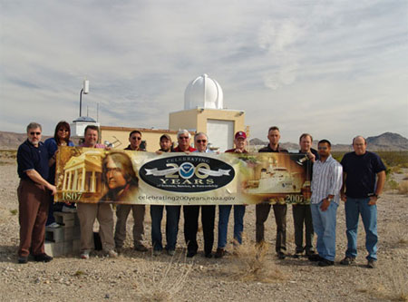 Greetings
from the NOAA Air Resources Laboratory, Special Operations and Research Division (ARL/SORD), Desert Rock Meteorological Observatory, located on the Nevada Test Site (NTS).
ARL/SORD personnel provide comprehensive meteorological services and supporting research to the National Nuclear Security Administration, Nevada Support Office, national
defense programs conducted on the NTS. Meteorological data collected by the SORD NTS mesonet, the SORD lightning detection network, and the NOAA SURFRAD Network and Climate
Reference Network stations, located at DRA, are shared with other NOAA offices. Shown (from left): Marc Pitchford, Karen Balecha, Rick Lantrip, Don Kim, Paul Rogers,
Ray Dennis, Darryl Randerson, Don Bullard, Phil Abbott, Kip Smith, Ogie Olanday, and James Wood.
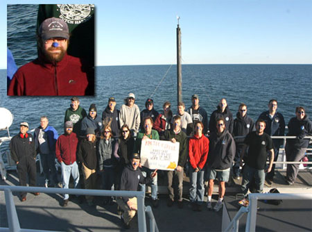 On September 4, 2007, the scientists and crew of the
NOAA Ship OSCAR DYSON entered the Arctic Circle during the Bering-Aleutian Salmon International Survey in the Chuckchi Sea and Eastern Bering Sea Shelf. To celebrate,
everyone got their "Bluenose". Pictured from (from left): back row: LF Patrick Kreigh, 2C Kurt Kier, LT Mike Levine, CB Willie Sliney, F Nathan Thomas, SST Kathy Hough,
O Drew Barth, LET Vince Welton, ENS Nathan Witherly, ENS Carl Rhodes, LT Bill Mowitt, SST Colleen Peters; front row: 1AE Kim Gwan, EET Terry Miles, Sam Laney, Sarah Mincks,
Lisa Eisner, Liz Labunski, Morgan Busby, Jim Murphy, Lauren Kuehne, Jenefer Bell, and AB Joel Kellogg, with CDR Mike Francisco in front.
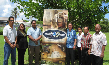 Managers from the National Weather Service Offices (WFO) in Micronesia
gathered on Guam for a week-long meeting at WFO Guam to discuss regional issues among the offices. The Micronesia WSOs fall under the umbrella of the National Weather
Service Pacific Region and provide valuable weather information in the data sparse area of the Western North Pacific. The Managers visited with the U.S. Coast Guard,
University of Guam Distance Education Communications Center, and the Water Institute. Pictured (from left): Johannes Berdon (WSO Chuuk OIC), Maria Ngemaes (WSO Koror MIC),
David Aranug (WSO Yap MIC), Chip Guard (WFO Guam WCM), Genevieve Miller (WFO Guam MIC), Eden Skilling (WSO Pohnpei OIC), and Reginald White (WSO Majuro MIC).
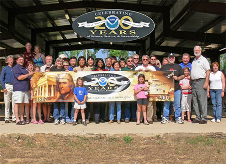 The
National Data Buoy Center (NDBC) commemorated NOAA's 200th celebration with a catfish fry attended by NDBC and its technical services contractor, Science Applications International
Corporation (SAIC). Led by NDBC Director Dr. Paul Moersdorf (second from the right) and SAIC's Program Manager Ted Neville (third from the left) over 100 employees, spouses, and children
attended and enjoyed a beautiful south Mississippi afternoon. NDBC builds, deploys, and maintains the National Weather Service's coastal buoys and shore stations to provide input critical
to nearshore wind and sea warnings; the tropical Pacific climate buoy array which is a prime indicator developing El Nino or La Nina conditions; a suite of 12 hurricane buoys in the open
Atlantic, Caribbean Sea, and Gulf of Mexico; and the Pacific and Atlantic tsunami detection stations. NDBC is also the key Data Assembly Center for real-time data in support of the
Integrated Ocean Observing System.
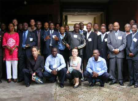 Greetings from Cameroon, West Africa! During the week of September 3-7, 2007, the National Ocean
Service Office of Response and Restoration (OR&R) sent a member to Douala, Cameroon, West Africa, to co-teach a class with the U.S. Coast Guard on the Incident
Command System (ICS) to 30 students from the governments of Cameroon, Equatorial Guinea, and Gabon. Attendees represented the executive level of many ministries
including the Cameroonian Navy, municipal fire departments, mining, civil defense, and public health ministries. Capping off the class was an oil spill exercise that
showcased the General NOAA Oil Modeling Environment program developed in OR&R. The students eagerly asked for more background on ICS, joint contingency planning, and
spill modeling; many wanted their superiors to learn ICS as well in order to implement the system on a larger scale. Pictured are the students from Cameroon, Equatorial
Guinea, and Gabon, as well as course instructor Mark Dix, from OR&R, and co-instructors from the U.S. Coast Guard and U.S. Forest Service.
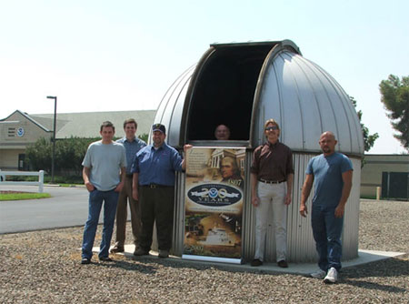 Greetings from the San Joaquin Valley of California! The National Weather Service
Office in Hanford provides forecasts, advisories, watches, and warnings for a large and geographically diverse area of interior Central California stretching from the
central and southern portion of the San Joaquin Valley eastward to the crest of the southern Sierra Nevada and southward into the northwestern Mojave Desert. A familiar
site that greets visitors to our office is the large dome structure that houses a Dobson Ozone spectrophotometer. This ground-based instrument measures ozone concentration
in a column of the atmosphere by measuring differences in absorption of ultraviolet light with the sun as a light source. Comparisons are then made in the differences in
ultraviolet intensity at wavelengths that are absorbed both strongly and weakly by ozone in order to come up with the column ozone content. Measurements of ozone are done
by personnel at the National Weather Service Office in Hanford three times a day, each day of the week. Our office is one of just seven sites that takes these readings in
the Lower 48. Pictured (from left): Chris Stachelski, Steve Mendenhall, James Brotherton, Paul Jones, Kevin Durfee, and Jim Knutson.
 Greetings
from the NOAA Air Resources Laboratory, Special Operations and Research Division (ARL/SORD), Desert Rock Meteorological Observatory, located on the Nevada Test Site (NTS).
ARL/SORD personnel provide comprehensive meteorological services and supporting research to the National Nuclear Security Administration, Nevada Support Office, national
defense programs conducted on the NTS. Meteorological data collected by the SORD NTS mesonet, the SORD lightning detection network, and the NOAA SURFRAD Network and Climate
Reference Network stations, located at DRA, are shared with other NOAA offices. Shown (from left): Marc Pitchford, Karen Balecha, Rick Lantrip, Don Kim, Paul Rogers,
Ray Dennis, Darryl Randerson, Don Bullard, Phil Abbott, Kip Smith, Ogie Olanday, and James Wood.
 On September 4, 2007, the scientists and crew of the
NOAA Ship OSCAR DYSON entered the Arctic Circle during the Bering-Aleutian Salmon International Survey in the Chuckchi Sea and Eastern Bering Sea Shelf. To celebrate,
everyone got their "Bluenose". Pictured from (from left): back row: LF Patrick Kreigh, 2C Kurt Kier, LT Mike Levine, CB Willie Sliney, F Nathan Thomas, SST Kathy Hough,
O Drew Barth, LET Vince Welton, ENS Nathan Witherly, ENS Carl Rhodes, LT Bill Mowitt, SST Colleen Peters; front row: 1AE Kim Gwan, EET Terry Miles, Sam Laney, Sarah Mincks,
Lisa Eisner, Liz Labunski, Morgan Busby, Jim Murphy, Lauren Kuehne, Jenefer Bell, and AB Joel Kellogg, with CDR Mike Francisco in front.
 Managers from the National Weather Service Offices (WFO) in Micronesia
gathered on Guam for a week-long meeting at WFO Guam to discuss regional issues among the offices. The Micronesia WSOs fall under the umbrella of the National Weather
Service Pacific Region and provide valuable weather information in the data sparse area of the Western North Pacific. The Managers visited with the U.S. Coast Guard,
University of Guam Distance Education Communications Center, and the Water Institute. Pictured (from left): Johannes Berdon (WSO Chuuk OIC), Maria Ngemaes (WSO Koror MIC),
David Aranug (WSO Yap MIC), Chip Guard (WFO Guam WCM), Genevieve Miller (WFO Guam MIC), Eden Skilling (WSO Pohnpei OIC), and Reginald White (WSO Majuro MIC).
 The
National Data Buoy Center (NDBC) commemorated NOAA's 200th celebration with a catfish fry attended by NDBC and its technical services contractor, Science Applications International
Corporation (SAIC). Led by NDBC Director Dr. Paul Moersdorf (second from the right) and SAIC's Program Manager Ted Neville (third from the left) over 100 employees, spouses, and children
attended and enjoyed a beautiful south Mississippi afternoon. NDBC builds, deploys, and maintains the National Weather Service's coastal buoys and shore stations to provide input critical
to nearshore wind and sea warnings; the tropical Pacific climate buoy array which is a prime indicator developing El Nino or La Nina conditions; a suite of 12 hurricane buoys in the open
Atlantic, Caribbean Sea, and Gulf of Mexico; and the Pacific and Atlantic tsunami detection stations. NDBC is also the key Data Assembly Center for real-time data in support of the
Integrated Ocean Observing System.
 Greetings from Cameroon, West Africa! During the week of September 3-7, 2007, the National Ocean
Service Office of Response and Restoration (OR&R) sent a member to Douala, Cameroon, West Africa, to co-teach a class with the U.S. Coast Guard on the Incident
Command System (ICS) to 30 students from the governments of Cameroon, Equatorial Guinea, and Gabon. Attendees represented the executive level of many ministries
including the Cameroonian Navy, municipal fire departments, mining, civil defense, and public health ministries. Capping off the class was an oil spill exercise that
showcased the General NOAA Oil Modeling Environment program developed in OR&R. The students eagerly asked for more background on ICS, joint contingency planning, and
spill modeling; many wanted their superiors to learn ICS as well in order to implement the system on a larger scale. Pictured are the students from Cameroon, Equatorial
Guinea, and Gabon, as well as course instructor Mark Dix, from OR&R, and co-instructors from the U.S. Coast Guard and U.S. Forest Service.
 Greetings from the San Joaquin Valley of California! The National Weather Service
Office in Hanford provides forecasts, advisories, watches, and warnings for a large and geographically diverse area of interior Central California stretching from the
central and southern portion of the San Joaquin Valley eastward to the crest of the southern Sierra Nevada and southward into the northwestern Mojave Desert. A familiar
site that greets visitors to our office is the large dome structure that houses a Dobson Ozone spectrophotometer. This ground-based instrument measures ozone concentration
in a column of the atmosphere by measuring differences in absorption of ultraviolet light with the sun as a light source. Comparisons are then made in the differences in
ultraviolet intensity at wavelengths that are absorbed both strongly and weakly by ozone in order to come up with the column ozone content. Measurements of ozone are done
by personnel at the National Weather Service Office in Hanford three times a day, each day of the week. Our office is one of just seven sites that takes these readings in
the Lower 48. Pictured (from left): Chris Stachelski, Steve Mendenhall, James Brotherton, Paul Jones, Kevin Durfee, and Jim Knutson.