
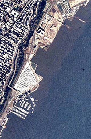
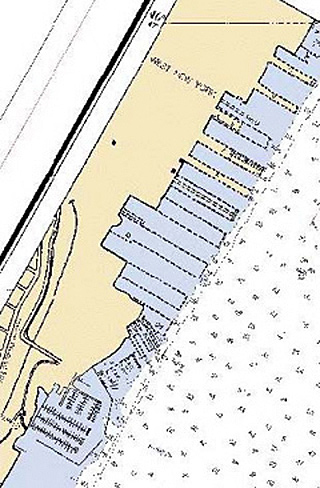
Left is a high-altitude aerial photography of Hudson River, New York. The same area is shown on a NOAA nautical chart on the right. Comparing these sources, created at different times, provides information on the rate of change in the coastal zone, which aids in the design of coastal zone mapping projects.