
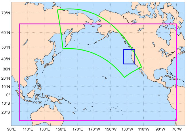
Areas defined by the colored boxes help illustrate how GLOBEC scientists use nested computer models within successively smaller geographic areas. The shorter distance between data points in the smaller areas allows modelers to predict local ecological impacts of global climate change.