
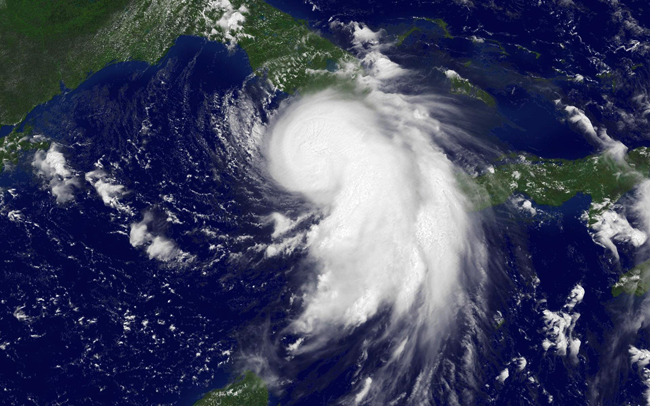
Today, NOAA uses an arsenal of tools to forecast hurricanes and inform the public about impending danger. This satellite image shows Hurricane Katrina at 1:15 p.m. EDT on August 26, three days before the storm made landfall as a Category 3 hurricane with maximum winds estimated near 125 miles per hour to the east of the storm center.
High resolution available. (740KB, 1920x1200).