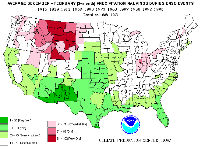
NOAA products, such as this map for the lower 48 states that illustrates the likelihood of extremes of temperature and precipitation during El Niño events, can be used to help decision makers plan when ENSO events are predicted.
With the NOAA 200th Celebration coming to a close at the end of 2007, maintenance of this Web site ceased. Updates to the site are no longer being made.

NOAA products, such as this map for the lower 48 states that illustrates the likelihood of extremes of temperature and precipitation during El Niño events, can be used to help decision makers plan when ENSO events are predicted.