
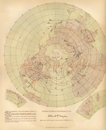
Dated October 1, 1877, this map was produced by General Myer’s division in Washington, DC. The map is based on daily synchronous weather observations made in the U.S., Europe, and ships at sea. This map is a testament to the cooperation Myer received around the world and his commitment to creating an international weather observation network.