
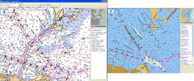
Raster navigational chart (left) and electronic navigational chart of the same area at the mouth of Chesapeake Bay. NOAA produces raster navigational charts by scanning electronically at high resolution the original color separates that are used to print the paper charts. Electronic navigational charts are created from a database of chart objects and their attributes. The objects may be turned on and off when the chart is displayed on a computer screen.