
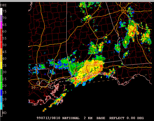
Doppler radar enables forecasters to create different types of images that allow them to track and forecast severe weather in real time. This base reflectivity image for a region along the Gulf of Mexico indicates that the most intense precipitation is falling in the small red areas within the larger yellow areas.